Posts by DW Rowlands — Contributor

-

Many people use ZIP codes to determine place names. Here’s why that doesn’t work well.
In unincorporated areas, the names the US Postal Service associates with ZIP codes are commonly used to label a place. However, that’s a flawed method — here’s why. Keep reading…
-

How the Baltimore & Potomac Railroad and the Penn Line shaped the region’s suburbs
Much of DC beyond the original L’Enfant city and Georgetown consists of “streetcar suburbs,” namely late-19th and early-20th Century communities that grew up around streetcar lines. This week we’re digging into the Baltimore & Potomac Railroad and the Penn Line. Keep reading…
-

The fascinating story of DC’s aqueducts and reservoirs
Have you ever wondered where the District’s drinking water comes from or puzzled over why the McMillan reservoir is located in the center of the city, far from the water sources that supply it? GGWash contributor Elliot Carter’s DC Underground Atlas showcases the history and engineering of this hidden underground world. Here’s a taste of what he found. Keep reading…
-

How Prince George’s County was divided and named in colonial times and after independence
In May, I wrote a pair of articles on the difficulties in naming regions of Prince George’s County. This time, I’m going to go all the way back to colonial Maryland to dive into how regions of the county were divided up and named in the past. Keep reading…
-
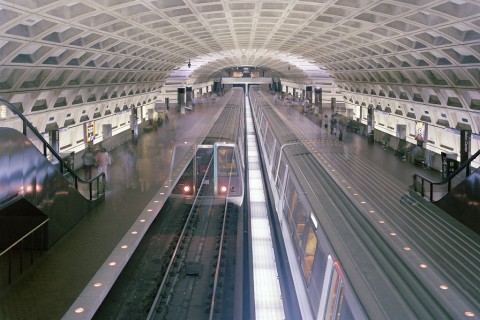
What lies beneath DC? A lot more tunnels than you might think!
Have you ever wondered what’s under your feet in the District? Everyone who rides Metro regularly has some sense of where the subway tunnels in the region are, but may not know that DC also has a number of former streetcar tunnels, currently-used railway tunnels, and a collection of road tunnels as well. Keep reading…
-

All commuting distances are not created equal in Washington
Our region’s wealthier neighborhoods afford their residents more, faster options for traveling around the region than poorer ones, even if the wealthier ones are farther away from the core. Keep reading…
-
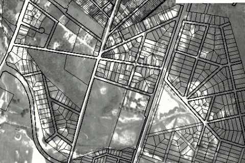
This GIS atlas reveals the history of Prince George’s County
Hey history buffs: Prince George’s Atlas has a slew of fascinating old aerial photos, maps, and other cartographic information about the county, including property boundaries and environmental information. What did your neighborhood look like a century ago? Keep reading…
-

Does access to frequent transit affect property values in Baltimore?
Almost a year and a half ago, Baltimore’s bus network was redesigned to emphasize high-frequency corridors. While it’s unclear whether frequency has actually improved due to problems with buses running far behind schedule, I recently decided to make a map to see how much of Baltimore is served by frequent transit, and how this corresponds to property values. Keep reading…
-

These beautiful maps show how the region’s population density has changed since 1970
DC’s population growth has slowed since the 2009 boom, but the population still continues to climb. In December 2018, the US Census Bureau announced that DC’s population reached 702,455, officially passing the 700,000 mark. Keep reading…
-

Where people in our region are filling out the census, and where they’re not, in 12 maps
About 95% of US households will fill out their 2020 census information using forms mailed to their house that they will reply to via the internet, phone or mail. In the Washington region, the self-response rate from these forms varies greatly depending on location, density, race, population and income. Keep reading…