Posts by DW Rowlands — Contributor

-

This map shows how easy it is to take transit to work
We spend a lot of time praising neighborhood walkability and proximity to transit. But how valuable is the ability to walk to the grocery store if residents still need to drive a long distance to get to work? Keep reading…
-

Traffic jams are up during SafeTrack
Getting from Point A to Point B by car has taken longer than usual during SafeTrack, and while people changed when they commute during some of the work surges, few changed their actual routes. Those are two of the key takeaways from an analysis of rush hour congestion during SafeTrack that came out on Monday. Keep reading…
-
A streetcar used to run down Rhode Island Avenue, connecting College Park and downtown DC
Most of Washington’s original “streetcar suburbs” were built within the District’s boundaries. However, one important corridor of streetcar suburbs went up in Prince George’s County, in the communities along Route 1 south of the Beltway. Keep reading…
-

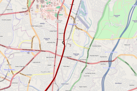
A streetcar used to run from H Street to Berwyn Heights, near College Park
Like those in a lot of other US cities, DC and surrounding areas’ best-known streetcar lines tend to be ones where service survived into the 1950’s and 1960’s. However, routes like the Washington, Gretta, & Spa Spring, which perished during the 1920’s heyday of streetcar service, often had a lasting effect on the urban landscape. Keep reading…
-

Express trains wouldn’t be of much help to Metro riders
Despite popular belief, having more tracks isn’t necessary for proper maintenance of the Metro system. It also turns out that express tracks wouldn’t provide much benefit to everyday riders, and it might even do more harm than good. This may seem a bit surprising to people familiar with express trains on the New York subway, where express tracks can cut a rider’s… Keep reading…