Does access to frequent transit affect property values in Baltimore?
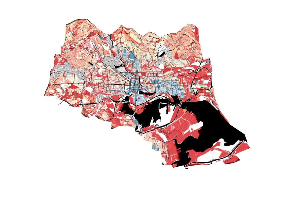
A 3-D map of property values (blue is high, red is low) and distance from frequent transit (shown as elevation) in Baltimore City.
This article was first published on November 20, 2018. It’s an interesting study, so we are sharing it again.
Almost a year and a half ago, Baltimore’s bus network was redesigned to emphasize high-frequency corridors. While it’s unclear whether frequency has actually improved due to problems with buses running far behind schedule, I recently decided to make a map to see how much of Baltimore is served by frequent transit, and how this corresponds to property values.
I wanted to know whether land values and frequent transit affect each other in Baltimore. It doesn’t look like they do.
How much of Baltimore has access to frequent transit?
One upside of Baltimore’s bus redesign is that it has made it much easier to identify which bus routes operate relatively frequently: the “CityLink” routes, identified with colors rather than numbers, are all supposed to operate every 15 minutes all day on weekdays and to have 24-7 service.
To see how much of the city actually had regular access to them, I created a map of the city overlaid with a hexagonal grid that’s color-coded by the distance of the center of each hex from the nearest CityLink, Baltimore Light Rail, or Baltimore Metro Subway stop.
Distance to nearest transit stop with frequent service (defined as light rail, subway, or “CityLink” bus) in Baltimore City. Hexes form a roughly quarter-mile grid. The darkest blue hexes are within a quarter mile of the nearest stop; the next-lightest are within a half-mile. Image by the author.![]()
Here’s how good transit correlates with property values
To get a clearer idea of whether the areas without good transit service are high-property value neighborhoods or poorer areas, I decided to try mapping real property values in Baltimore. Using data from the Baltimore Real Property Database, I mapped the city’s estimated property values for every privately-owned lot in the city.
Rather than using assessed property values, I used the city’s estimate of the actual cash values of lots, and calculated them per square meter of lot area to avoid the map from being dominated by the largest lots.
Cash values per square meter for land and improvements on privately-owned lots in Baltimore City. Bluer-colored lots have higher values per square meter. Image by the author.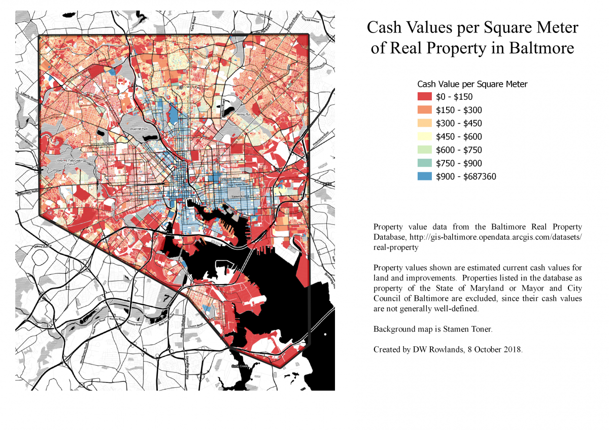
From looking at this data, it’s not really clear to me that there is a correlation between property value and distance from frequent transit. Unsurprisingly, the downtown area with the most frequent transit service also has some of the highest property values in the city. However, the relationship between frequent transit and property values is much less consistent in the outer areas of the city.
The corridors followed by the subway and light rail to the northwest and south of downtown have access to frequent and fast transit to downtown. However, the property values in these areas are low by Baltimore standards, while nearby areas with worse transit access have higher property values. Still, the areas of the city that are furthest from frequent transit do generally have low property values.
This post is based on a class project I did for “GES 687: Advanced Geographic Information Systems” at the University of Maryland, Baltimore County. You can find the original project on my portfolio on GitHub here.