See all of the region’s historic trolley routes on one map

Image by SDC licensed under Creative Commons.
We first published this post on January 9, 2013. We're running it again with a cool update.
This map claims to show every local electric railway line that operated in the region between 1890 and 1962, regardless of who operated it or when it ran. That makes this much more comprehensive than DC Transit maps that only show one company’s lines, and only from a single year.
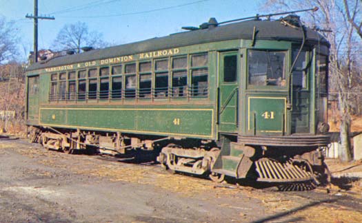
Some of the longer lines on this map are “interurbans,” which were trolley vehicles that functioned more like commuter rail than central city streetcars, stopping less frequently and running on longer headways. Today we’d probably call them light rail. They’re on the map because no matter their route characteristics, they were basically electric trolleys. That includes Virginia’s well-known W&OD, which isn’t usually called a trolley line today.
The top map first appeared on Wikipedia and was created by the anonymous user “SDC.” When we published this the first time, one of our commenters, David C, transcribed its routes onto a Google Map to better illustrate where they ran:
Cross-posted on BeyondDC.