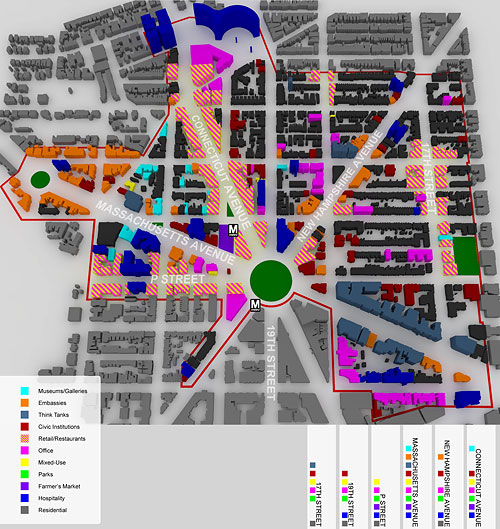
UMich team visualizes Dupont land use
A team of graduate students from the University of Michigan conducted a strategic analysis of the Dupont Circle neighborhood and its retail competitiveness, with sponsorship and participation from Historic Dupont Circle Main Streets.
One of the most fascinating elements of the analysis is this visualization of the neighborhood (at least the parts they studied):
The more data is available through open formats, the easier it becomes to generate graphics like these. At the H Street Pop-up Lab, GIS developer Katie Filbert and others have been mapping retail there for the OpenStreetMap project, an open source repository of geographic information.