Use this tool to see how often Metrobuses come to a particular stop, and where they go from there
Metrobus is a great way to get around, but some people avoid it because it’s not easy to remember where, exactly, buses run, or when they come to your stop. A new tool from Metro hopes to make finding that information a lot easier.
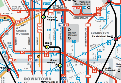
Image from WMATA.
With Metrorail, maps, charts showing the next stop, and PIDs all make it clear where train lines go, when they come, and where they stop. With the bus network, it can be hard to provide such detailed information at each stop because it’s far larger and more complicated.
WMATA has made big strides by adding real-time arrival boards to some bus stations, and in 2012 the agency introduced a new bus map that makes it clearer where each line runs. But that map still has quite a bit going on, especially if you’re trying to use an online version by loading it on a small screen or picking between multiple route options.
To address this issue, planners at WMATA have developed Metrobus Explorer, an online tool that gives users real-time arrival displays and a personalized spider map showing where bus lines from a given stop run to. Spider maps clear the clutter of information a typical bus map gives riders, allowing them to see only the routes and stops relevant to them.
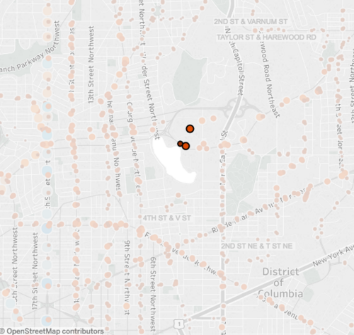
Here, we’ve selected three bus stops that run along Michigan Avenue, just north of the McMillan Reservoir and south of Washington Hospital Center. When you hover your mouse over the stops in the app, you see how many buses run there per hour.
Metrobus Explorer shows you a map of all the region’s Metrobus stops, marked with larger dots for locations with more frequent service. It then allows you to select one or more stops. After selecting the stop (or stops) you want information for, a second map showing the routes available from those stops and their destinations is displayed.
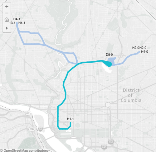
The tool shows us which bus lines run from these stops and where they go.
The information is available for each hour of the day, reflecting the changes in frequency throughout the day. For a route view in both directions of a bus line, you need to select the stop on both sides of the street.
Metrobus Explorer is a great tool for riders; something that provides accurate, easy-to-understand information should help increase bus ridership. That said, the current version of Metrobus Explorer is a bit clunky and in order to create a full working version to be incorporate into wmata.com, WMATA would like hear your feedback.
WMATA is hoping to hear from users on the following:
- Would the tool be useful?
- What features are important? Would you like to be able to print your personalized spider map?
- What is missing? Should the route lines’ thickness vary depending on headway?
- Should this be available on mobile? Would that be more or less useful than BusETA or other transit planning apps?
You can comment directly on the Metro planning page or leave a comment with your thoughts below.