Check out this DC bike map from 1896
Did you know our region had bike lanes all the way back in 1896? This map shows the best way to get around DC and parts of Maryland and Virginia on two wheels before the start of the 20th Century.
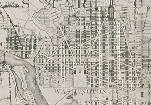
Image from the DC Public Library.
The map is one of 70 that the DC Public Library recently added to its Dig DC collection.
These newly available maps are part of DCPL’s ongoing effort to digitize the Washingtonia Map Collection, which includes material from various sources dating back to 1612. So far, the collection on Dig DC includes maps from 1768 through 1900.

Image from the DC Public Library.
According to the note above, the direction and frequency of triangles along paths indicates the slope and incline of hills. If topography is your top concern, this map could still be helpful in choosing your best route: The gentle decline of Bladensburg Road as you travel southward into the city could certainly offset traffic considerations.
It’s also interesting to note that certain roads — 7th St. NW, Connecticut Ave. NW, Pennsylvania Ave. SE, among others — are as preferable now as they were then. One detail begs the question: was Virginia Avenue SW/SE once a preferred bike route?
What else about this map do you notice?