In 1892, DC had railroads and windy paths on the Mall
Tom at Ghosts of DC posted an 1892 map of the L’Enfant City. Union Station did not yet exist, and instead, railroads from the south carried trains right to a terminal where the National Gallery is today. Streetcars plied most major thoroughfares.
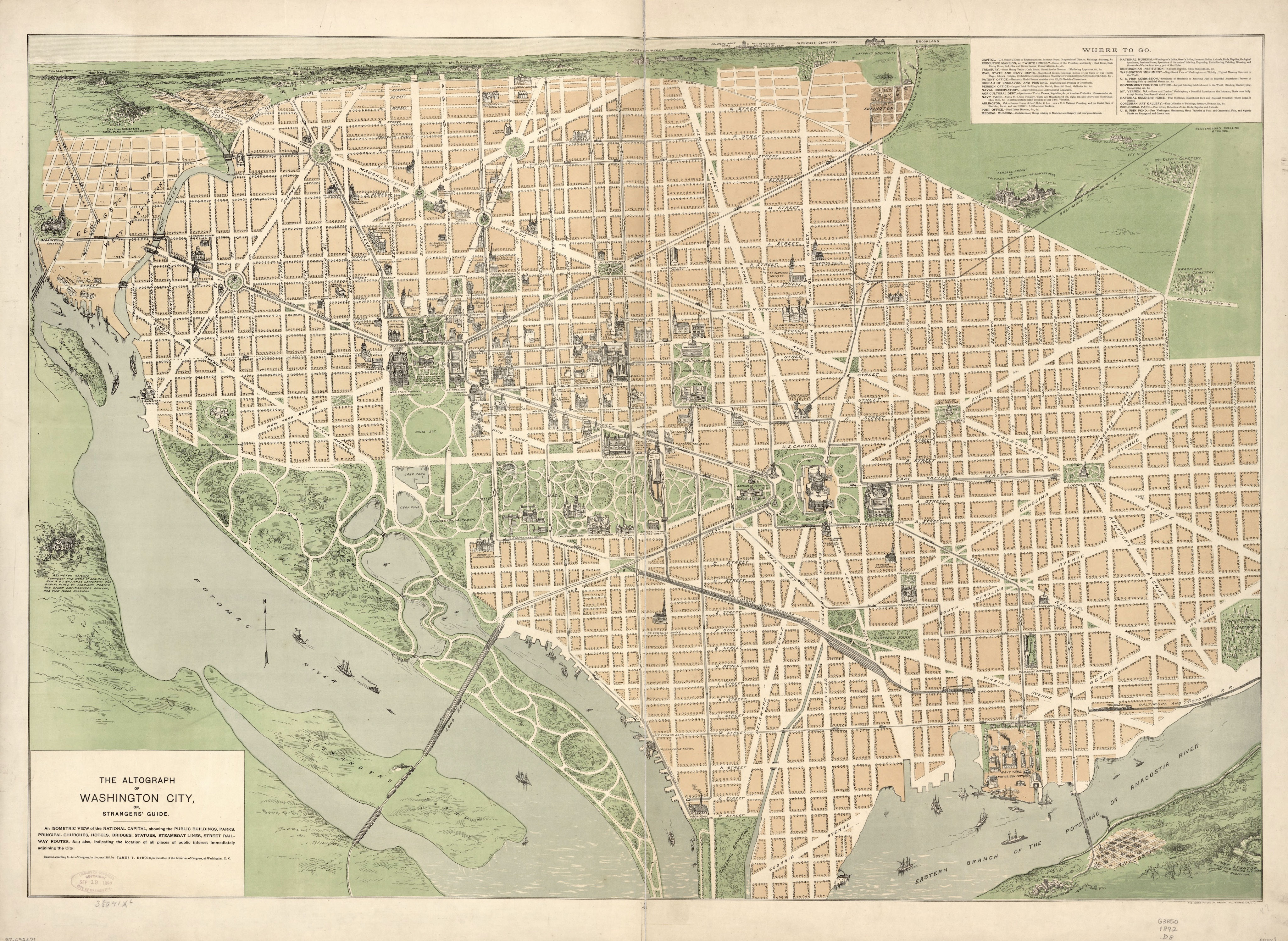
Image from the Library of Congress.
Ed Summers pointed out on Twitter how the paths on the Mall are much windier and loopier than the straight, formal paths today. The same is true of Dupont Circle and Iowa Circle (now Logan Circle, but at the time, Logan Circle was the name for what’s now Sheridan Circle), and other parks.
Many DC parks changed from a more natural, Victorian-era layout to a more formal one around the time of the 1902 McMillan Plan, which also created the Federal Triangle, the Lincoln and Jefferson Memorial sites, and other elements that shape the monumental core today.
Maybe the 20th century patterns are better, or maybe not. But it does further make a mockery of the National Park Service’s claims that parks forever must match the layouts they had around, say, 1929. Our parks have changed and should continue to change to accommodate the recreational and relaxational needs of residents and visitors.
What else do you notice on the map?