Tysons was built around cars. How can it transform into a place people can walk?

Tysons was built for cars, not people walking.
This article was first published on August 27, 2019. We thought this piece brought up relevant issues about the future of Tysons and wanted to share it again.
Tysons wants to transform from a suburban office park into a bona-fide city filled with more residents, even more jobs, and culture and activities. According to its comprehensive plan, Tysons is aiming to become “a true urban downtown for Fairfax County” by 2050. But the question on a lot of people’s minds is how they will get there, and how they will get around within the four-square-mile area.
Right now, it’s really hard to walk or bicycle around Tysons. The “edge city” mushroomed during the age of the jet and the highway, and it was built for cars, not people walking or bicycling. But a walkable place tends to be a hospitable one, and walkability in Tysons is a major ingredient in creating a successful urban center where people want to stay to live and play.
“Walkability is key to our future transportation network,” says Tom Biesiadny, Director of the Fairfax County Department of Transportation (FCDOT). “It’s integral to the multi-model approach we are taking to our transportation system. It’s the ability to get from the office, to go to lunch, to get your dry cleaning, to get home; it’s critical to everything we’re doing.”
Walkability is the future
Biesiadny heads the department for all of Fairfax County, but he understands Tysons’ specific needs. The county conducted a transportation analysis as part of the plan amendment approved in 2010, and found walkability was an area that needs improvement.
“We have to have the ability to walk, as well as drive and take transit,” Biesiadny says. “Tysons isn’t going to work if the only way to get around town in Tysons is to get in your car and drive across the street. There has to be a viable, workable, efficient pedestrian network.”
To that end, Biesiadny says the FCDOT has spent about $300 million to date on pedestrian improvements around the county, which includes bicycle, pedestrian, and bus stop improvement projects to date. We reached out to the county to find out how much was spent in Tysons specifically, and will update the article when we receive that information.
“Tysons is transforming in a way that is great. With the Silver Line coming through, it’s opened up a lot of possibilities,” says Sonya Breehey, Northern Virginia Advocacy Manager for the Coalition for Smarter Growth, which promotes walkable, inclusive, transit-oriented communities in the region. She says Tysons had the advantage of a comprehensive plan that detailed walkability improvements.
Breehey, who also serves on the board of the Fairfax Alliance of Better Bicycling, sees firsthand the changes and challenges of creating walking and bicycle-friendly spaces.
“There is a great vision for reinventing Tysons,” Breehey says, but said when transitioning into a more walkable place: “There will be bumps along the way. There are very wide roads that focus on moving cars and keeping that flow going. So having wide roadways for pedestrians and cyclists to cross upon can be unsafe, [and] very uncomfortable, because it’s quite a stretch if you’re out in the sun in the heat of summer or the cold of winter.”
Breehey points to the recently-completed sidewalk on along Route 7 under Route 123 as a milestone for better walkability and improved access for bicyclists. However, she says there are still a lot of ramp crossings, especially near the Beltway and near major intersections, with high-speed right-hand turns that “present some serious conflict points for ped and cyclists that are trying to use the shared path.”
Local developers have walkability requirements
Fairfax County’s transportation demand management guidelines have requirements for reducing auto trips in Tysons. For instance, if development in Tysons reaches overall square footage of 65 million (in 2018 Tysons had 52.2 million square feet), properties between 0 and 1/8 mile from Metro need to reduce their auto trips by 45%. The closer a development is to Metro, the more requirements it has to fulfill, plus those requirement rachet up as the 2050 deadline gets closer.
“The thought is that as Tysons becomes more urban, [these requirements] become more achievable,” says Justin B. Schor. Schor is principal at Wells + Associates, a company the Tysons Partnership brought in to help local developers and properties meet standards set out in the comp plan to reduce the number of auto trips in the area.
Today there are more buildings and amenities near Metro stops, but it's still not easy to walk around. A more vertical Tysons by Rob Pegoraro licensed under Creative Commons._800_600_90.jpg)
In order to help developments create more walkable spaces, Schor says the company has several different approaches, including trying to get commuters and residents to consider walking instead of driving.
“In some instances, it’s a younger demographic that’s looking to say, commute to Arlington. So we will target those folks with a message on how to walk most safely and effectively to Metro,” Schor said. “Other instances we’ll create an access guide that says ‘hey, welcome to the neighborhood,’ adding things that are within walking distance within a half-mile of their building. We really try to get people to understand that so they can go either car-light or car-free.”
But what makes an area walkable?
Walkability is so important that future of Tysons may depend on whether people can safely and easily get around on foot. But how do you know if an area is walkable?
Andrew Mondschein, a professor in the Department of Urban and Environmental planning in the School of Architecture at the University of Virginia, may have some answers. He has been teaching there for six years, and has been studying walkability in Tysons for about as long.
“I’ve been studying walkability since the year after I arrived in Virginia,” Mondschein said. “It’s such an important project and example of trying to transform an American suburban area into something that is totally different, into something that is not only dense but is also friendly to travel modes other than driving.”
Like many people I have spoken to, Mondschein emphasizes how unique Tysons’ transformation is, and how important its success or failure will be.
“There’s examples of this everywhere, but in terms of truly moving from pure suburban office and retail to something that is like a city, there’s few examples that are like this anywhere in the country, if not the world,” Mondschein said. “I think that is a really amazing goal the county has set for itself.”
On Dolly Madison Boulevard in Tysons, a street only has crosswalks on one side of the street. Image by the author.
How does one go about measuring walkability in the first place? That question itself is complicated, Mondschein said.
“Walkability is actually a lot of things,” Mondschein said. “It’s not just simply sidewalks, and of course if they are safe. It’s also a question of accessibility. Are there places to go when people are on foot? It’s a question of comfort. Is it the kind of street you would actually want to be on? It’s a question of health. Do you even know if you’re breathing fumes from cars or trucks? There are so many dimensions to what makes a place walkable.”
Getting multifaceted answers requires complex tools and processes. Mondschein and a crew of students and volunteers traveled to Tysons, using the same boundaries of the area in the comprehensive plan, at different times of the year. They carry sensors that can fit inside of a backpack to measure noise and pollution levels, and also track temperatures on the sidewalks.
Mondschein collects these numbers and combines them with data on accessibility, traffic, and safety to “really understand walkability in a really comprehensive way,” he said. Since 2015, he’s been mapping the area for walkability, and is reaching the point where his ongoing study can provide some substantive information.
How is Tysons doing on walkability so far?
Grading a city on plan only a quarter of the way complete in is a little unfair. But examining almost a decade of initiatives, infrastructure improvements, and developments can shed some light on how walkability is progressing.
“What I’ve seen is definite improvements in spots as far as local walkability, and we’ve also seen investments in walkability with bridges. Good things have happened,” Mondschein said. “It still does not function well as a comprehensive walkable city. It’s bigger than a neighborhood, but those neighborhoods are still very disconnected.
“And there are a lot of issues you don’t perceive unless you are on the sidewalk, like noise, and just kind of the discomfort of being on the sidewalk of large roads that are just going to be general challenges,” Mondschein adds. “It’s not to give up hope, it’s just more challenges some of which can change quickly and some of which will take time to address.”
On West Park Drive near Tysons Corner Center, it is hard to get across the street. Image by the author.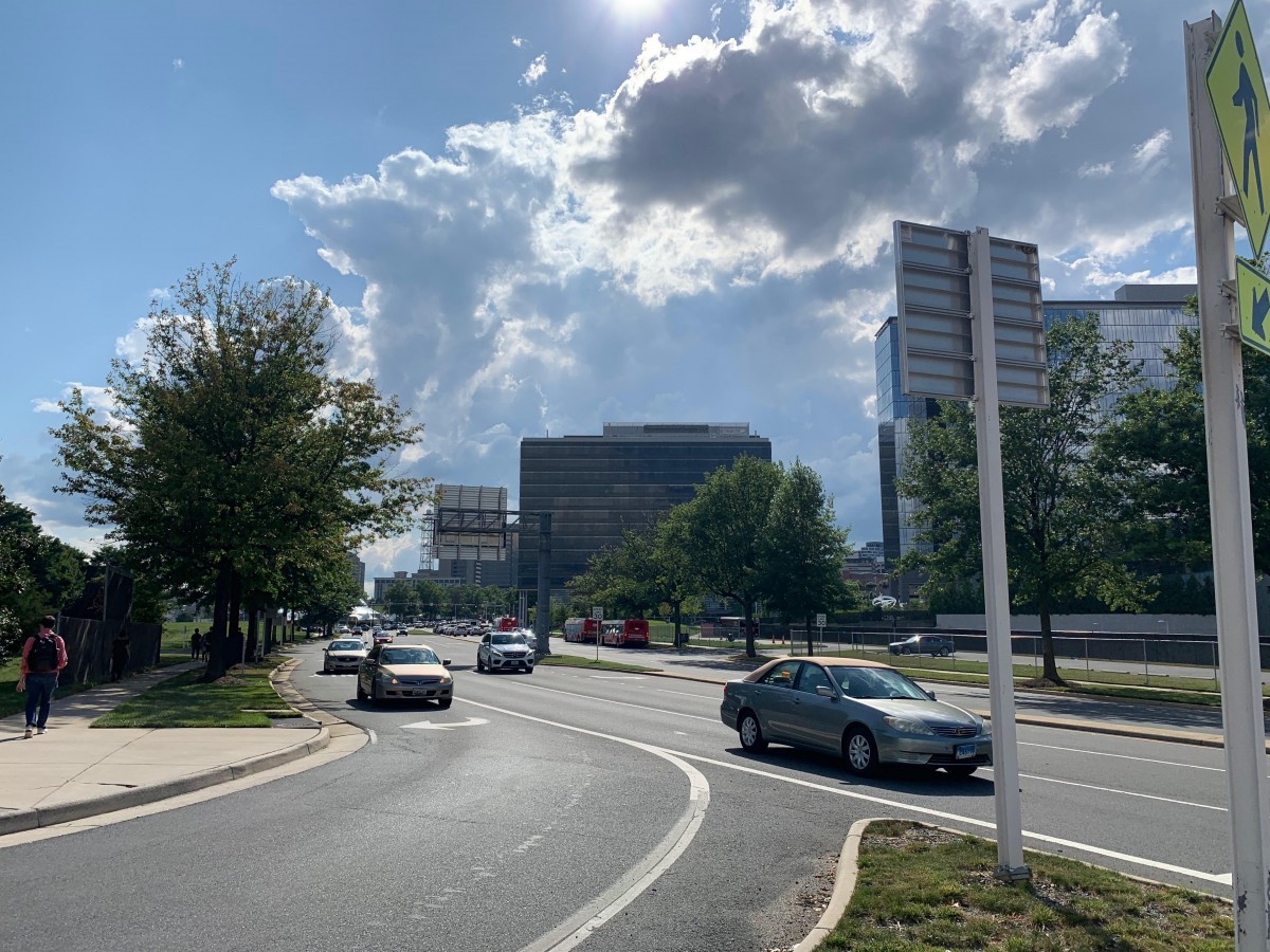
Biesiadny knows the goal of walkability in Tysons is a moving target. He points to the 2011 Tysons Metrorail Station Access Management Study for context, which lays out key transportation goals for Tysons as well as solutions, such as pedestrian walkways that cross onto the Dulles Toll Road and I-495 from Route 7 and Route 123.
The study states that “pedestrian and bicycle access into Tysons Corner is difficult and dangerous along these corridors, specifically along Route 7 from areas north of Tysons Corner and along Route 123 from areas east of Tysons Corner.” Recommendations range from enhancing crosswalk design with things like colored pavements, to adding refuge areas in medians for people trying to cross on foot, to getting permission from developers for pedestrians and bicyclists to pass through private property to get to nearby Metrorail stations.
According to Biesiadny, the county has made substantial efforts to address 29 of the 36 recommendations in the study. One of FCDOT and the Virginia Department of Transportation’s major local projects is the Jones Branch Connector, a bridge with wide sidewalks that crosses over the Capital Beltway into Tysons. They plan to add an eight- to 12-foot-wide lighted sidewalk, landscaping, and other amenities to make streets safer throughout Tysons for people bicycling and walking.
Two months of work in 1 minute at the Jones Branch Connector! Crews making serious progress on this new link across the Beltway in Tysons. Two lanes open now, sidewalk coming later this summer, everything wraps up later this year. More: https://t.co/7W2Od2jdqv #TimeLapse pic.twitter.com/Y8cebX2me2
— VDOT Northern VA (@VaDOTNOVA) July 12, 2019
“Between now and 2050, we are going to see ebbs and flow in growth,” Biesiadny said. “There are a lot of pieces that need to be put together. We’ve made a lot of progress, but there still is a lot that needs to be done and 30 years may seem like a long time, but it actually will be here sooner than we know it.”