Hidden clues reveal an old road that disappeared from DC

In this 1861 map by Albert Boschke, Milkhouse Ford Road appears in what is now Rock Creek Park, but the road has long since vanished. A topgraphical map of DC by Library of Congress.
This article was first published on January, 8 2015. It’s interesting to look back at the region’s history, so we are sharing it again.
Milkhouse Ford Road in Northwest DC no longer exists as a major thoroughfare. But clues of its past life are still visible thanks to skewed property lines, an abandoned ford over Rock Creek, and seemingly misplaced street names around the city.
Milkhouse Ford Road was an old country road dating to the 18th century. It connected Broad Branch Road in what is now Chevy Chase to the neighborhoods now known as Brightwood and Fort Totten. Adjacent landowners built the road, which was the only northern crossing of Rock Creek in the early days of the District. American soldiers crossed the road on their way to the Battle of Bladensburg during the War of 1812.
The earliest and most extensive layout of the road’s route appears in the topographical map of the District that German-born cartographer Albert Boschke published 1861.
When neighborhoods went up in Chevy Chase, Brightwood, and Petworth, old and windy roads didn’t fit into DC’s street grid. Slowly over time, property developers turned stretches of the road into residential lots. You can see the road’s path, along with its slow demise, on various historical maps of the city.
By overlaying the Boschke map over maps from both the 20th century and today, we can trace the path of the road with a few adjustments to account for the inevitable inaccuracies of his 19th century mapmaking.
And really, you don’t even have to look at old maps to find the road. A pair of hiking boots and an observant eye will reveal the road to anyone curious to find it. Here are some of the sites and anomalies that show us the path of the long-gone road.
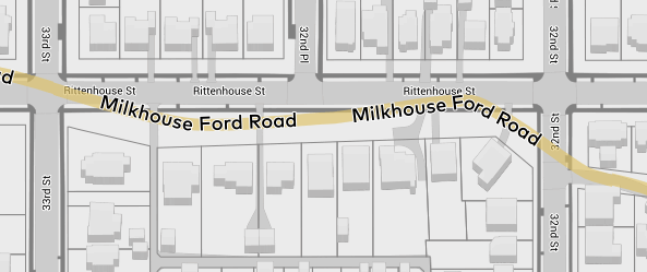
A block of spacious front yards
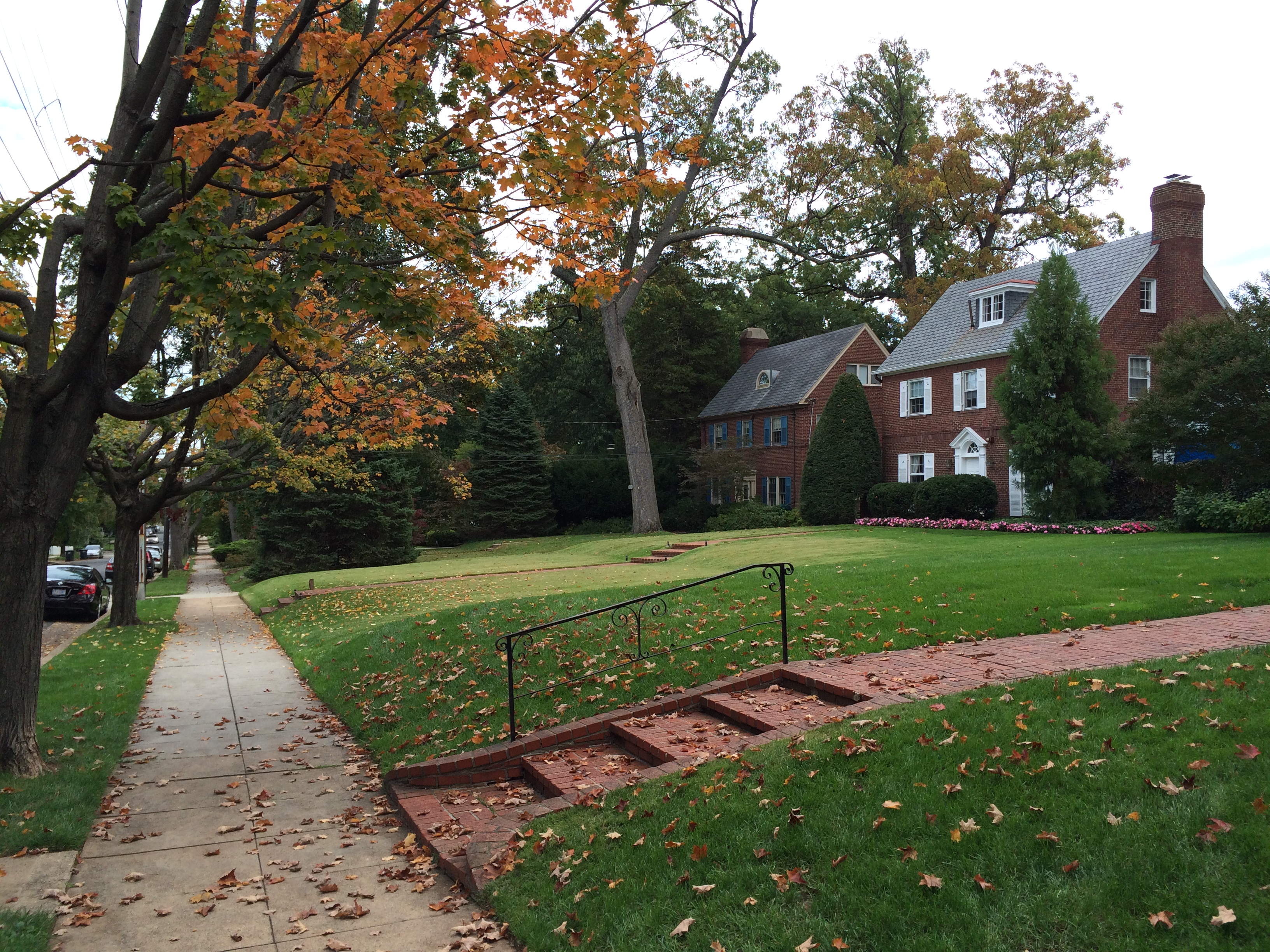
Unusually spacious yards on the 3200 block of Rittenhouse Street NW reveal the old road’s path. Photos by the author unless otherwise noted.
On the 3200 block of Rittenhouse Street NW, today’s skewed property lines and unusually generous setbacks show that the road passed through what are now the front yards on the south side of the street.
Skewed property lines accommodated the old road’s path. Map by the author. GIS data from data.dc.gov.
The 1919 Baist Real Estate Atlas confirms that the road, later renamed Rock Creek Ford Road, passed through what are now the front lawns of houses on this block.
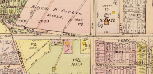
Map from the 1919 Baist Real Estate Atlas.
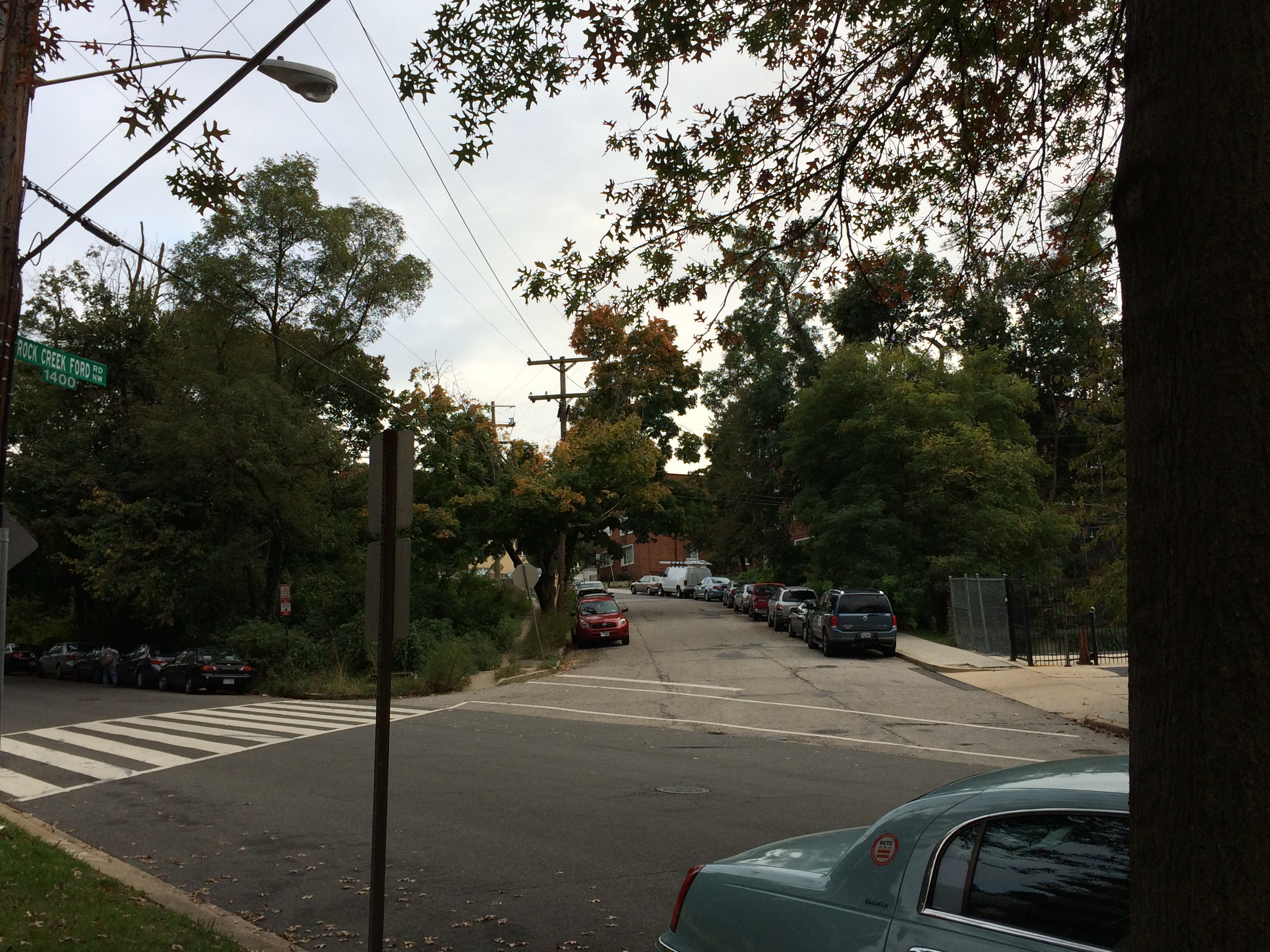
An alley out of nowhere
One block east, an alley splits off to the right of Quesada Street NW. This alley is officially named Rock Creek Ford Road and traces the path of the old road.

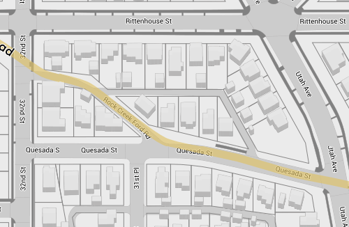
The old road (yellow) still exists for this block. Map by the author. GIS data from data.dc.gov.
From this point to the western edge of Rock Creek Park, today’s landscape makes it hard to spot the road’s path. Subsequent landowners simply disregarded the road when building new developments.
An abandoned ford crosses Rock Creek
In Rock Creek Park, the old road ran over what is now a stream valley hiking trail connecting to the Milkhouse Ford. The trail’s packed dirt surface is similar to what the road’s original surface would have been.
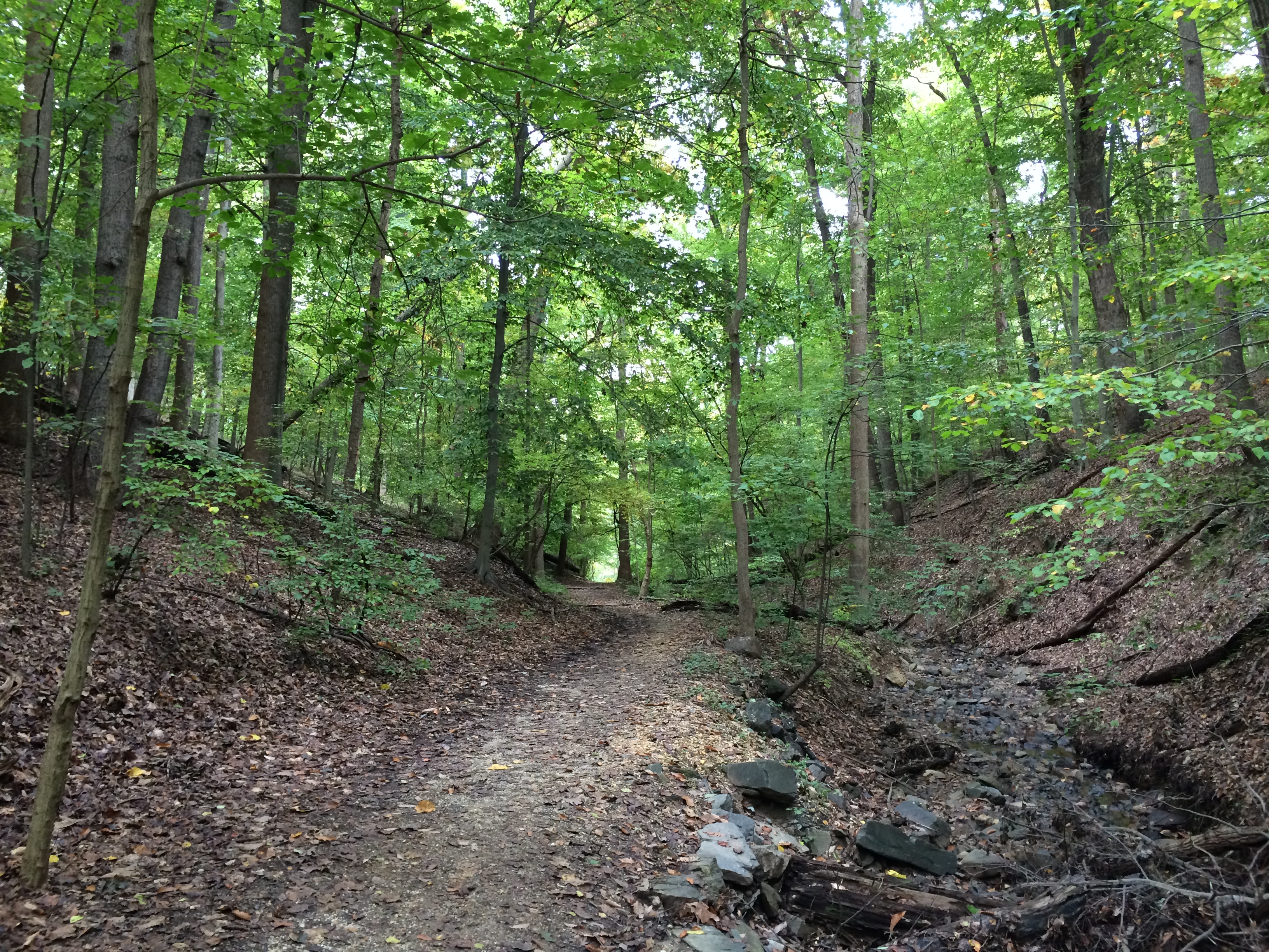
Visitors to the northern end of Rock Creek Park have undoubtedly noticed the ford north of Military Road. During the Civil War, the Union Army surrounded Washington with forts perched on the ridges of the area’s rolling farmland. The Army constructed Military Road to connect these northern DC forts, but before Military Road, Milkhouse Ford was the only Rock Creek crossing in the northern part of DC. It served as a vital east-west route.
In 1890, Congress established Rock Creek Park but was slow to invest in the park’s infrastructure until the turn of the century, when it macadamized numerous park roads and paid for the ford to be repaved with concrete. In 1926, the Office of Public Buildings and Public Parks built a bridge across the creek so motorists could avoid the ford. From then until the National Park Service closed the ford to automobiles in 1996, the crossing served as an entertaining diversion for adventurous drivers.
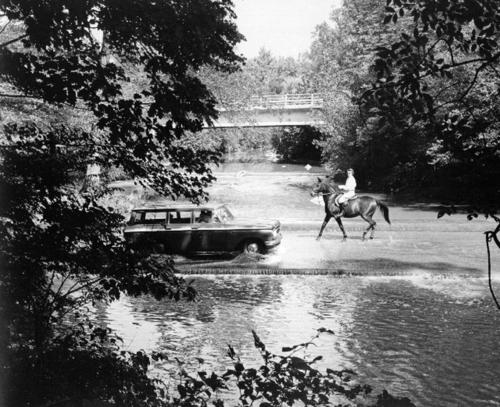
Photo from the National Park Service.
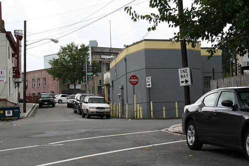
Indentations in the land mark the ghost road
Just east of the ford and Beach Drive, an indentation in the forest marks where the road ascended the stream valley to what is now the Rock Creek Golf Course. Exploring this section requires some hiking boots, but the road’s old path is discernible if you look carefully.
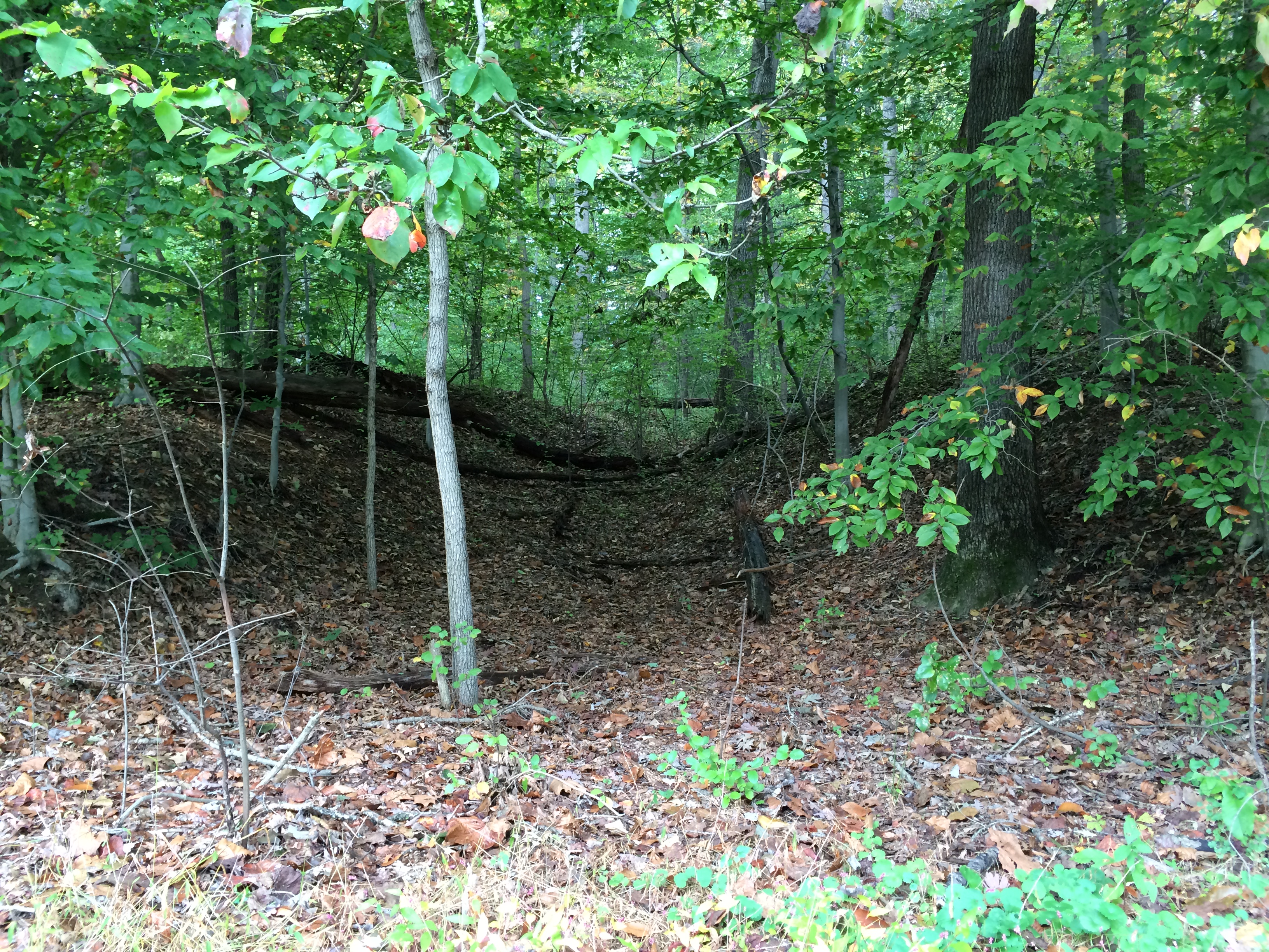
The golf course’s creation, which lasted from 1907 to 1909, eliminated all signs of the roadway through the rest of the park. But at 16th Street, builders incorporated the road into Brightwood’s street network, and it still exists today as a narrow street that cuts diagonally toward Georgia Avenue.
Map by the author. GIS data from data.dc.gov.
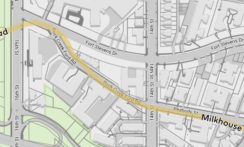
Rock Creek Ford Road branching off from Fort Stevens Drive.
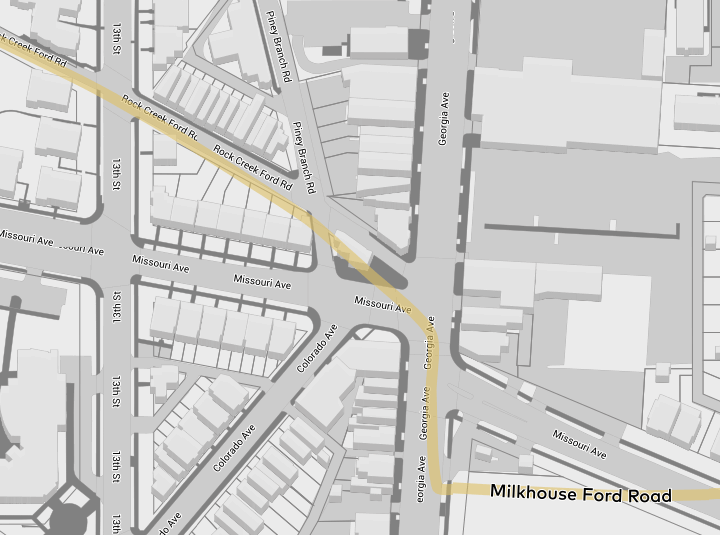
The narrow road met what is now Colorado Avenue and Georgia Avenue (then called the Seventh Street Turnpike). This is just south of Fort Stevens, where Abraham Lincoln observed a battle between Union and Confederate soldiers. Missouri Avenue wasn’t there yet, so the intersection was not as complicated to navigate as it is today.
The old narrow road as it met the turnpike that is now Georgia Avenue.
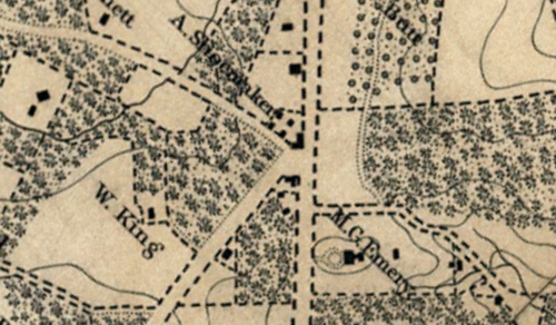
1861 Boschke map of DC. Milkhouse Ford Road (now Rock Creek Ford Road) enters at the top-left corner and continues just north of the M.G. Emery estate.
The old road (yellow) still passes through Brightwood. Map by the author. GIS data from data.dc.gov.
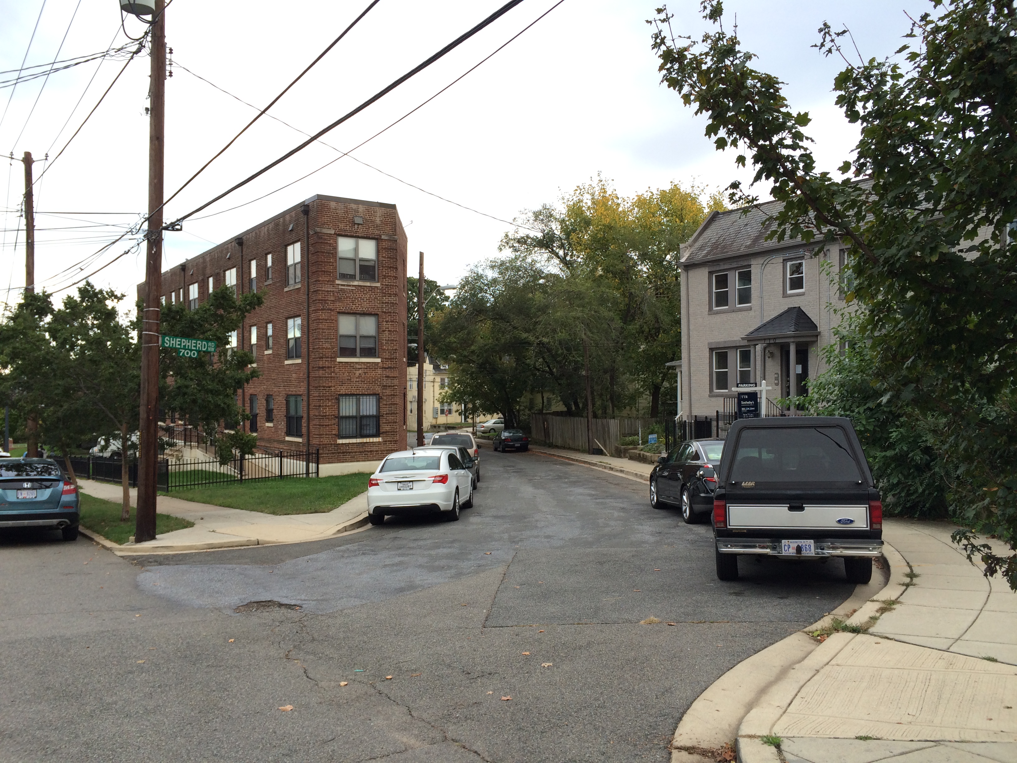
From Georgia Avenue to its end near North Capitol Street, Milkhouse Ford Road was eventually renamed Shepherd Road. With a few exceptions, it followed the path of today’s Missouri Avenue.
The extant road remains as an alley between the 400 block of Longfellow Street and the 700 block of Madison Street NW.
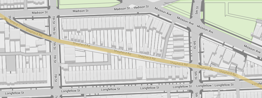
Map by the author. GIS data from data.dc.gov.
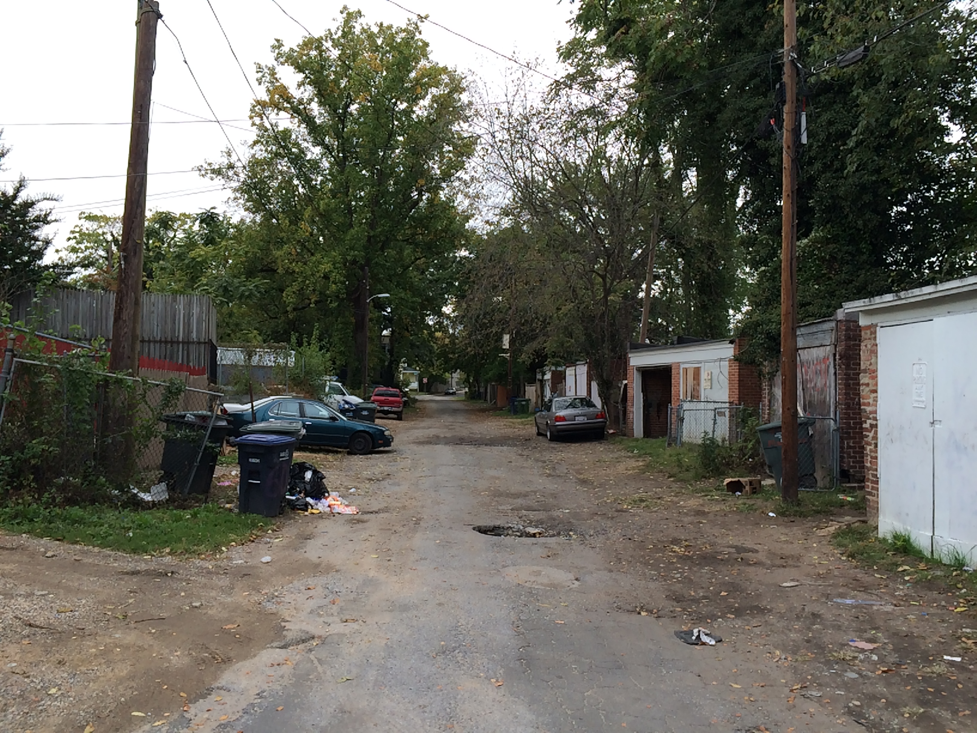
The road ended at an intersection with Rock Creek Church Road in what is now private land. Rock Creek Church Road is a similar old road. It started in Columbia Heights, passed through Petworth, and ended near what is now Fort Totten.
The road ended in the backyard of what is now a residence. Rock Creek Church Road, pictured in the foreground originally extended through the buildings straight ahead.
DC had many old, rural roads before the city’s development covered the entire District. Most still exist today as main thoroughfares, like Georgia Avenue or Bladensburg Road. The difference between these and Milkhouse Ford Road is that Georgia and Bladensburg are largely intact today.
You can explore the road’s path with this interactive map.