Here are the answers to whichWMATA week 146
On Tuesday, we featured the 146th challenge to see how well you know the Metro system. Here are the answers. How’d you do?
This week, we got 13 guesses. Four of you got all five. Great work Christopher Deal, Peter K, AlexC, and ArlFfx!
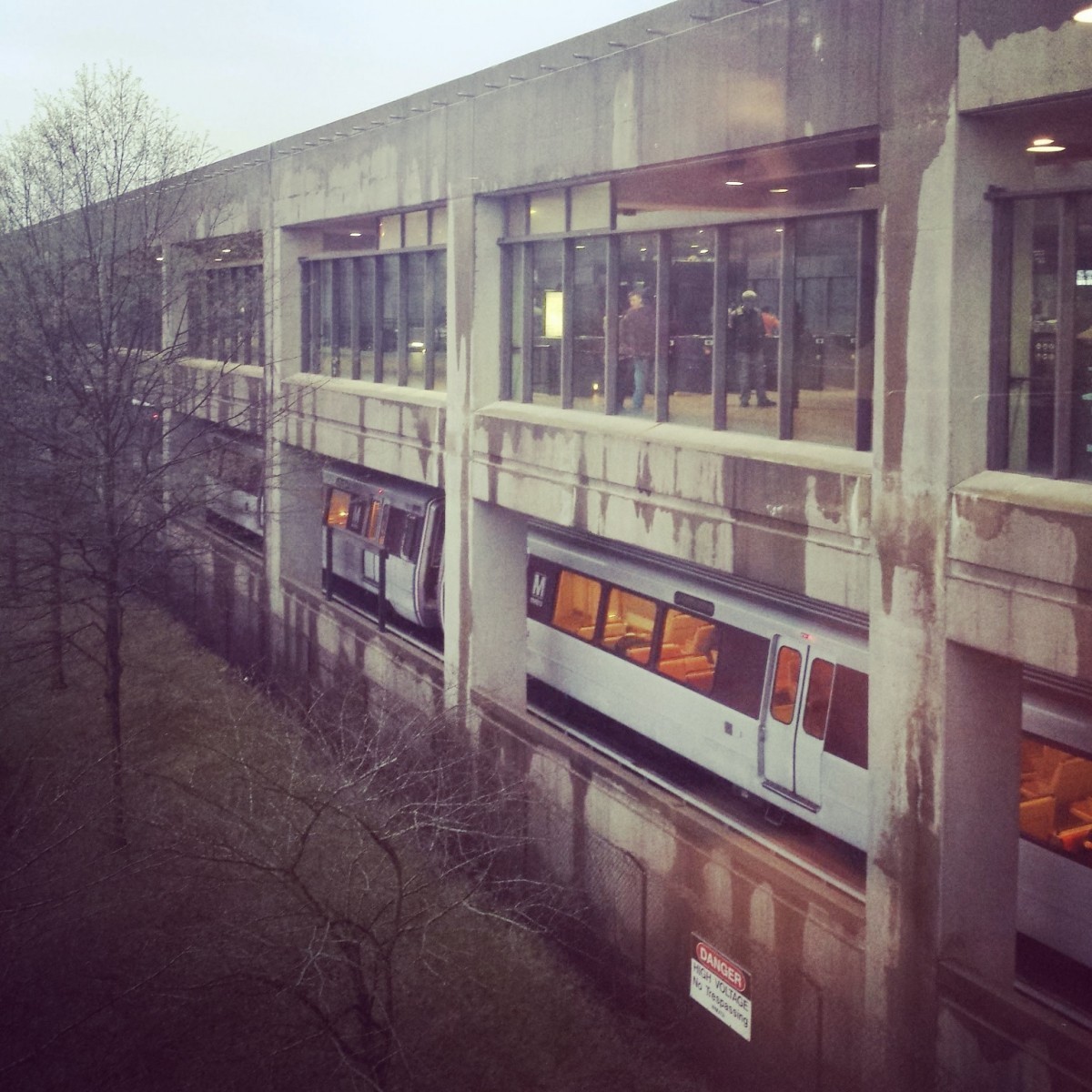
Image 1: L'Enfant Plaza 
The first image shows the northern end of the Greenbelt and Huntington platforms at L’Enfant Plaza. There were two clues here that combined should have pointed you directly to L’Enfant Plaza.
The first is the set of three “tuning fork” escalator arrays. The tuning fork style of escalator arrays is nearly universal for side platform stations, but they usually come in pairs. Only a few stations have three in sequence: Ballston, L’Enfant Plaza, and Pentagon City.
But to eliminate Ballston and Pentagon City, you should have noted the extra-wide platform. There’s room to walk on both sides of each escalator. At most side-platform stations, the outboard edge of the escalator lines up with the platform rear edge wall. Only L’Enfant Plaza and Metro Center have these extra-wide platforms.
Six of you knew this one.
Image 2: Farragut North 
The second image shows the northern mezzanine at Farragut North. Unlike most waffle-style stations, the fare array at this entrance doesn’t “float” under the vault. Here, escalators at the end of the platform rise to a mezzanine north of the trainroom. The flat, coffered ceiling is evocative of the waffle style vault, but is clearly distinct. This arrangement is clearly the Farragut North mezzanine leading to the northeast corner of Connecticut and L.
Five of you got this one right.
Image 3: Franconia-Springfield
The third image shows Franconia-Springfield from the bridge to the bus loop and parking garage. Franconia is one of only four “high peak” stations. The other three are all located on the southern end of the Green Line. You can discount Southern Avenue, Suitland, and Branch Avenue because they don’t have the same design on the side at the mezzanine level. Those stations use less glass and have a slightly set back mezzanine. Additionally, their bridges don’t have glass walls, and a close look at the photo shows some of the bridge lighting reflecting off of the glass.
Ten of you figured this one out.
Image 4: Metro Center 
The fourth image shows the entrance to Metro Center from the downtown Macy’s. This entrance is accessible off of the northern mezzanine. The main street entrance here leads up to 12th & G, but on the opposite side of the mezzanine, there’s a direct entrance to Macy’s. This view looks down toward Metro Center from Macy’s.
Six of you guessed correctly.
Image 5: Minnesota Avenue 
The final image shows the ramp leading from Minnesota Avenue up to the bridge over DC 295. Especially in combination with the catenary poles above the Landover Subdivision at right, the bridge should have been fairly distinctive for most of you.
Eight of you came to the correct conclusion.
Great work, everyone. Thanks for playing! We’ll be back in three weeks with challenge #147.
Information about contest rules, submission guidelines, and a leaderboard is available at http://ggwash.org/whichwmata.