Here are the answers to whichWMATA week 144
On Tuesday, we featured the 144th challenge to see how well you know the Metro system. Here are the answers. How’d you do?
This week, we got 40 guesses. 36 of you got all five. Great work everyone!
All of these pictures were taken on a recent flight of mine landing at National Airport. While all the photos were taken of stations in Prince George’s County (Capitol Heights is on the DC line), the real theme is they’re pretty much in a direct line from Baltimore to Fort Washington, which is the route my flight took.
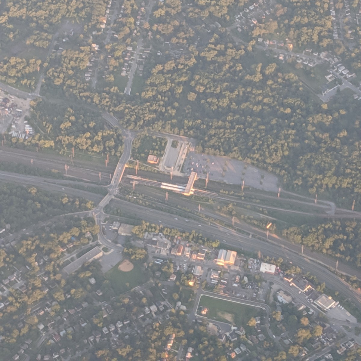
Image 1: Branch Avenue 
The first image shows a view of Branch Avenue and the Branch Avenue rail yard. The layout of this station is very distinctive because the tracks leading to the rail yard make a sharp turn away from the trajectory of the line. Additional clues include the surrounding development and the high peak style canopy.
40 of you knew this one.
Image 2: Addison Road 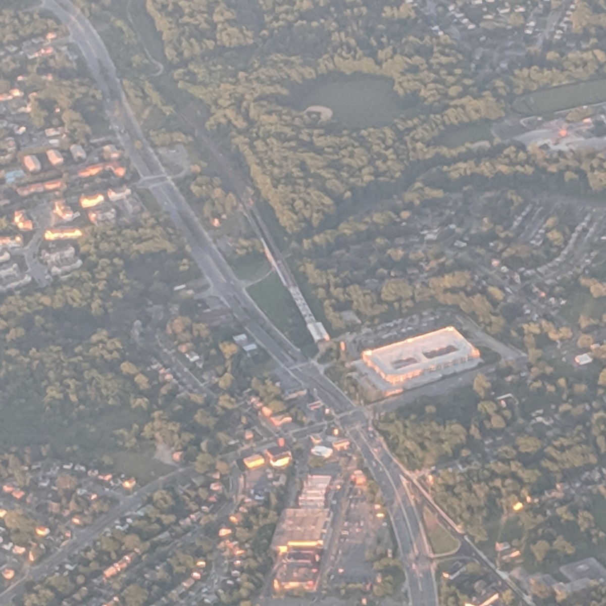
The next image shows Addison Road. This is the point where the Blue Line emerges from underground and after the station has a brief elevated section. Clues include the parking garage and the surrounding street newtork and development pattern.
40 of you got this one right.
Image 6: Owings Mills (Baltimore) 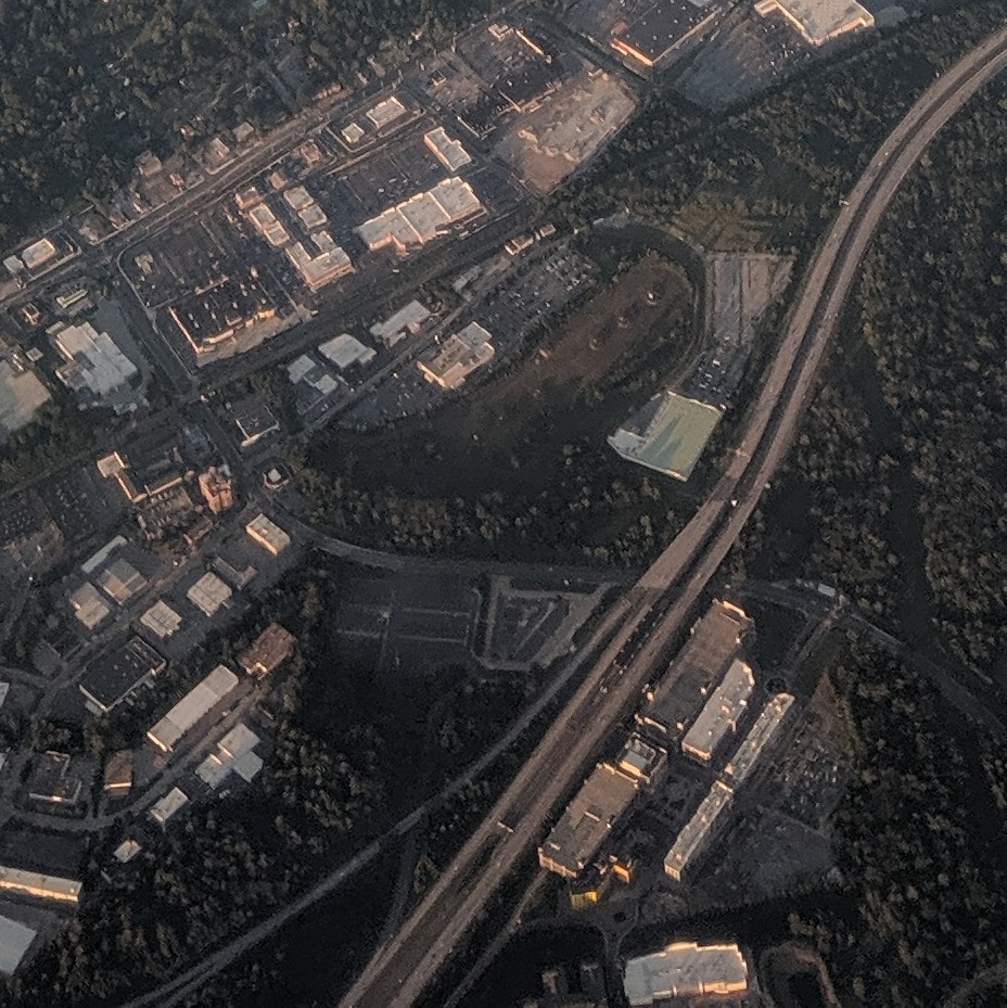
The third picture shows New Carrollton. The Metro and Amtrak/MARC stations are at center, surrounded by both new and old devevlopment. The curved buildings in the foreground, west of the station, are somewhat recognizable, as is the curved pedestrian bridge leading to the station. US 50 is visible, as are the catendary poles for the Northeast Corridor, which runs alongside the Orange Line here.
39 of you figured this one out.
Image 3: New Carrollton 
The fourth image shows Cheverly, sandwiched between the Northeast Corridor and the Landover Subdivision. It is unique in its siting, as well as having side platforms with a mezzanine above the tracks.
40 of you guessed correctly.
Image 4: Cheverly
The final image was more difficult because none of the station is visible, just the bus loop and parking. However, the street grid should have been a clue. The eastern cornner of the District, where Eastern Avenue and Southern Avenue intersect, is visible at center-left.
36 of you came to the correct conclusion.
Image 5: Capitol Heights 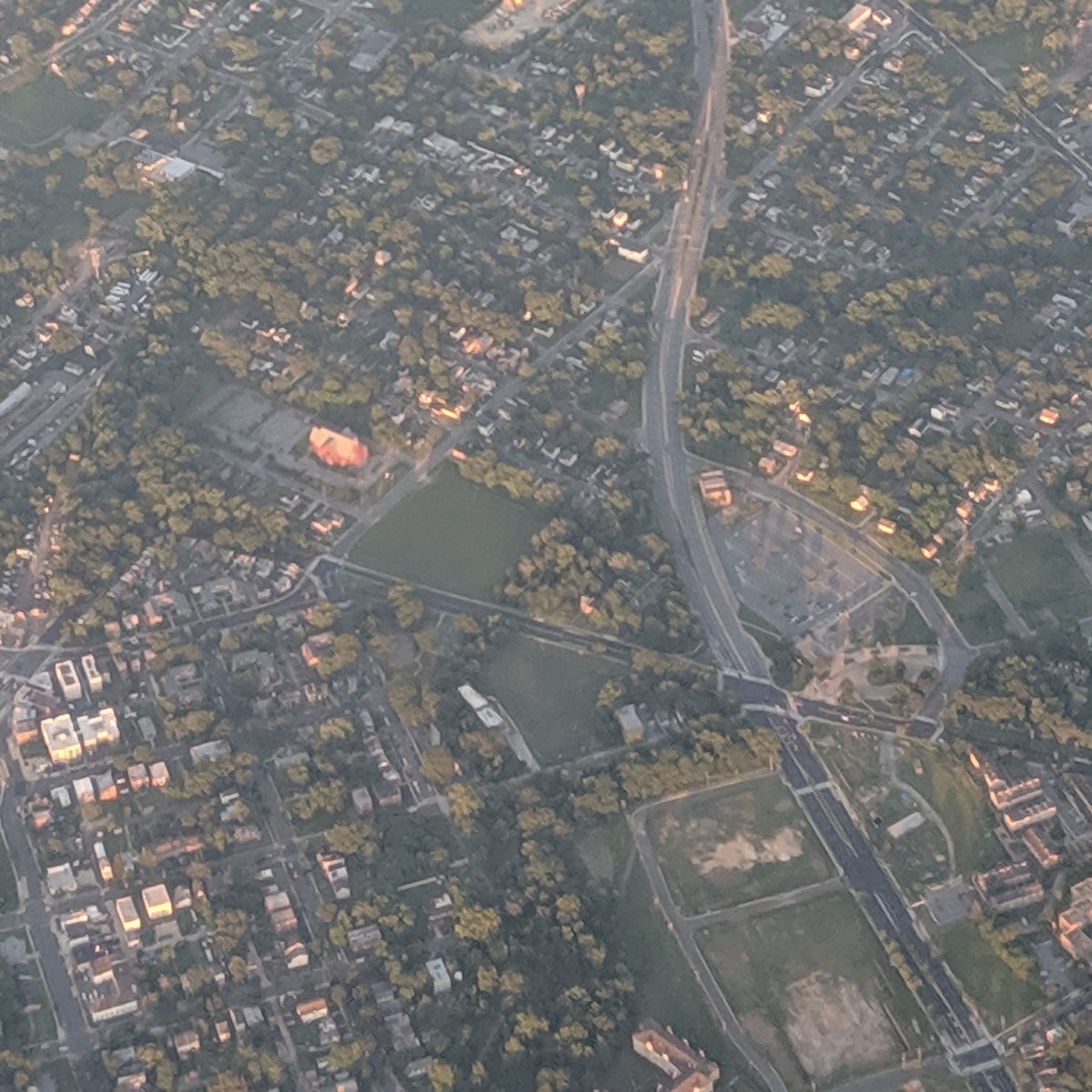
The bonus image shows a view of Owings Mills station in Baltimore. This is the westernmost stop on the Baltimore Metro Subway, also known as the Green Line. Solving this one required locating stations in freeway medians. The transit-oriented development and the arrangement of the offramps may have helped you narrow this one down.
30 of you got this one right.
Great work, everyone. Thanks for playing! We’ll be back in two weeks with challenge #145.
Information about contest rules, submission guidelines, and a leaderboard is available at http://ggwash.org/whichwmata.