Here are the answers to whichWMATA week 133
On Tuesday, we featured the 133rd challenge to see how well you know the Metro system. Here are the answers. How'd you do?
This week, we got 30 guesses. Twelve of you got all five. Great work, McLovin, Sand Box John, Peter K, Justin…, ArlFfx, Greg Jordan-Detamore, AlexC, Maurice Corbett, David Breisch, Suze, William, and Frank IBC!
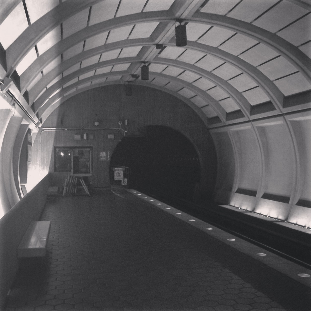
Image 1: National Airport 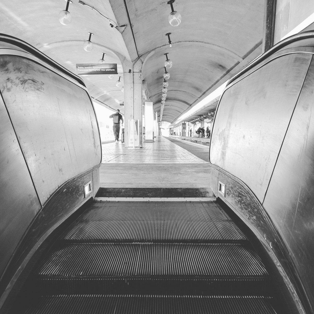
The first image looks north along the Huntington/Franconia platform at National Airport from the escalator. This one was clearly very easy, because everyone got it right. Clues include the dual platforms split by a third track; the modified Gull I canopies; the newer unique canopy at the north end; and the “continue ahead to board trains” signage.
30 of you knew this one.
Image 2: Tysons Corner 
The next picture looks toward Tysons Corner station from the bridge leading south toward the Tysons Corner Center. Most of you realized that this was clearly one of the new Silver Line stations. But which one? If you look closely at the right side, you can see that the platform is elevated above a roadway. The only Gambrel-style station that has a roadway under it is Tysons Corner.
21 of you got this one right.
Image 3: King Street 
The third image shows the platform at King Street. The canopy here is the primary clue. Only two stations have this type of roof, which we call an Alexandria Peak. King Street is unique because the canopy is separated into two different sections. This allows the viewshed down King Street of the George Washington Masonic Memorial Tower to be unobstructed.
27 of you figured this one out.
Image 4: Rhode Island Ave 
Rhode Island Avenue was the next subject. This station was the first elevated station in the Metro system to open. You can tell at the top center that the canopy is a Gull I style. There are only five elevated stations with Gull I canopies. This can't be Eisenhower Avenue, which has side platforms. We can eliminate Fort Totten and Silver Spring, which are flanked by the CSX tracks and have different structural support beams for that reason. And we can eliminate National Airport because its structure also looks different, and it isn't served by Capital Bikeshare. That leaves Rhode Island Avenue.
21 of you guessed correctly.
Image 5: Wheaton
The final image was the most challenging. Most of you knew it was one of the two Twin Tube stations. But was it Wheaton or Forest Glen? The answer lies in that window at the end of the platform.
Wheaton was the end of the Red Line for nearly a decade. And as a result, Metro built a terminal supervisor's booth at the inbound end of the inbound track. Many of the stations have have served as terminals have supervisor's booths. Some are temporary (but still present), like the ones at Ballston, Stadium/Armory, and U Street. Others are permanent ones designed into the station, like the ones at Silver Spring, Rhode Island Avenue, and Wheaton.
Forest Glen never served as a terminal, and doesn't have a supervisor's booth. Note, not all stations that have served as terminals have booths. Mostly that's the case when they weren't terminals for very long. Friendship Heights, for example, was only a terminal for 6 months, and was actually never intended to be a terminal at all. Metro originally intended to open the entire line from Van Ness to Shady Grove at once. But there weren't enough railcars on hand to operate service in the summer of 1984, so Metro first opened the line from Van Ness to Friendship Heights before extending the line to Shady Grove at the end of 1984.
18 of you came to the correct conclusion.
Great work, everyone. Thanks for playing! We'll be back in two weeks with challenge #134.
Information about contest rules, submission guidelines, and a leaderboard is available at http://ggwash.org/whichwmata.