Here are the answers to whichWMATA week 122. How’d you do?
On Tuesday, we featured the 122nd challenge to see how well you know the Metro system. Here are the answers.
This week, we got 22 guesses. Eight got all five right. Great work, Christopher Deal, AlexC, Sean F, ArlFfx, cpterp, PLKDC, Solomon, and Stephen C!
Image 1: Rockville 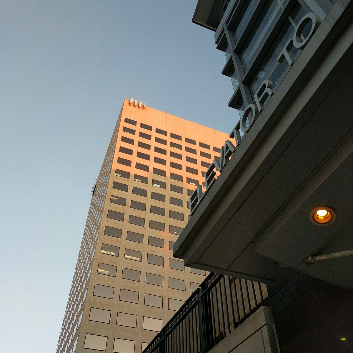
The first image shows an elevator connecting the Rockville station skybridge to the town center. We featured this same elevator four years ago in Week 13. If you didn't recognize the elevator, the building in the background, 51 Monroe, may have been a hint.
18 knew this one.
Image 2: Fort Totten 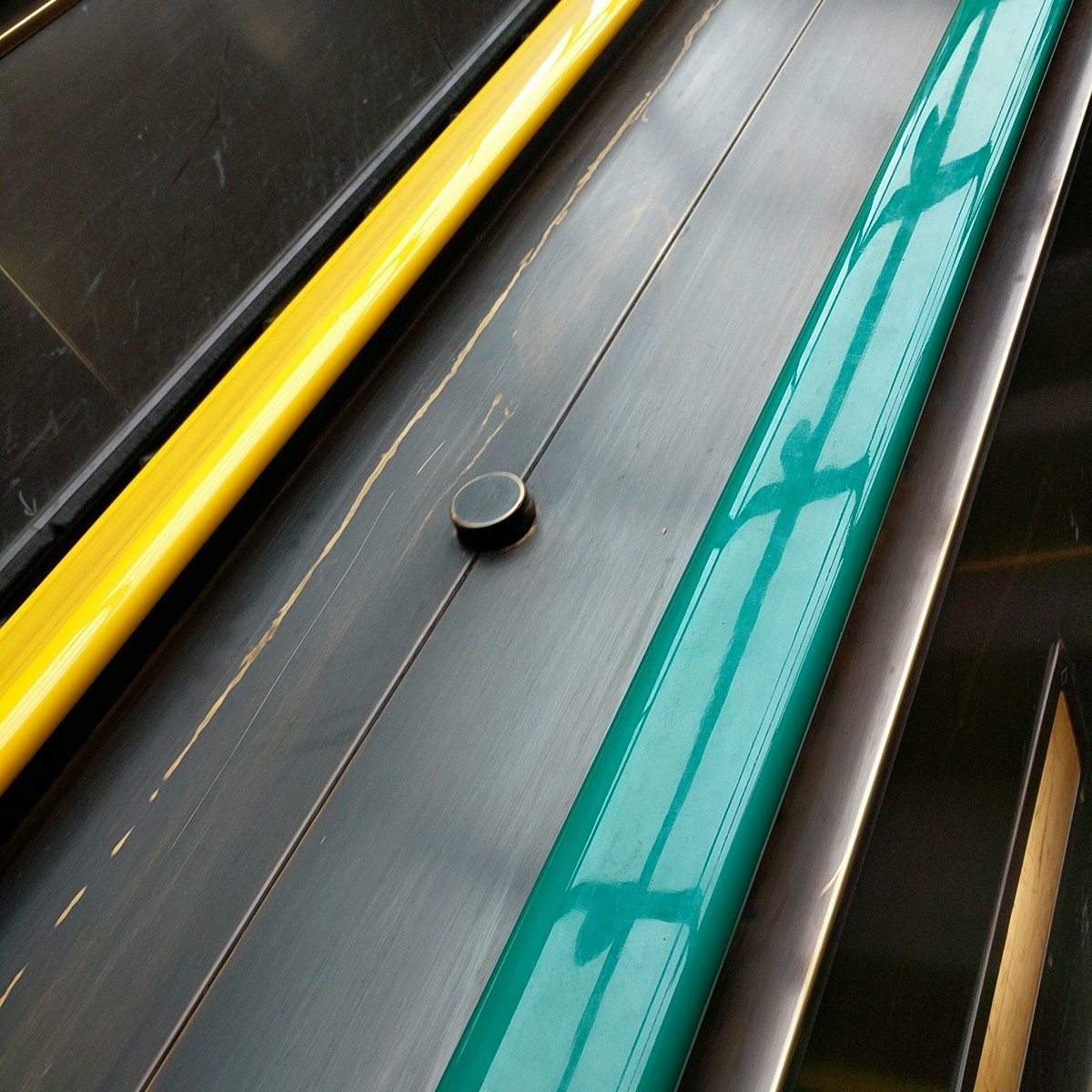
The second image shows one of Metro's newest unique features: color-coded handrails at Fort Totten. These were installed this weekend, and we covered it. If you don't read the site regularly, you might have been at a disadvantage with this clue.
Since most of you are clearly avid readers, 21 of you got it right.
Image 3: College Park 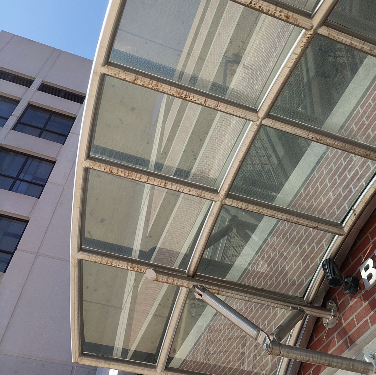
The third image also features a unique design element that we covered: The installation of the system's first (and still only) bike and ride at College Park station. As AlexC notes, the brick veneer on the parking structure is typical of those constructed in the mid-2000s, like at Largo and Glenmont (west). But the awning here and the visible “B” are clues to point to College Park.
13 of you guessed correctly.
Image 4: Medical Center 
The fourth image shows the pedestrian detour and construction work at Medical Center. Montgomery County is building a new underpass beneath Rockville Pike at this location as well as a new eastern station entrance. The new entrance will be like the second Rosslyn entrance, with several elevators ascending directly from the mezzanine to the street level. Aside from the construction, the primary clue is the distinctive Art Deco tower at the Bethesda National Naval Medical Center (now Walter Reed National Military Medical Center), which lent its name to the station.
19 knew this was Medical Center.
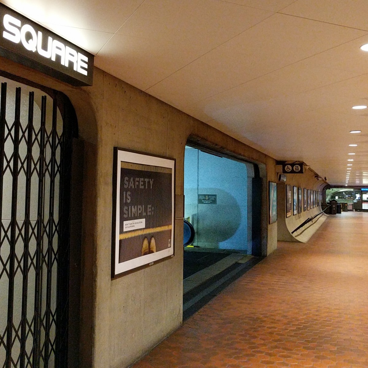
Image 5: Farragut West
The final image was the hardest. It shows a view toward the western mezzanine at Farragut West station. A few of Metro's downtown stations have underground passageways that connect to adjacent buildings. This hallway is under I Street NW and leads from the western end of the trainroom to a point just west of 18th Street. There, an elevator and three escalators pointed north lead up to street level. Just west of that junction, there's another entrance. This leads directly into the International Square building, but is closed after hours, like when this photo was taken.
The “Square” visible in the picture was a bit of a red herring. It refers to International Square, and not one of the four squares which have stations named after them (Judiciary Square, McPherson Square, Mount Vernon Square, and Virginia Square). A hint to that fact is the non-Helvetica font.
12 of you came to the correct conclusion.
Great work, everyone. Thanks for playing! We'll be back soon with challenge #123.
Information about contest rules, submission guidelines, and a leaderboard is available at http://ggwash.org/whichwmata.