Here are the answers to whichWMATA week 13
On Monday, we posted our thirteenth photo challenge to see how well you know Metro. I took photos of five stations. Here are the answers. How well did you do?
There were 44 guesses on this post. Eight of you got all five correct. Great work FN, Sean Emerson, MZEBE, Peter K, Rob K, JayTee, Roger, and King Terrapin!

Image 1: Fort Totten.
The first image shows the lower level of Fort Totten, viewed from the mezzanine. The lower level of Fort Totten is unique in that it’s partially above ground and partially below ground. The northbound train that’s visible is emerging from the subterranean portion of the station. 32 of you knew this one.
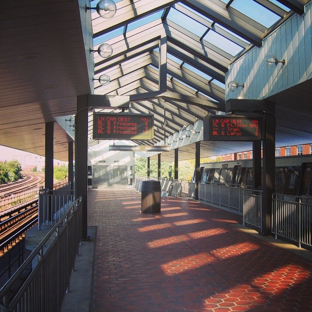
Image 2: King Street.
The second image shows the north end of the platform at King Street. This entrance is newer than the rest of the station, and is at the end of an extension of the platform. The fences are there because trains don’t stop at this section. The roof type (only present at King Street and Braddock Road) and dual elevators are both clues to the station’s identity. 26 of you got this one right.
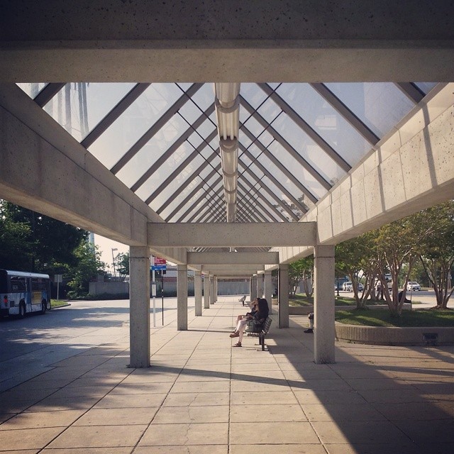
Image 3: Glenmont.
This image shows the bus loop at Glenmont station. This canopy is unique to Glenmont. The Ride On bus you can see at the left was a clue to help narrow down the possibilities. (I specifically waited to take the picture until the bus drove into the frame). 23 of you guessed correctly.
Image 4: Vienna.
The fourth image is a shot of Vienna station from one of the parking garages on the south side of the station. While this station does have the common glass and concrete peaked roof, it is clearly a median station, which narrows it to one of the four Orange Line stations along I-66.
The pedestrian bridges on both sides of the freeway, however, mean that this must be Vienna. West Falls Chruch and Dunn Loring only have a bridge to one side, and East Falls Church has an exit below the platform rather than above. 28 knew that this was Vienna.

Image 5: Rockville.
The final image was somewhat harder. This is a picture of an elevator near Rockville station. This elevator leads from Monroe Street to the pedestrian bridge that takes riders across Route 355 to the station. One clue to the location is the Brutalist Montgomery County Executive Office Building, visible at right. Only 11 of you guessed this one correctly.
Congratulations to the winners!
Submit your photos
Do you have a photo for next week’s whichWMATA? If so, please email it to whichwmata@ggwash.org by tomorrow (Thursday) evening.
Include the station where you took the photo and the name you want credited as photographer. Any photos you submit must be photos you have taken personally, and by emailing us the photo, you give us permission to use and republish it.