Shared space could be coming to Connecticut Avenue in Cleveland Park
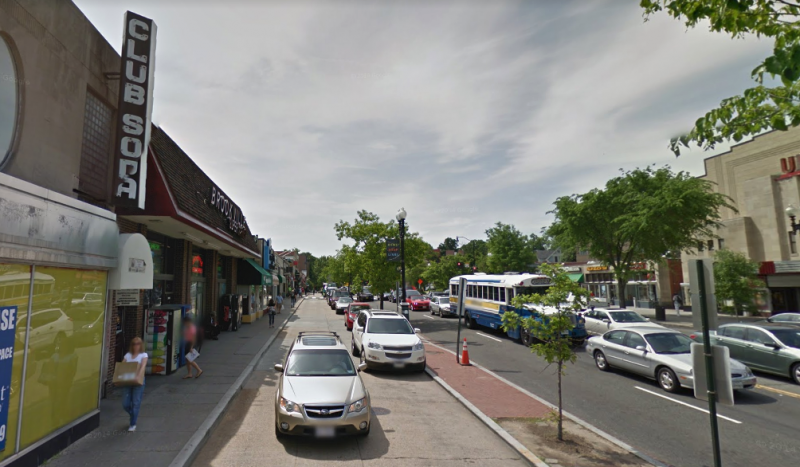
This is a view from the service lane on Connecticut Avenue in Cleveland Park. It is slated to become a pedestrian area. Image made with Google Maps.
More shared space could be coming to Cleveland Park under the District Department of Transportation's (DDOT) most recent proposal for the Connecticut Avenue service lane, which is a local road that runs parallel to the higher-speed one. New pedestrian plazas and upgraded drainage facilities would be included in a major overhaul for the area.
These drainage improvements are much needed, as demonstrated by the June of 2016 downpour that flooded the Cleveland Park metro station, swept onto the sidewalks, and rushed onto Connecticut Avenue. That was a particularly dramatic incident, but the area had frequently been plagued with flooding before.
DDOT outlined the details of its latest plan last week at a public forum at John Eaton Elementary School. Recommendations to improve Cleveland Park's streetscape have been ongoing since at least 2013, and the first meeting for the current project took place back in 2016. Officials believe the latest proposal addresses many of the problems resulting from the area's current infrastructure, while still respecting the history and character of the neighborhood.
This is the project area. Image by DDOT.
Service lane into a shared space
Previously, the service lane was slated to remain largely the same as it is today, with a narrow sidewalk separated from the roadway by a physical curb. The latest draft proposes a shared space concept for the entire lane, similar to many areas of The Wharf in southwest DC. The roadway would be raised so it's at the same level as the sidewalk, with bollards, plants, and different pavement materials helping to denote how pedestrians and drivers should use the space.
Designers hope the changes will make pedestrians feel more comfortable walking along the lane, while still allowing drivers to park outside the businesses.
View from the service lane on Connecticut Avenue and Ordway Street in Cleveland Park. Image created with Google Maps. 
At the northern end, the service lane would be shifted left so that vehicles exit directly onto Connecticut Avenue via a dedicated signal rather than onto Ordway Street. This allows the intersection of Connecticut Avenue and Ordway Street to be simplified for drivers and pedestrians. It also means there's space for the construction of a dedicated pedestrian plaza adjacent to Ordway. Much of the lane's parking would still be preserved, with only four spaces lost due to the new roadway design.
Current. Image by DDOT.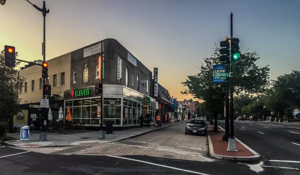
Proposed. Image by DDOT.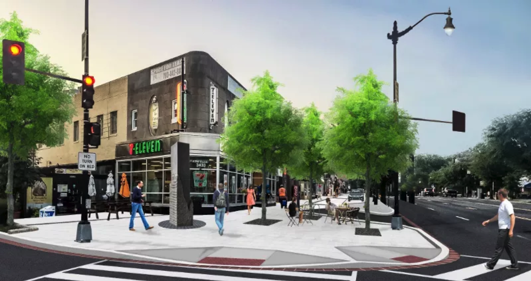
Transforming the service lane into a shared space would be a big win for the area's walkability. Instead of being confined to a narrow, crumbling sidewalk, the proposed design would allow pedestrians the spread out when the area is crowded. The new pedestrian plaza and streetscape improvements would encourage them to linger and relax, all while maintaining parking and vehicle access for the shops and restaurants along the lane.
Some steps backwards
Some other changes are less positive, however. A previous plan had a pedestrian bulb-out at Connecticut and Newark. A bulb-out is a sidewalk extension that narrows a roadway and provides more pedestrian space and improves safety at key locations, such as a sidewalk. This iteration of the plan removed it, apparently due to drainage and storm water flow concerns. Some residents in attendance pushed back on this removal, noting that the bulbout had been an official safety recommendation dating back to 2013.
Current. Image by DDOT.
Proposed. Image by DDOT.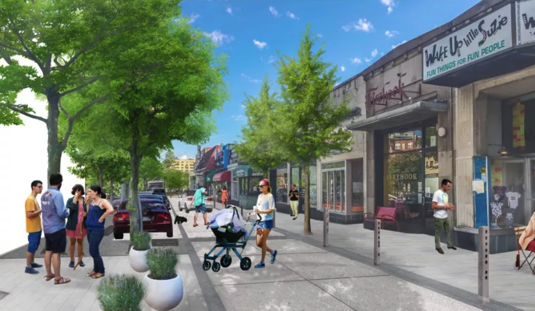
Another significant change is the reintroduction of a third driveway for the Exxon gas station at Connecticut and Porter. Previous designs had removed the third driveway for pedestrian safety. This time officials indicated that, after further study, the driveway needed to be kept for adequate flow in and out of the gas station.
Drainage improvements
During the question period, a number of residents wanted to make sure the plan did enough to alleviate flooding and erosion caused by heavy rains. Previous plans proposed building bio-retention areas and installing larger sewer pipes under Connecticut Avenue to collect storm water runoff. However, these ideas proved infeasible due to the presence of Metro's Red Line. There isn't enough underground clearance along Connecticut Avenue for larger pipes, and WMATA nixed approval of bio-retention ponds out of fear they would lead to increased water infiltration in the tunnels.
Instead, DDOT is now proposing building a new secondary drainage pipe under the alley behind the Exxon and Sam's Park and Shop. Combined with new sewer drains and subtle grade changes, the hope is that enough runoff could be redirected to this secondary pipe to help prevent water from collecting in the low spot on Connecticut right by the Metro entrances.
The details outlined last week by officials are part of the 65 percent proposal, meaning the plan is not yet final. Additional changes may be made in the coming weeks, taking into consideration public comments and input from other interested stakeholders. DDOT hopes to have a final plan ready by March, with approval and construction bids taking place this summer. If all goes well, construction could begin in early 2019.