Here are the answers to whichWMATA week 114. How’d you do?
On Tuesday, we featured the 114th challenge to see how well you know the Metro system. Here are the answers.
This week, we got 22 guesses. 14 of you got all five. Great work, Alex B, Peter K, cceval, Greg Jordan-Detamore, PLKDC, ArlFfx, David Duck, Solomon, animannyac, Stephen C, JamesDCane, Peter K is a nice guy don't be hatin' on him!, J-Train-21, and AlexC!
Image 1: Foggy Bottom 
The first image shows a view up the street escalator and stair shaft at Foggy Bottom. From the visible buildings, you could have surmised that this is a Metro entrance in an urban area. Few of those entrances have stairs and escalators (most are escalator-only). So that narrowed the field down. We also featured a similar view in Week 111.
17 knew the right answer.
Image 2: Crystal City 
The second image had a bit of the name visible as one of the clues. If you guessed Crystal City, you got it right. There are two stations with “City” in their title, which you should have been able to guess from the letters visible on the pylon. Both stations have side platforms, so that didn't help. Knowing the escalator configuration was the key you needed.
At Pentagon City, the sole mezzanine is at the far north end of the station, with the entrance through the end wall above the tracks. It has three escalators lined up on each side, all facing the same direction. That doesn't match the picture here.
At Crystal City, there are three escalators on each side of the tracks, but two face railroad south and one faces railroad north (the station is actually oriented roughly east-west). The entrance to the mezzanine is near the center of the station, instead of at one end, like at Pentagon City. And that's what you see in this image.
We discussed the mezzanine layouts of Crystal City and Pentagon City in Week 105. To recap, Pentagon City looks like this: [:::::::::::>>>] and Crystal City looks like this: [:::::>><::::::].
17 guessed correctly.
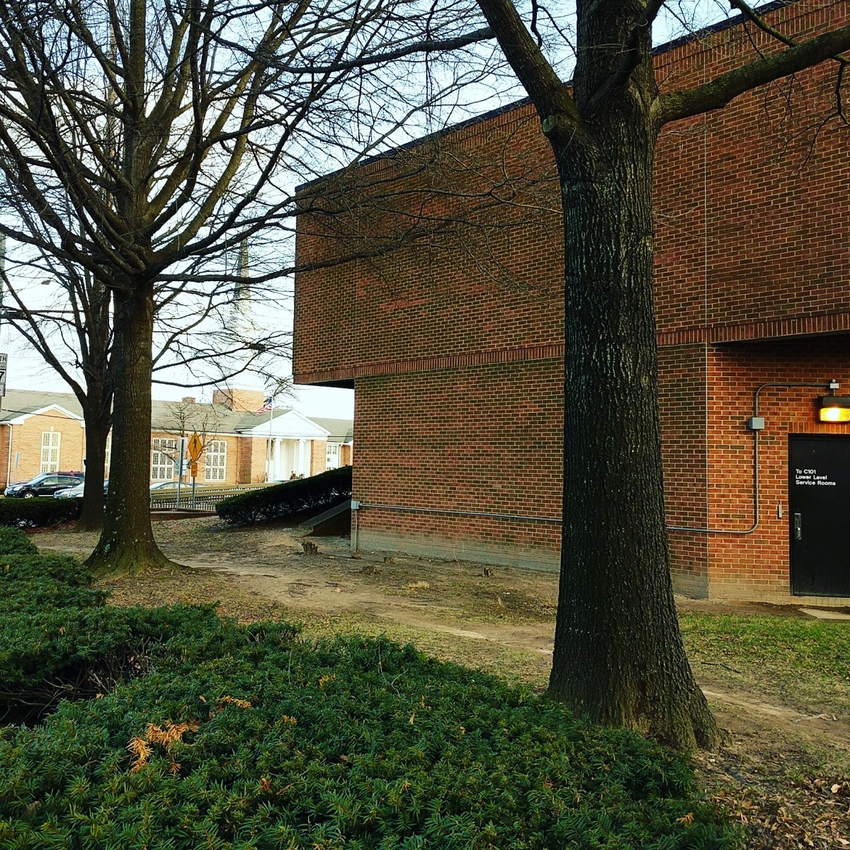
Image 3: Forest Glen
The third image shows the exterior of the mezzanine structure at Forest Glen. This brick structure housing the station entrance is fairly unique in Metro and is a result of the elevator hoistway equipment above the partially below-grade mezzanine. This station doesn't have escalators, only six high-speed elevators linking the platforms more than twenty stories below ground.
I also carefully cropped the image to leave just the edge of a Maryland state highway shield at far left. The square signs are unique to Maryland within the region as Virginia's are either circular or acorn-shaped and DC only has one numbered “state” highway. You should have been able to discern that the last digit was a “7”, and that may have led you to guess that the road in question is Georgia Avenue / MD 97. There are three Metro stations located directly adjacent to MD 97: Forest Glen, Wheaton, and Glenmont. Using Google street view was one way to narrow this down if you didn't recognize the structure or surrounding buildings.
18 gave the right answer.
Image 4: National Airport 
National Airport is our next photo subject. This image shows the southern (Terminal B) mezzanine. I expect that many of you have used this station and probably recognized elements of the design. Some of the clues include the unique signage indicating which platform is for downtown and which platform is for trains headed south, the glass mezzanine walls, and the girder carrying the center trackway above the station manager's kiosk.
One additional clue is that all the visible faregates are entry gates. The absence of exit gates indicates that those gates are out of frame on the other side of the station manager's booth, and that should tell you that the station is wide enough to have another platform and set of escalators to the left.
18 guessed National Airport.
Image 5: Fort Totten 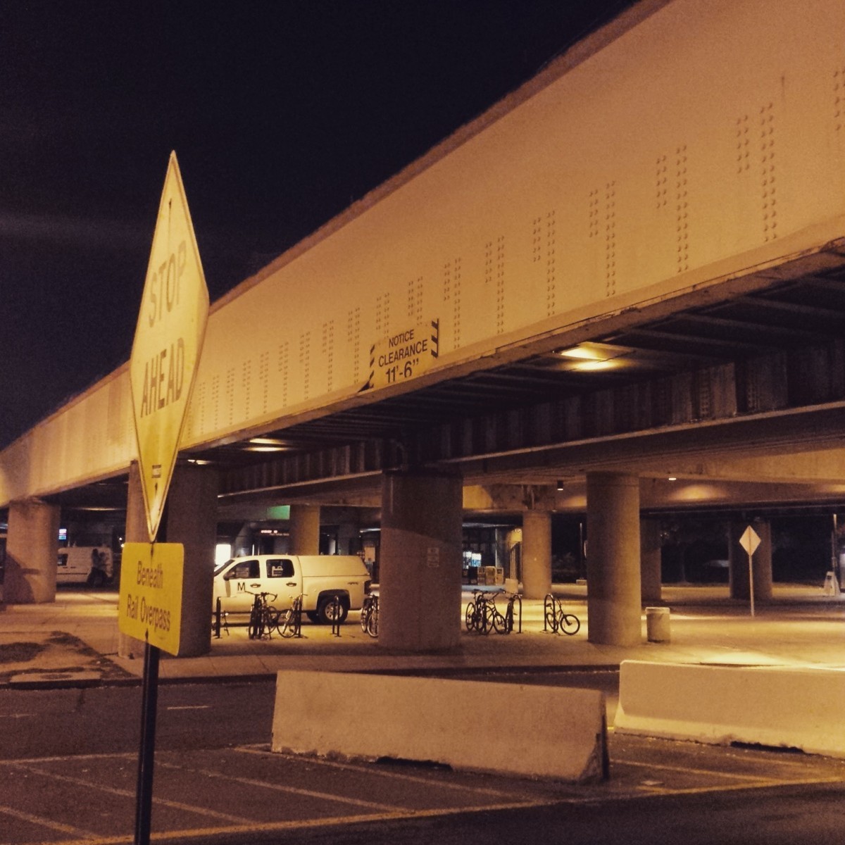
The final image shows the kiss and ride and bus loop at Fort Totten. This wide road area underneath the north end of the platform is fairly distinctive. The overpass structure is indicative of the elevated stations along the shared WMATA/CSX corridor between Brookland and Silver Spring. Brookland station isn't elevated, so that leaves three stations: Fort Totten, Takoma, and Silver Spring. The shared corridor has the two Metro Red Line tracks sandwiched in between the two CSX/MARC tracks, and the result is the large-girder CSX bridges flank the Metro tracks. Here, the undercrossing is especially long because of the four tracks and the width of the Metro platform as well.
21 came to the correct conclusion.
Great work, everyone. Thanks for playing! We'll be back in two weeks with challenge #115.
Information about contest rules, submission guidelines, and a leaderboard is available at http://ggwash.org/whichwmata.