This online GIS atlas reveals the history of Prince George’s County
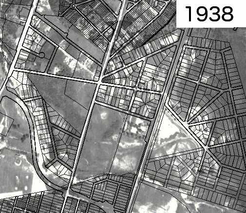
Aerial photos of Lakeland from 1938 to 2018, with property lines overlaid. Image by M-NCPPC’s PG Atlas.
The online Prince George's Atlas is a virtual treasure trove of historic aerial photos, maps and other cartographic information about the region.
Volunteers at the Prince George's County Historical Society's reference library first tipped me off to this Atlas when I was researching Nineteenth Century maps of the county. The Prince George's Atlas site, maintained by the M-NCPPC, is a bit lacking in instructions. However after a few minutes clicking around, I found it to be reasonably intuitive, so I'll be your guide.
Exploring 19th Century Maps
The most important feature–indicated by a button with three rectangles layered on top of each other known as a hamburger button–is a menu that allows one to select from a long list of map layers providing different kinds of data.
The same view, of Good Luck Road and Campus Drive in College Park and Riverdale in the Martinet map (above) and Hopkins Atlas (below). Image by M-NCPPC’s PG Atlas.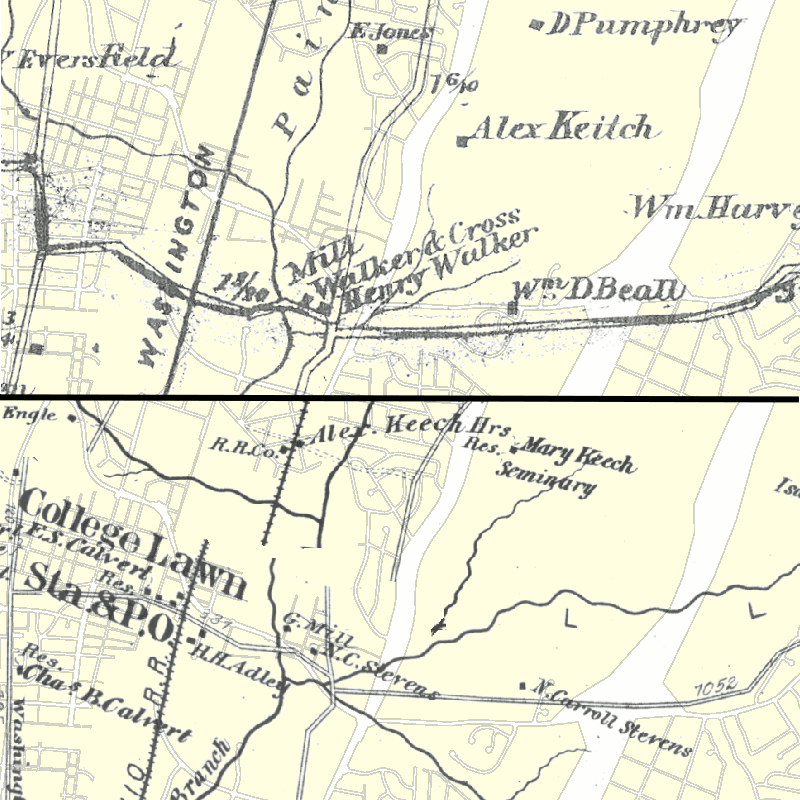
The site contains the two oldest maps of the County, the 1861 Martenet Map and the 1878 Hopkins Atlas. (These layers are listed under “Supplemental Imagery.”) Both can be overlaid on the current street grid to allow one to see what a neighborhood was like one hundred and fifty years ago.
However, the historical maps don't match up exactly–I suspect they weren't surveyed very precisely–and there are discontinuities, so it takes a bit of guesswork and local familiarity to figure out what roads correspond to the ones seen on the map.
Finding Abandoned Neighborhoods
For a more recent historical view, the Atlas contains aerial photography–also under “Supplemental Imagery”–of the County going back to 1938. Unlike the historical maps, these match up very closely with the current street grid, making them easier to understand.
Besides allowing one to see when areas of the County were originally developed, this feature allowed me to find a neighborhood of College Park that no longer exists.
Aerial photos of Lakeland from 1938 to 2018, with property lines overlaid. Image by M-NCPPC’s PG Atlas.
Lakeland, the neighborhood of College Park east of US-1 and just north of Campus Drive, is a historically-African American neighborhood surrounded by subdivisions that were originally whites-only.
The neighborhood currently ends at the MARC Camden Line railroad tracks, but it originally extended further east, on the land that is now Lake Artemesia. By overlaying the old aerial photos and the property lines in the area, one can see where the eastern half of the community used to be, and how it was originally broken up into lots.
The photos also help confirm that although the land directly north of Campus Drive between US-1 and Rhode Island Avenue–now part of the Paint Branch Trail park–was divided up into lots with several streets. It doesn't appear to ever have been built on, likely because it was too swampy.
Discovering property and utility boundaries and environmental information
Along with the property lines I mentioned previously, one can overlay the maps with various other boundaries, including electoral districts, school boundaries for elementary, middle, and high school students, and even utility boundaries.
A map of the areas of New Carrollton served by the three elementary schools inside the city limits. Image by M-NCPPC’s PG Atlas.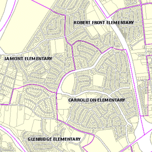
I found the County Council districts particularly useful, because the County government doesn't seem to have very detailed maps of them on its website.
A map of electric utilities in Prince George's county. Green for BG&E, blue for PEPCO, and orange for the Southern Maryland Electric Cooperative. Image by M-NCPPC’s PG Atlas.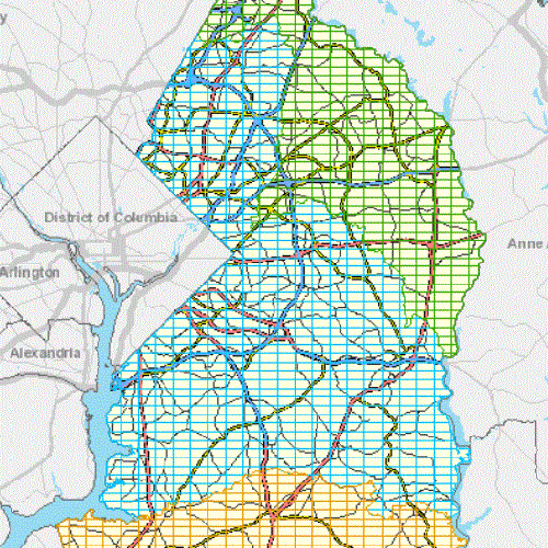
It was also interesting to see where exactly the boundary between PEPCO and BG&E service is. I hadn't realized that BG&E provided electricity to some areas inside the Beltway, or that the southern part of the County got its electricity from the Southern Maryland Electric Cooperative.
Another feature of the Prince George's Atlas is the ability to display several types of environmental information, including ground cover, impervious surfaces, floodplains, watersheds, and a contour map of the county with two-foot contours.
A map of groundcover in the western half of Greenbelt and northern Berwyn Heights. Black is roads, grey parking lots and other pavement, red is buildings, dark green is trees, light green is grass, blue is water, and brown is bare soil. Image by M-NCPPC’s PG Atlas.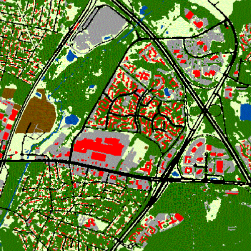
A few downsides to the resource
While the Prince George's Atlas provides a number of interesting map layers, the user interface is hardly perfect. Using the site is not incredibly self-explanatory, and it took me an hour or two to fully understand it.
Furthermore, a number of the layers will only display if you are zoomed in very closely, making it hard to get a good overview of a large area. A display of major roads is overlaid on any map layer if you zoom out beyond a medium-sized area.
What do you think about this tool? What information would you look for?