University of Maryland students redesigned DC’s Banneker Overlook and Southwest Waterfront
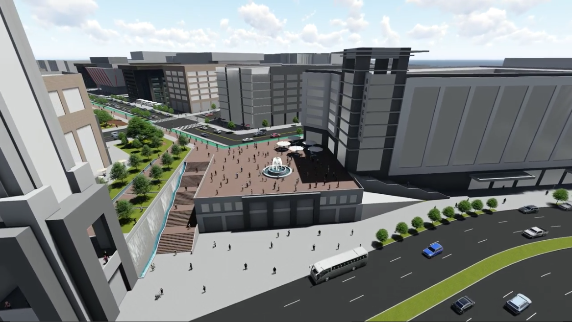
Screen shot from Professor Matthew Bell's student video, showing a redesign plan for Benjamin Banneker Park and the area surrounding it in Southwest DC. Image used with permission.
University of Maryland’s Graduate School of Architecture, Planning, and Preservation has just released a video of their vision for Banneker Overlook in Southwest DC. The Overlook is located in the Southwest Ecodistrict, which was formed to improve the urban design of Southwest Waterfront. While the students' design will most likely never become a reality, it creates an interesting vision – as well as an opportunity to talk about how we can make this area of Southwest Waterfront a better public space. Two people relax on the grassy lawn overlooking the Fish Market near Benjamin Banneker Park at L'Enfant Plaza. Image by Elvert Barnes licensed under Creative Commons.
Multiple proposals to update this area exist – with varying degrees of new development – but many of them focus on revamping the Banneker Overlook and the L’Enfant Plaza Promenade. By contrast, this proposal offers a fly-by-wire view of what the Southwest Waterfront could look like with a new tiered plaza where the overlook currently is, and with denser, mixed-use development surrounding it.

Correcting historical design errors
In the middle of the 20th Century, the federal government underwent a major urban renewal project in Southwest DC that cleared out most of the existing development, including a large slum. One of the renewal project’s biggest casualties was an accessible path between the National Mall and the Potomac Waterfront.
Currently, 10th Street Southwest extends south from the Mall to form the L’Enfant Plaza Promenade, and then terminates at the Banneker Circle Overlook. This essentially forms a street with limited utility, since the promenade does not intersect with any cross streets and Banneker Circle only has one other outlet.
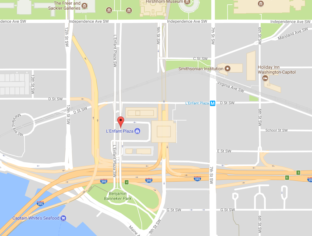
Architect Dan Kiley created the original design of the Overlook to be a green space above Maine Avenue and the Waterfront. Unfortunately, due to its awkward location, isolation, and limited access for pedestrians and street traffic alike, the area mostly serves as a parking lot for nearby offices and tour buses. This map shows the location of Banneker Park. Image by the author.
This new design attempts to rectify the current lack of access to Banneker Circle. Under the supervision of Professor Matthew Bell, FAIA, students Yoel Alemayehu, Erin Barkman, Adrian Bradshaw, Pedro Camargo, Jennifer Chorosevic, Emily Latham, Lawrence Manongdo, and Eli Shanklin created this new vision. It reimagines the Banneker overlook as a tiered plaza or terrace, proposing a more continuous street experience between the Mall and The Wharf. The video also shows a lot of new development, filling in areas around L’Enfant Plaza and spanning over the existing I-395.
Screenshot of the terraced steps that would replace the current ramps and hills. Image used with permission. The Benjamin Banneker memorial in Banneker Park. Image by Amaury Laporte licensed under Creative Commons.
Bell and his students see this as a way to correct the mistakes of a mid-20th Century design with a 21st Century urban environment. Bell notes that prior to the Southwest urban renewal project there was vibrant commercial activity located on the Waterfront, and connectivity to the area was better.

Preserving the legacy of a great man – while boosting accessibility
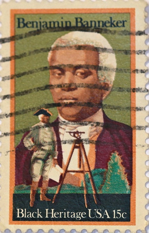
One challenge for the community is preserving the legacy of Benjamin Banneker, the person for whom the overlook was named and an unsung figure in the early history of the District of Columbia. Born in Baltimore County a free black man and largely self-educated, Banneker worked under Major Andrew Ellicott to survey the District. He was instrumental in establishing the modern boundaries of the nation's capital.
Because of his historical importance, advocates such as the Washington Interdependence Group argue that any redesign must appropriately memorialize Banneker and his accomplishments. Benjamin Banneker (1731 – 1806) was a free African American astronomer, mathematician, almanac author, and farmer born in Baltimore County, Maryland. He helped survey the borders of the original District of Columbia. Image by John Flannery licensed under Creative Commons. Ramp near the Overlook, which isn't ideal in terms of accessibility. Image by Elvert Barnes licensed under Creative Commons.
Bell says his students are attempting to create better connections to The Wharf. The result is a more urban and more accessible area, but its design, according to Bell, could incorporate civic art such as a new memorial to Banneker. The biggest problem with the current Banneker overlook is that it is a public space without much public accessibility.
As a Southwest resident, I first learned about Benjamin Banneker and his accomplishments through a placard located in the traffic circle. People outside of neighborhood residents are much less likely to know about this park, however. If we truly want to honor the legacy of Banneker, then we must have a public space honoring him that is actually designed for public use.

What do you think of the design? How could Banneker Overlook and the Southwest Waterfront be improved?