Connecticut Ave’s service lane in Cleveland Park may soon look much different
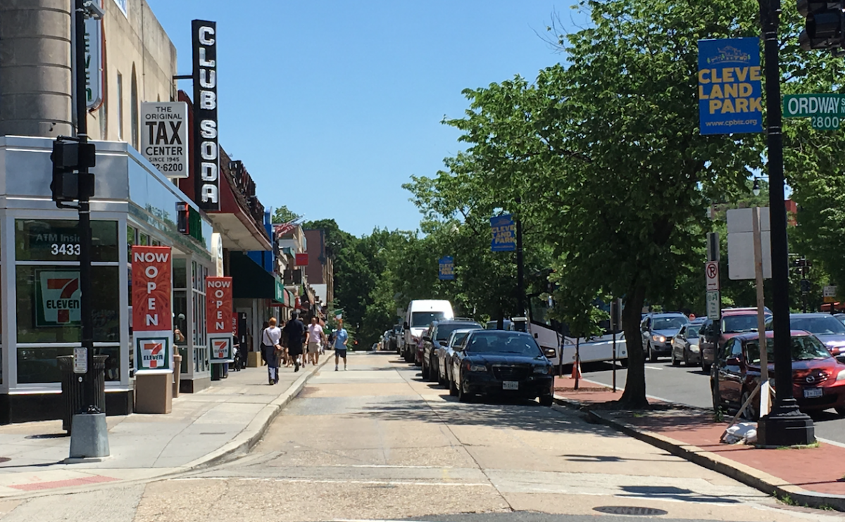
Pedestrians walk along the service lane in Cleveland Park. Image by the author.
Along Connecticut Avenue in Cleveland Park, there's a service lane whose best use has long been the subject of debate, along with an intersection that's very difficult for pedestrians to navigate. The District Department of Transportation's plan for the area would keep the lane for cars but also work to slow driving speeds. It would also re-do the intersection to make it much easier to walk through.
The main commercial strip in Cleveland Park runs along Connecticut, from the Metro stop at Porter Street NW down to Macomb Street. The area features many shops and restaurants, a public library, and multiple bus lines. With the District looking to realize Vision Zero, a plan where nobody dies from traffic-related injuries, the neighborhood is full of opportunities for newer (and safer) pedestrian infrastructure.
Scope of work along Connecticut Ave. Image by DDOT.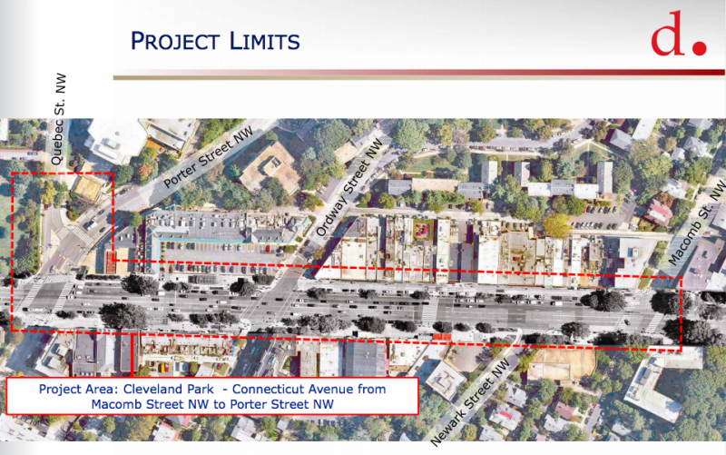
Last year, heavy rain caused the Cleveland Park Metro station to flood, highlighting the need for better drainage in the area. Plans for changes were already underway, but according to Ward 3 Councilmember Mary Cheh, who represents this area, the storm kicked things into gear.
The service lane stays, but with more space for people
The service lane, whose entrance is on Macomb Street and exit is on Ordway, is home to about 25 parking spaces. For years, some have argued that it should become a sidewalk. Others, particularly business owners, have said they depend on customers who park there. It’s such a contentious issue that DDOT even published a 330 page study about it!
The service lane along the eastern side of Connecticut Avenue. Image by Google Maps.
One problem with the current arrangement is that it results in an awkward five-way intersection at Connecticut and Ordway. Another is that it makes for a narrow sidewalk— often no wider than six feet— along the storefronts. It’s not uncommon to see pedestrians walking in the service lane during busier periods.
Narrow sidewalk along the service lane. Image by the author.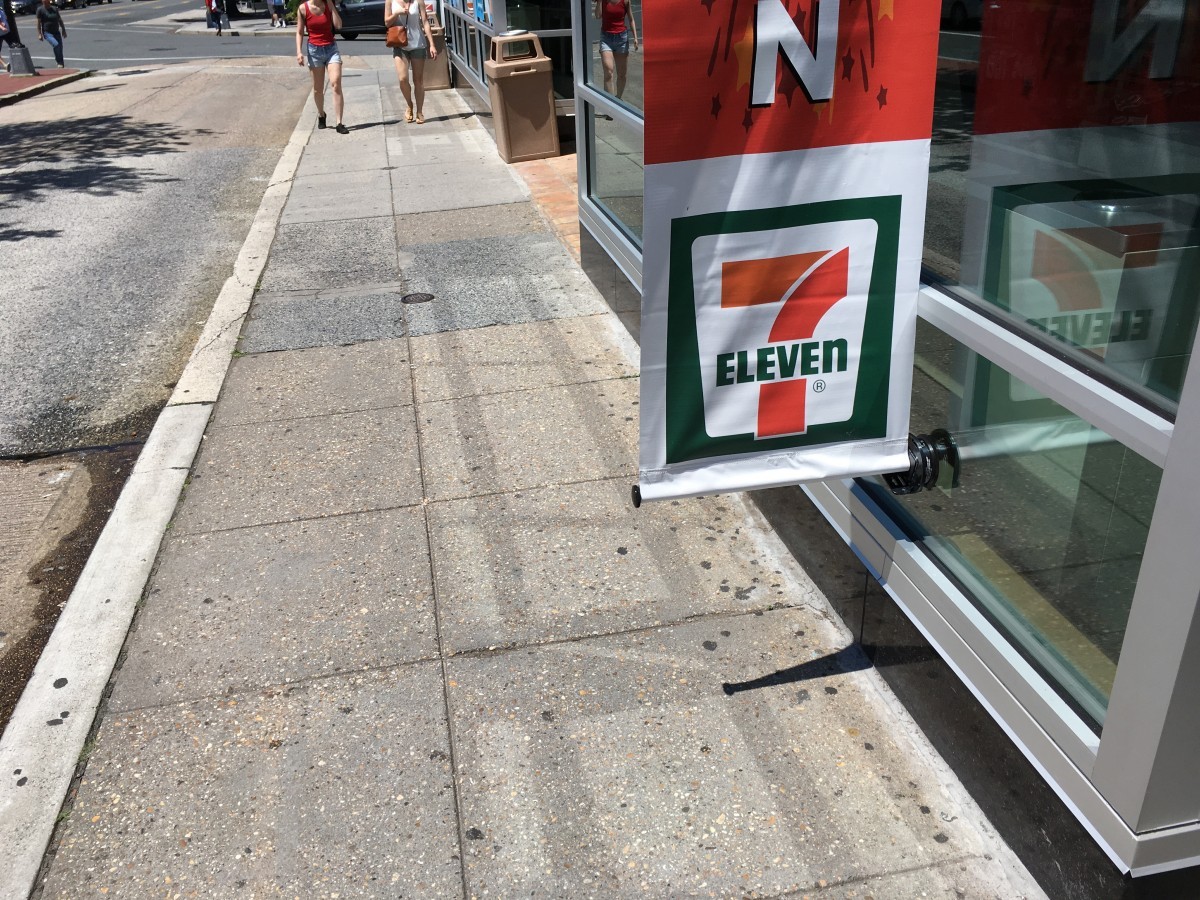
DDOT has proposed three plans for keeping the service lane open to cars while moving its exit onto Connecticut Avenue. Bulb-outs would go between the lane and Ordway, creating new space for a small plaza and simplifiying the intersection of Connecticut and Ordway.
Proposed alternatives for the service lane. Image by DDOT.
The agency is also looking repaving the lane with cobblestones while leaving the sidewalks concrete. This would slow traffic and visually separate the parking area from the sidewalk.
A much more pedestrian-friendly intersection at Connecticut and Porter
At the intersection of Connecticut and Porter, slip lanes from Quebec Street force pedestrians onto traffic islands and encourage higher speed turns. They also mean the bus stop is in an inconvenient place farther east on Porter. An awkwardly-placed driveway for an Exxon station on the southeast corner of the intersection adds another potential conflict point for pedestrians and drivers.
The intersection of Connecticut Ave with Porter and Quebec Streets. Image from Google Maps. 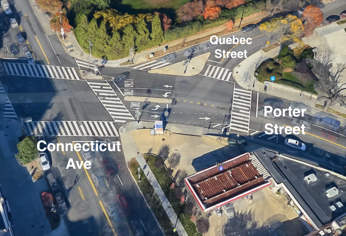
The plan DDOT has put forward would remove the slip lanes, using the space to widen the sidewalk, add places to sit, and move the bus stop closer to Connecticut Avenue. One of the Exxon driveways would also go, and Porter Street would get a pedestrian island and bulbouts.
Proposed redesign of the intersection of Connecticut Ave and Porter St. Image by DDOT.
New seating and better drainage, too
The plan also slates other parts of Connecticut Avenue for changes. Since the western side of the street has a wide sidewalk, DDOT has proposed new gathering and seating areas; the street furnishings could be designed with an eye toward complementing the area’s architecture. DDOT's plans also call for bioretention ponds that would reduce water runoff, and to raise the Metro station's service vents to cut back on the chance of flooding.
The neighborhood's architectural history could be incorporated into the design of street infrastructure. Image by DDOT.
DDOT will host a public meeting about the latest designs on June 8, 2017 from 6:30-8:30 pm at John Eaton Elementary School. Revisions to these proposals will be made through the summer, with a final plan coming by December 2017. Construction could begin by May 2018.