Here are the answers to whichWMATA week 106
On Tuesday, we featured the 106th challenge to see how well you knew the Metro system. Here are the answers. How'd you do?
This week, we got 27 guesses. Fifteen got all five. Great work, Peter K, Justin…, J-Train-21, dpod, Stephen C, Solomon, Andy B, ArlFfx, AlexC, MZEBE, DavidDuck, JamesDCane, We Will Crush Peter K, Peter K is a nice guy don't be hatin' on him, and Greg Jordan-Detamore!
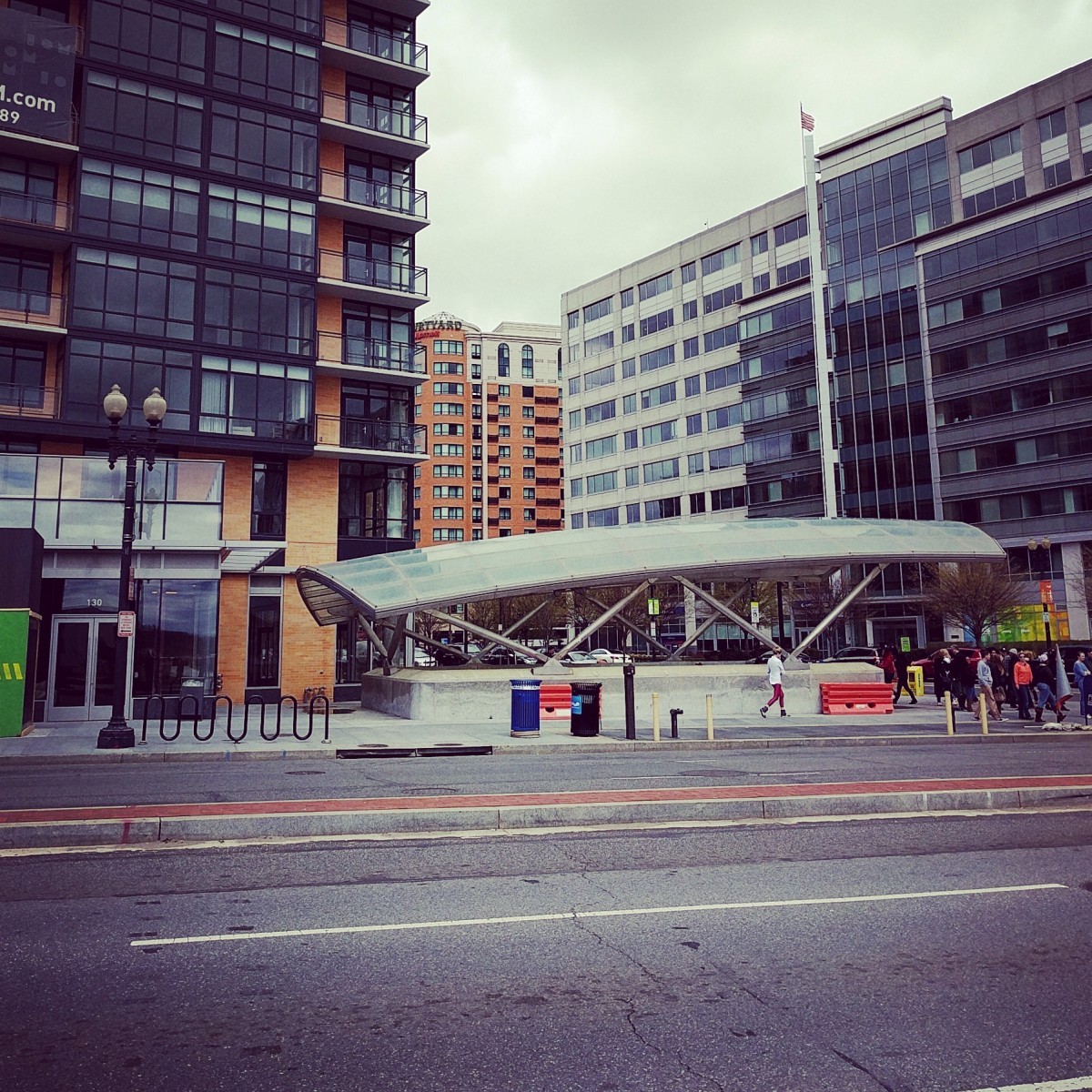
Image 1: Largo 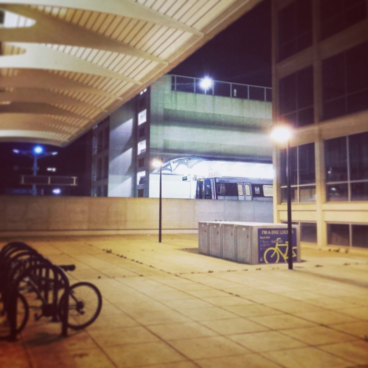
The first image shows the southern entry plaza at Largo station. This station is flanked by parking garages and has a Gull II canopy. This canopy type is only present at the three stations opened in 2004. Neither Morgan Boulevard nor NoMa have parking structures, so that leaves Largo as the only possibility.
25 got it right.
Image 2: Navy Yard
The second image shows the New Jersey Avenue entrance canopy at Navy Yard. Until recently, this entrance was covered with scaffolding to protect it from the construction of the adjacent building, Insignia on M. There is a Courtyard by Marriott in the background (at New Jersey and L), which may have helped you figure this out. Other clues include the bevy of newer buildings characteristic of the ever-growing Navy Yard area and the wide cross-section and brick median of M Street SW.
25 guessed correctly.
Image 3: Cleveland Park 
The third picture was taken at Cleveland Park. There are a few stations in the system with “Park” in their names, but only two of them are underground Arch I stations. The Arch I stops are located along the Red Line section that was opened in 1981 and 1984, from Woodley Park to Medical Center. We can discount Woodley Park, because from this perspective you'd be able to see the rest of the station's name (Woodley Park-Zoo/Adams Morgan).
But even without using the word “Park”, this has to be Cleveland Park because it's the only Arch I station that has an escalator and stair at the end of the mezzanine. At Woodley Park, it's a pair of escalators, which is the case at most of the Arch I stations.
26 knew this one.
Image 4: Shady Grove 
The fourth featured station was Shady Grove. The picture is taken from the northern end of the platform, looking west toward the loop track at Shady Grove Yard. A parked train and other yard infrastructure is visible, which should have tipped you that this was a station near a rail yard. The visible loop track has third rail as well, which means you can discount it being a freight track.
The other stations near yards are all farther from the yards and loop track than Shady Grove, so you could have eliminated those stations. Crabbs Branch is the watercourse that runs in a culvert under Shady Grove station, and it's visible here to the left of the rail yard.
24 figured it out.
Image 5: West Hyattsville 
The last image was taken near West Hyattsville. You can see the Green Line guideway at upper left, which should have helped you narrow this down to an elevated station. The sign is located adjacent to the path that connects Chillum Road to the Northwest Branch Trail and West Hyattsville station.
This was definitely the hardest picture this week, with only 17 coming to the correct conclusion.
Great work, everyone. Thanks for playing! We'll be back in two weeks with week 107.
Information about contest rules, submission guidelines, and a leaderboard is available at http://ggwash.org/whichwmata.