DDOT still tweaking bike share location map (now done)
DDOT let us know that the map you saw this morning wasn’t completely final; we all noticed the map before it was quite ready. They are now making some adjustments and will officially release it later today.
Update: It’s now released and embedded on the original post.
Earlier, I noted the absence of a station at Howard University, and commenters pointed out a conspicuous omission at Farragut Square. Those are now on the map. Many others moved, usually very slightly.
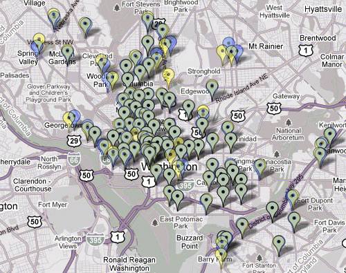
Here is a comparison of the current map (as of this posting) , which is now offline, and the screen shot BeyondDC took earlier this morning:
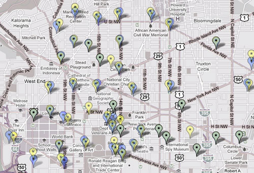
Greenish markers haven’t moved. Blue markers have disappeared from before, and yellow markers were added.
According to DDOT spokesperson Karyn LeBlanc, there had been a station at Farragut, for example, but it had been erroneously left off. Also, some people were calling to complain that stations were inside their houses or something, since the map hadn’t been accurate down to the finest detail.
DDOT may be making additional changes and will issue a formal release later today. Also, the map doesn’t show all 100 stations, leaving some opportunities for them to add a few based on feedback.
Update: Here’s another map showing the changes for the whole city, based on Housing Complex’s larger screen shot, also from around 8 am.