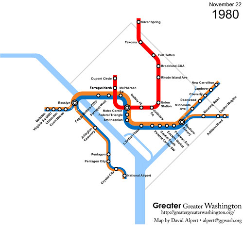
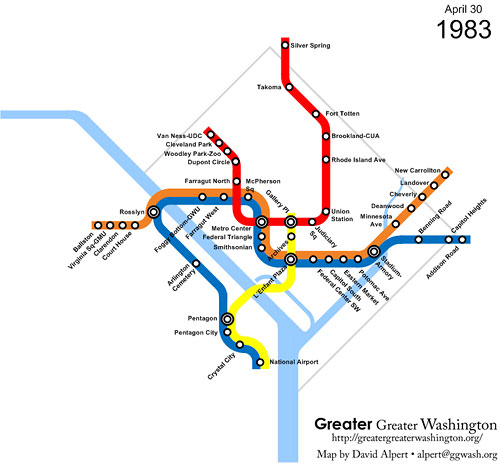
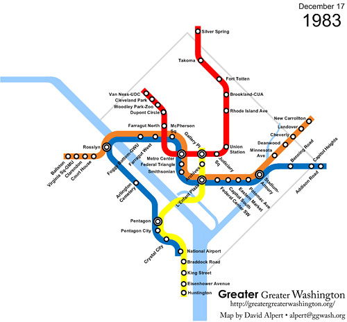
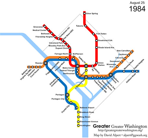
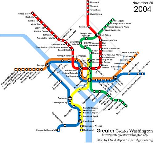
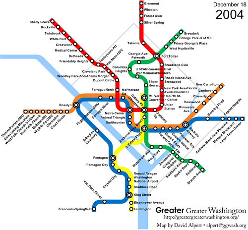
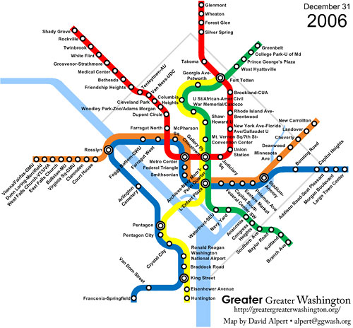
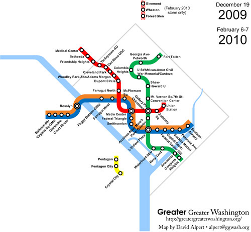
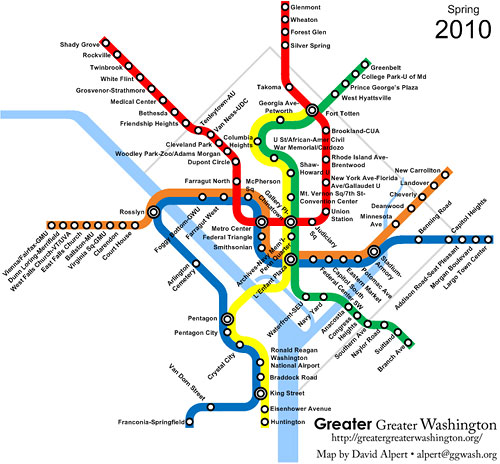
The evolution of Metrorail, 1976-2010
During December’s snowstorm, we wrote that the worst December storm since 1982 would (and did) create a Metro system with about the same number of stations as in 1982, as did this weekend’s storm.
This raises the question, what exactly did the rail system look like in 1982? Or other years? To answer that, I created a little slideshow:
This slideshow is no longer available, but you can see an updated one here.
The Metrorail system may have been about the same size as in 1982 during the recent storms, but if Metro has to make drastic cuts to bus and rail service in July as planned, it’ll indefinitely revert to a state far worse than it was in 2005. Sign CSG’s petition to ask local officials to support Metro and maintain our vital service.
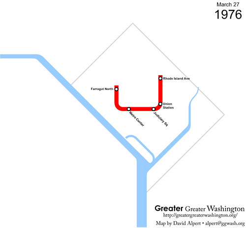

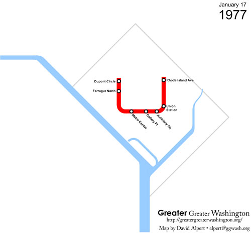
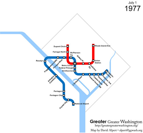

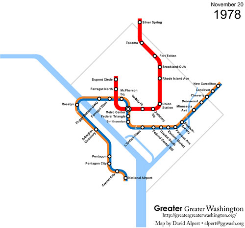


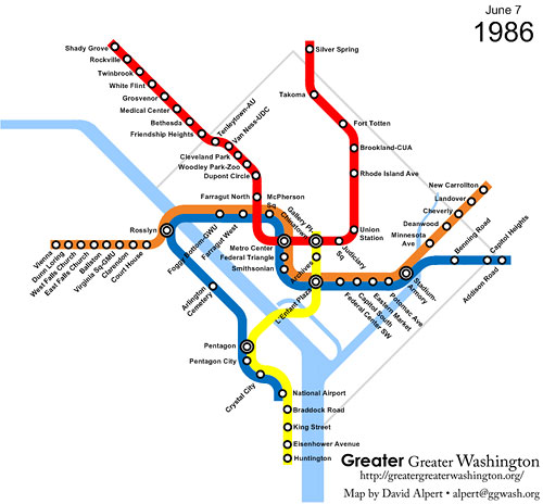
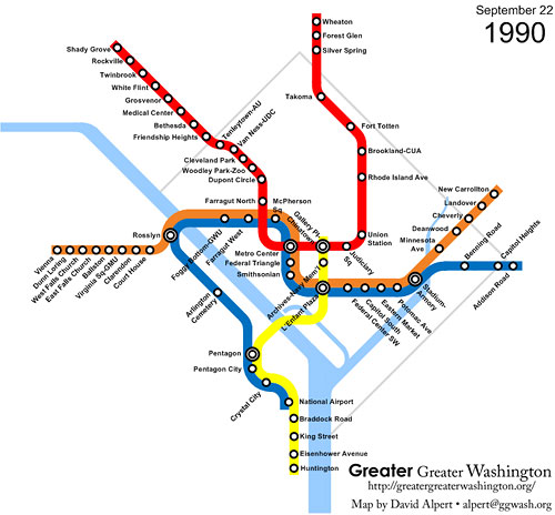
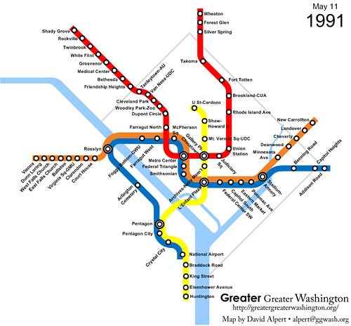
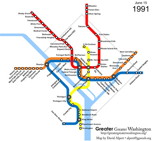

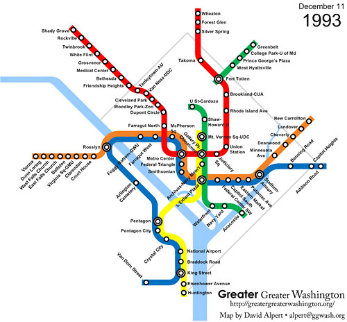
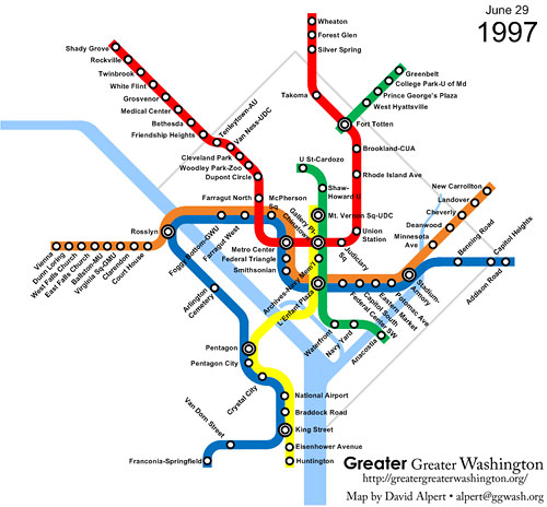
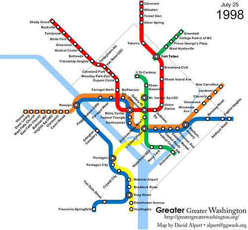
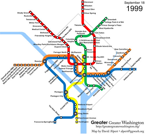

 Notes on the maps:
Most of the data comes from the excellent nycsubway.org timeline of the Washington Metro. I tried to identify the dates of station renamings from Wikipedia’s pages on individual stations and other online sources. To keep the number of maps manageable, and because many stations’ exact renaming dates are not available, I grouped station renamings in with the next major service change.
We know that around 1982, Orange and Blue trains operated a strange service pattern where Orange trains ran to New Carrollton, then turned around as Blue trains to run to National Airport; Orange trains the other way went to Ballston, then turned around as Blue trains to Addison Road.
According to coneyraven, this balanced the capacity as the New Carrollton and National Airport branches had higher ridership than the Ballston and Addison Road branches, while keeping the termini the same as their ultimate configurations (i.e. to get to New Carrollton, get on an Orange train).
I don’t have information on whether Metro used this pattern for the entire time between when the line to Addison Road opened on December 1, 1979 until the Yellow Line opened on April 30, 1983; the maps above assume that is the case.
The maps do not show the Green Line Commuter Shortcut, where from January 27, 1997 until the inner Green Line opened in September 17, 1999, rush hour Green Line trains on the Greenbelt segment used the switch at Fort Totten to continue to Farragut North. Metro maps from that era do not appear to show this service except in an info box.