This map puts a modern twist on Virginia’s old railroads
The tracks the Virginia Railway Express ran on today used to host all kinds of important rail service. This subway-style map tells the history of some of Virginia’s railways in 1921.
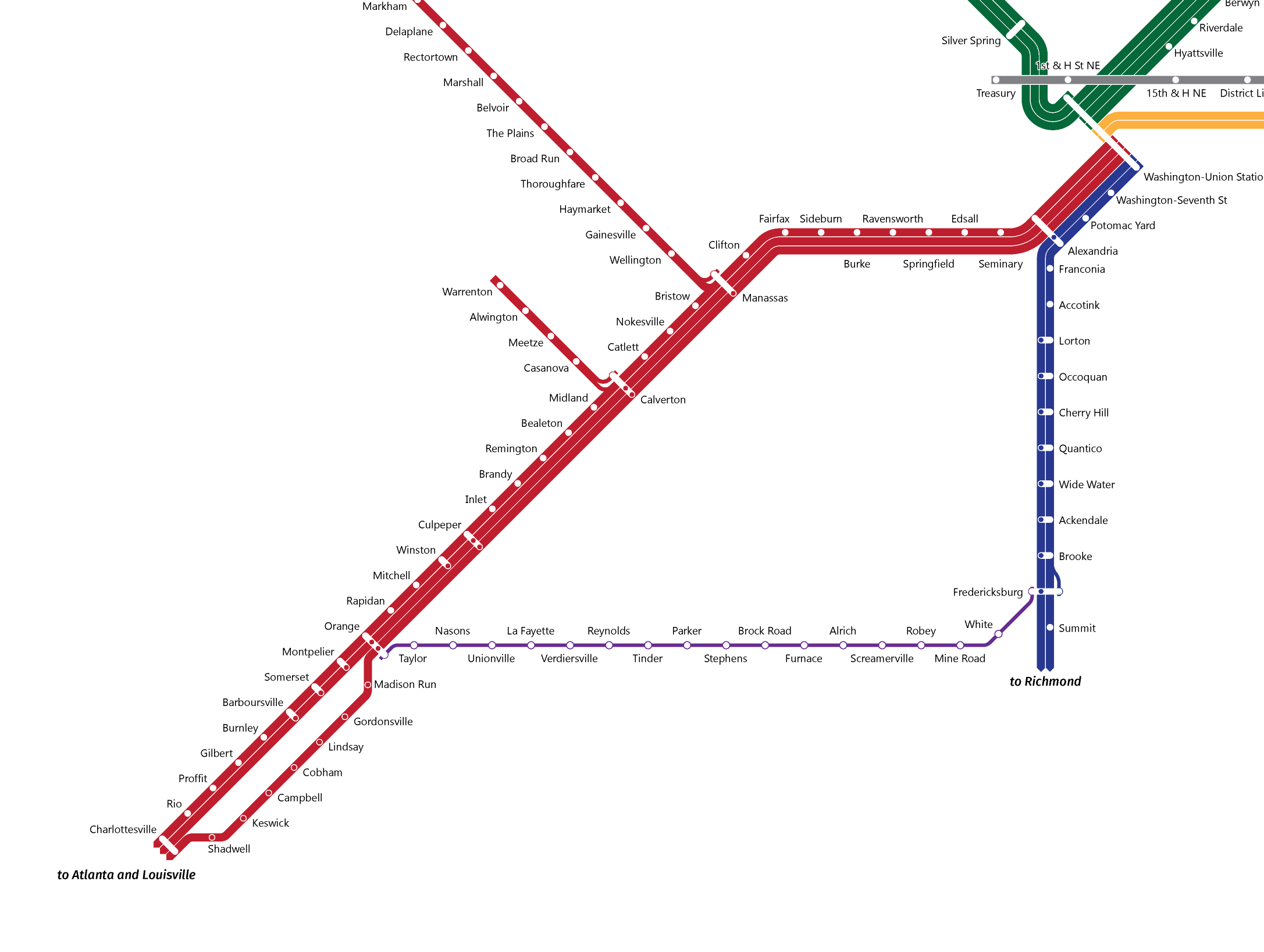
The main Virginia lines heading south from DC in 1921. Image by the author.
Trains that used these tracks ran both express and local, and there were branches that ran as far out as Warrenton and beyond Fredericksburg.
The map’s purple line is the Potomac, Fredericksburg, & Piedmont (PF&P) line, whose acronym was sometimes jokingly said to mean “Poor Folks and Preachers.” The PF&P was a vital link to Washington from a very poor part of Virginia.
The gray line from Union Sation is the WB&A, an interurban train that linked DC to Annapolis and Baltimore.
Maps in 1921 only showed geography, making service details nearly invisible. Times and locations were only available on arcane timetables that railroad employees had to interpret.
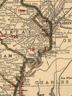
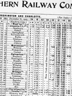
Left: A map of the land the tracks covered. Image from the David Rumsey Collection. Right: A timetable reflecting service in that area. Image from the Official Guide to the Railways.
The genius of a subway-style map is how it combines service information with geography, both of which riders need to get from A to B. Also, while surrounding geography is important, focusing on the rails themselves is the best way to illustrate the service we once had. Similar maps for other cities This is part of a bigger project whose goal is to map the 1921 railroads from the entire DC and Baltimore region. It’s a sequel to the map I made of the San Francisco Bay Area’s railroads in 1937.
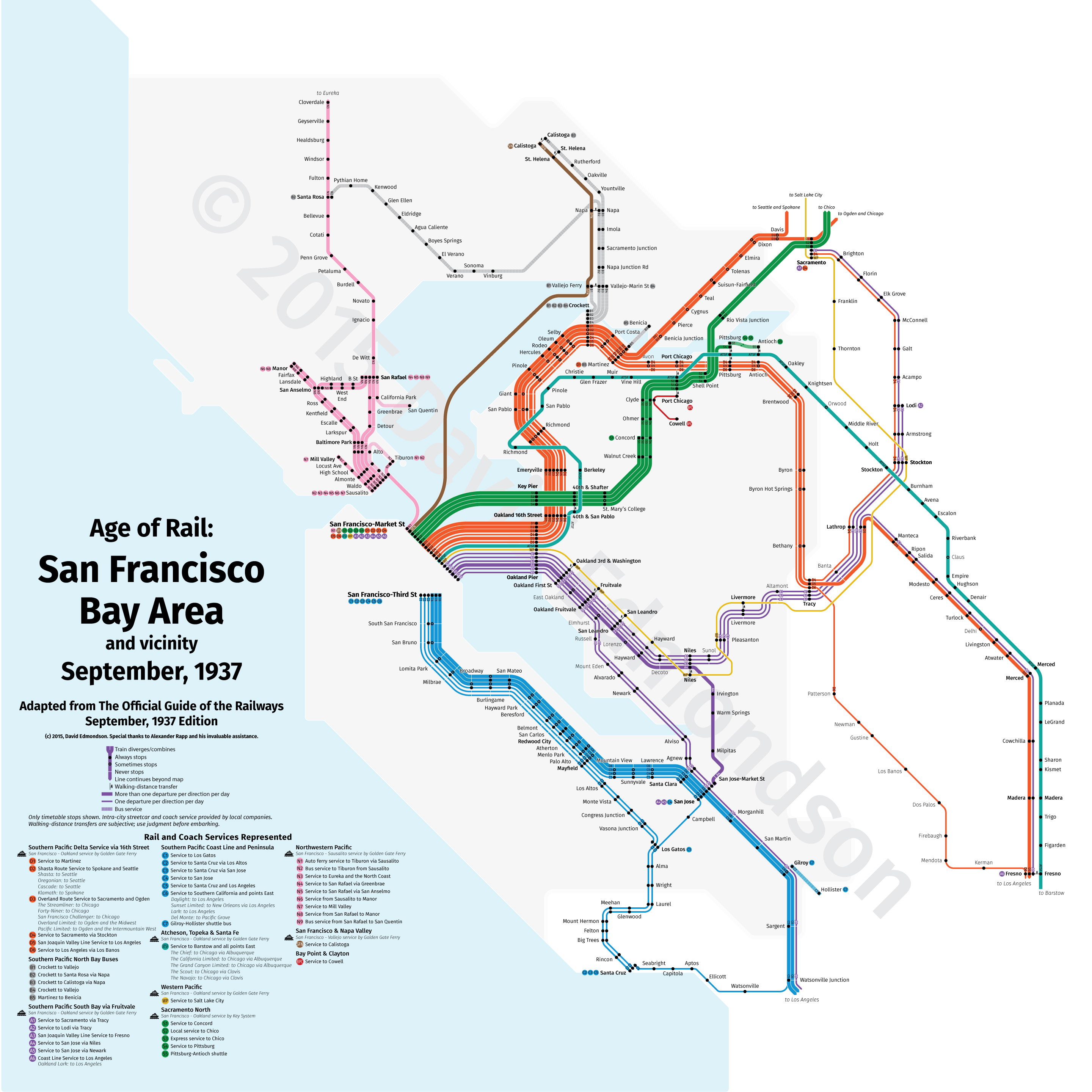
San Francisco’s railroads in 1937. Image by the author.
Even with just the southern lines from Washington complete, it’s easy to see how history of the region’s railroads informs contemporary planning. Just recently, VRE announced it may extend service from the Manassas Line to Haymarket, reactivating a bit of a branch that once extended out beyond Front Royal. What are the other lines that we might want to start using again?
I just wrapped up a successful Kickstarter so I can print maps like these, and hopefully others from around the country, as posters. After all, it’s one thing to have this information illustrated in a JPG for transit geeks to explore, but being able to put it on a wall would mean more people would see it.
This project’s goal is to open up our region’s transit history and spark conversations about what was and might be again. What else should this map include to help it achieve that goal?