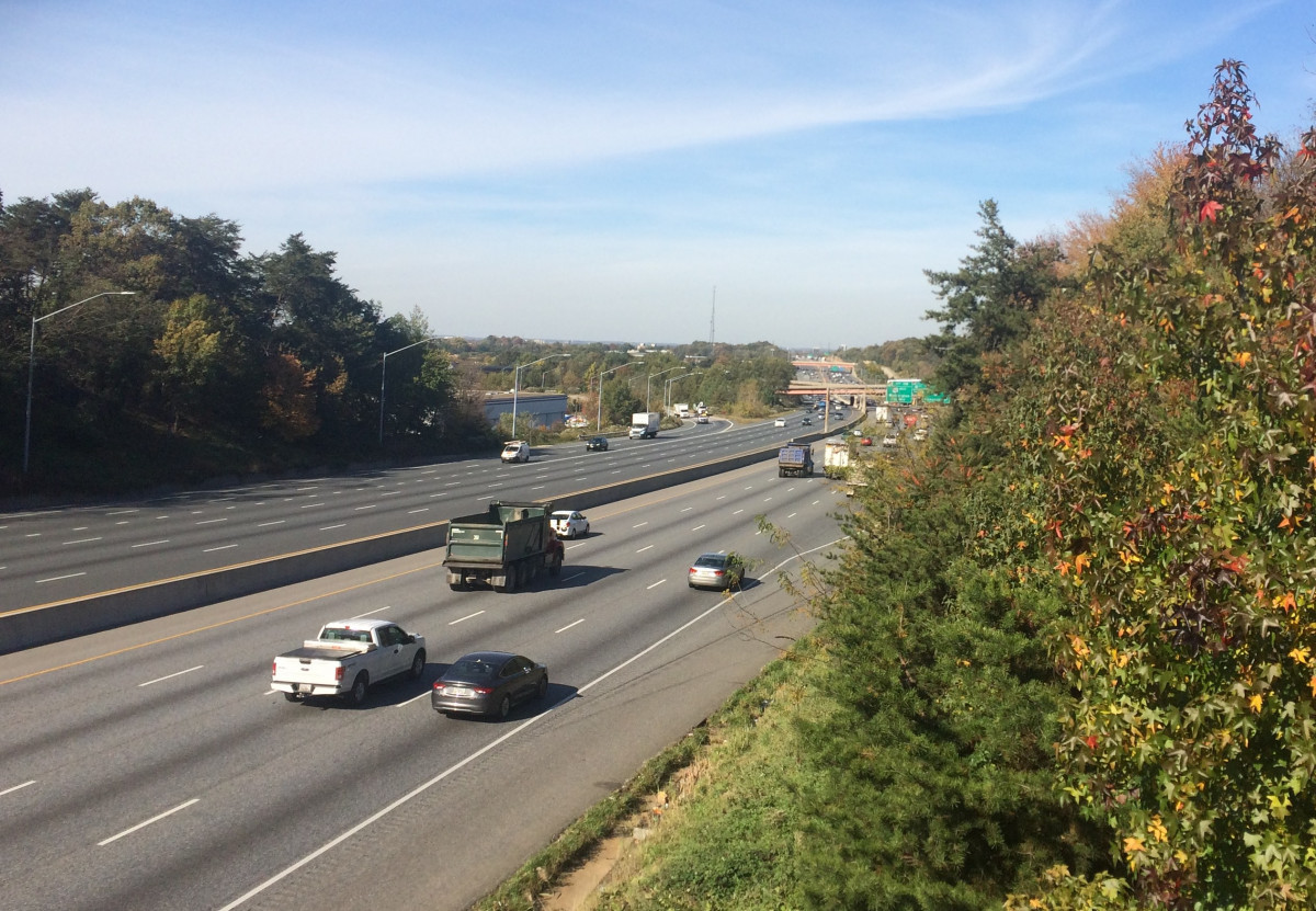
The Beltway blocks bike and pedestrian connectivity. Widening it could make the problem worse.
The Beltway at New Carrollton by the author.
The original construction of the Capital Beltway disrupted the communities and waterways where it was built and created problems for bicycle and pedestrian transportation that have only worsened during the last few decades. Now the State of Maryland is seriously considering a project to widen the Beltway (as well as I-270) and is asking for comments on a draft Environmental Impact Statement (EIS). Regrettably, the EIS does not propose to fix those problems; if anything, widening the beltway could make them worse.
The Beltway buried creeks, divided neighborhoods, and created bike-ped hazards
The beltway is a semi-permeable barrier that blocks the movement of people, wildlife, and water from one side to the other. The beltway divided a few neighborhoods when it was built during the late 1950s and early 1960s. Today it separates many neighborhoods from rail stations, shopping, and employment centers that are only a short walk away—if only you could. And in the few places where you can (e.g. New Carrollton), drivers exiting the beltway at high speeds are still a danger.
Building the beltway also buried creeks and floodplains, especially in then-agricultural portions of Prince George’s County, confining the flow of water to concrete sewer pipes known as “box culverts”. One of those creeks is Paint Branch, which provides a rare suburban spawning ground for brown trout several miles upstream.
During the last few decades, several efforts have been undertaken to improve bike-ped connectivity across the beltway, at least in Montgomery County. The beltway crosses over Rock Creek, Sligo Creek, and Northwest Branch rather than confining them to culverts, and trails run along these creeks under the beltway. The Bethesda Trolly Trail crosses on a pedestrian bridge. Although neither trails nor pedestrian bridges cross the beltway in Prince George’s County, approved plans assume that they eventually will. But when?
If the beltway is widened as proposed, that would be the time to do it. The cost of mitigating these problems later will be even greater than today if the beltway is widened without fixing them.
Culverts where Henson Creek crosses under the Beltway. Image by Jim Hudnall, Oxon Hill Bicycle and Trail Club. Used with permission. 
The Beltway prevents a trail along Henson Creek from reaching Metrorail
Consider Henson Creek, which runs from Forestville to Broad Creek, a few miles north of Fort Washington. In the 1990s, the Maryland National Capital Park and Planning Commission (M-NCPPC) built a trail along Henson Creek from Broad Creek to Temple Hill Road, planning to extend it across the beltway to the Branch Avenue Metro Station.
In 2008, M-NCPPC completed a 30% design for this trail connection and asked the Maryland Department of Transportation (MDOT) for permission to run the trail through the culvert under the beltway. (See photo). MDOT replied that the risk of a flash flood made that too dangerous. But a pedestrian bridge over the beltway would have to be over 1200 feet long to climb the 60 feet. In a follow-up letter, MDOT Secretary John Porcari wrote to county parks director Ronnie Gathers:
“If the culverts at Henson Creek are replaced by a bridge, we could certainly reinitiate discussions regarding a trail crossing during the project planning process.”
Replacing the culverts with a bridge was clearly not imminent. But it was a reasonable long-term expectation. By 2009, the environmental harm from culverts was better recognized than when the beltway was planned in the 1950s. The Intercounty Connector had just been built with bridges across Paint Branch, Little Paint Branch, Rock Creek, and other creeks to reduce the highway’s environmental impact.
An eventual beltway rebuild has long been expected, as the beltway roadbed nears the end of its 50 year design life. Clearly, that would be the time to replace the culvert with a bridge. For practical purposes, the roadbed of the beltway is a dam across the floodplain. Excavating that dam to build a bridge would be costly and disruptive. Yet if the entire highway is being rebuilt and widened, removing that dam from the floodplain and building a bridge is not such a tall order.
But the draft EIS envisions that MDOT will simply fill more of the floodplain with a wider roadbed and longer culverts. That would end any chance of the culverts being replaced with a bridge for many decades. The draft EIS claims that the environmental impact of the project is simply the wider footprint of the roadway, but the true impact is that instead of having a bridge and a trail, the creek will have a longer culvert and no trail.
The Draft EIS’s failure to consider bicycle and pedestrian crossings matter now
People disagree on whether Maryland should widen the beltway. But most people would agree that, if the widening occurs, it should be designed to enhance rather than harm the communities through which it runs.
While it will be a while before the beltway-widening project is authorized or rejected, the question of what the project would look like is under consideration right now.
Challenges with the EIS
The Draft EIS has two problems which, if not corrected, could make the project a lot more problematic than it has to be. First, the EIS completely misses the impact of the project on future bicycle and pedestrian crossing of the beltway. The project would foreclose for decades the possibility of enabling trails to cross the beltway along Little Paint Branch, Southwest Branch, Indian Creek, and other creeks. Widening the beltway would increase the cost of planned pedestrian bridges and new trails along roads that cross the beltway. By ignoring these impacts, the EIS fails to comply with the requirements of the National Environmental Policy Act to take a “hard look” at all the impacts of the project.
Second, the major creeks that cross the beltway are mostly on M-NCPPC owned land. Section (4)(f) of the Transportation Act of 1968 requires impacts on parks to be minimized. The required Section (4)(f) evaluation, proposes to reduce some impacts on wetlands, by including new bridges rather than culverts where new ramps cross Paint Branch, and narrowing the roadway in a few places to avoid burying more wetlands. But it also concludes that the project cannot avoid putting most creeks in larger culverts or larger shadows from wider bridges. It does not examine how to offset that impact by “daylighting” other creeks such as Henson Creek. Nor does it try to ensure that widening the beltway does not impede extension of park trails across the beltway.
In designing the Intercounty Connector, MDOT showed that it knows how to minimize the impact of a highway on adjacent parks and communities. But in this case, it has not done so.
The beltway cannot be widened without M-NCPPC’s concurrence. Given the impact of the current plan on park resources, M-NCPPC would have a fiduciary duty to withhold such concurrence on the project as presented in the draft EIS. Recently, M-NCPPC has announced that it will not concur with the Managed Lanes Project for at least 14 reasons, including the need to “mak[e] parks whole again” and properly address mitigation and water management. While M-NCPPC has indicated that it would be open to reconsidering the matter if its concerns are addressed, it should not concur with any beltway expansion proposal that fails to significantly fix problems caused by its original construction.
There is still an opportunity to weigh in on the plans, as the public commentary period continues until November 9, 2020.