A rich history and rising development could make the neighborhoods east of Fort Totten Metro a destination

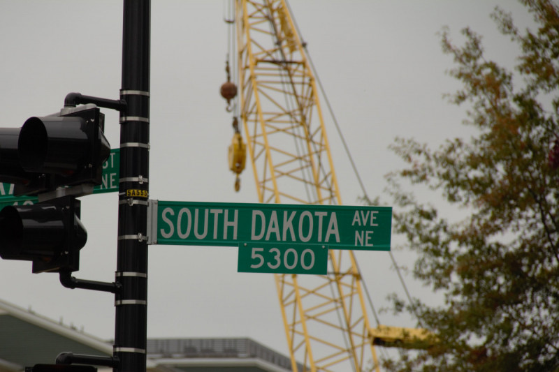
South Dakota Avenue NE by the author.
While it’s hard to imagine today, Washington DC was once “one of the most heavily fortified cities in the world,” according to the US National Park Service, and Fort Totten played a critical defensive role as one of the 68 forts located in the District during the Civil War. While the surrounding neighborhoods have moved beyond Fort Totten’s original moniker, the area still retains some surprising relics of history. For example, as recent as July of this year, NPS found the remnants of a bomb near the Fort Totten Metro station while constructing a pedestrian pathway.
For most District residents, the Fort Totten area is just where you transfer metro lines or drop off your solid waste at the solid waste disposal transfer station (or, as residents call it, Big Stinky). But the often-overlooked communities near this metro station offer a rich history dating back to the Civil War, a unique urban-suburban feel, and increasing development. As a resident of the area, I believe the communities east of the Fort Totten Metro will soon be seen as much more than a transfer junction.
Fort Totten, 1865 by Civil war photographs, 1861-1865, Library of Congress, Prints and Photographs Division.
After the Civil War, the B&O railroad began to galvanize development in the upper northeast. The railroad played a central role in connecting Washington to other major cities and prompted the development of industrial uses in the vicinity. After completion of the trolley line to Rhode Island Ave in 1897, residential communities emerged, extending into Maryland. This rail corridor’s regional impact continued to grow with intensifying industrial and commercial development. Residential development continued into the 1930s and 1940s in areas like Riggs Park. As veterans returned from World War II, many housing styles appeared, including duplexes (somewhat unique for the District).
The communities east of the Fort Totten Metro underwent significant demographic change during the 1960s and 1970s. Riggs Park, also known as Lamond-Riggs, was known in the 1950s as “Little Tel Aviv” due to its large Jewish population. That community, along with its synagogue, largely relocated to Maryland in the 1960s. By the early 1980s, the area had become a largely Black residential community. Further south, South Dakota Avenue divided the nearby communities of predominantly Black North Michigan Park and predominantly white Michigan Park.
The Fort Totten Metro station, built in the middle of Fort Totten Park in 1978, became a major anchor for surrounding communities. The Red Line tracks at Fort Totten run along the former B&O railroad. In 1993, the Green Line’s northern stretch opened through the station.
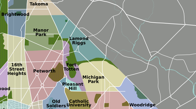
DC neighborhoods, cropped to show the areas east of Fort Totten by Peter Fitzgerald licensed under Creative Commons.
Today the area surrounding the Fort Totten Metro includes several neighborhoods in wards 4 and 5, including Fort Totten, Queens Chapel, Michigan Park, North Michigan Park, Lamond-Riggs, and Pleasant Hill. Many lifelong Washingtonians reside in these upper northeast communities, which have a strong tradition of participation and engagement. From a planning perspective, the area surrounding the metro is unusual; it’s a diverse area with a lot of residential communities, industrial land and open green space, including access to the Washington Metropolitan Branch Trail.
For the past decade, ongoing development projects along South Dakota Ave have been changing the look and feel of the area east of Fort Totten Metro. Neighborhood groups such as the Lamond-Riggs Citizens Association (LRCA) have worked with DC’s Office of Planning over that time to encourage development to “ensure quality of life for all residents.”
As a result, the Art Place at Fort Totten, a multi-phase planned unit development (PUD), incorporated community feedback and broke ground in 2014 across UDC’s Bertie Backus Campus. This mixed-use development includes more than 500 apartments, leasing space on the ground floor, the future home of Explore! Children’s Museum, MeowWolf, and a new Aldi. More residential communities are also emerging, such as Riggs Park Place across from the Walmart constructed in 2015. Lamond-Riggs Library, originally constructed in 1983, is slated for a fully funded renovation to be completed by 2022.
Outsiders often seem to overlook the communities surrounding Fort Totten Metro, seeing the area only as a way to reach Brookland or Petworth to the south or Takoma and Hyattsville to the north. Still, development is forging ahead. With three Metrorail lines, underutilized NPS park space, and diverse business anchors opening, the Fort Totten area could be a destination in years to come.
