Historic aerials show the disappearance of Southwest

Photo by absentmindedprof on Flickr.
HistoricAerials.com is a Google Maps-like page featuring aerial imagery from decades past. Its database includes images of Washington from several years.
The earliest aerials they have of the area are from 1949. It’s a fascinating way to watch neighborhoods change decade-to-decade.
The most visibly changed neighborhood in DC over the past 60 years has probably been Southwest. These historic aerials give us a bird’s-eye view of the transformation.
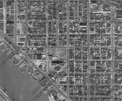
Until the 1950s Southwest was a vintage rowhouse neighborhood, urban in every way and filled buildings from the 18th and 19th centuries. Of course, mid-century planners could have none of that, so under the auspices of urban renewal it was almost completely bulldozed, and replaced by “towers in the park.”
Here is Southwest in 1949, before it was “fixed”:
Here is the same view 14 years later, in 1963:

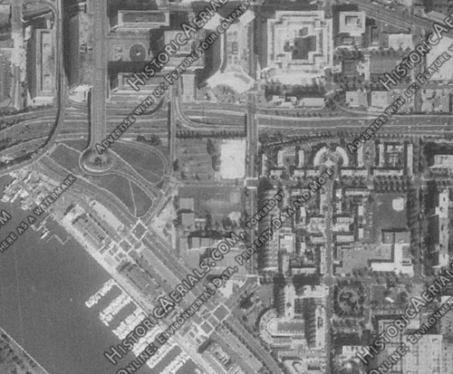
By 1979 the new Southwest was complete:
As if that weren’t sad enough on its own terms, things got even worse in other cities around the country. At least Southwest was rebuilt, albeit it in an inferior, too-suburban form. The same can’t be said for some neighborhoods in places like Detroit and Saint Louis, which through either misguided renewal efforts or simple neglect have gone from bustling to simply not there anymore.
 Cross-posted at BeyondDC.