Video: Da Vinci’s early 16th Century techniques carved a path for mapping cities
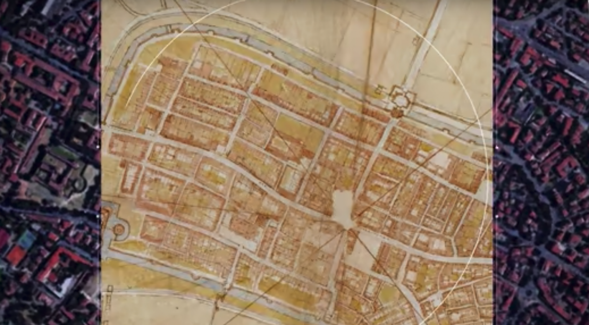
Image is a screenshot from the video.
Prior to the era of flight, accurately mapping cities was a cumbersome process. The intricate twists and turns of cities and the different footprints of their buildings posed major challenges to producing the accuracy and scale we enjoy today with our satellite-based maps.
Traditionally, medieval city maps were drawn from an angular perspective, such as the view from a nearby hillside. These perspective maps had flaws and inaccuracies, and these drawbacks became most apparent in military applications.
In 1502, Cesare Borgia wanted a map of the recently-conquered city of Imola, Italy. He comissioned Leonardo da Vinci to produce a map more suited to military defense of the city and its ramparts. What da Vinci produced was centuries ahead of its time, the product of meticulous measuring and tedious detail in order to accurately capture the intricacies of the city layout that were deemed necessary for its defense.
Over 500 years later, da Vinci's map conforms almost perfectly to the city plan captured on our satellite maps today. And he accomplished this feat without ever leaving the ground. To see how, check out the video below produced by Vox: