Check out this map of Washington streetcar and proposed subway lines in 1944
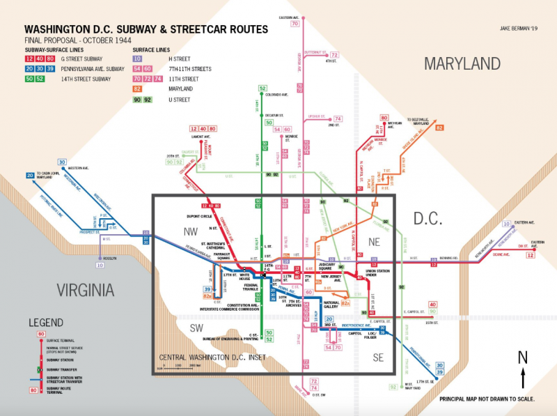
Image used with permission.
Jake Berman, an artist living in New York City, recently sent us this beautiful map of existing streetcar routes and proposed subway lines in DC and surrounding areas in 1944.
The purple, pink, orange, and light green lines show existing surface streetcars. (Nobody was talking about changing them at the time; same for the thin portions of the other lines.) The thick portions of the red, blue, and dark green lines were the proposed subways.
The surface streetcars would have run into them as the same line, like how surface streetcars in Philadelphia go underground when they approach downtown.
A SEPTA Subway–Surface trolley car travels along Market Street tunnel in Philadelphia. Image by SignalPAD licensed under Creative Commons.
We’ve written a lot about how streetcars helped shape and connect the region, from the Eckington neighborhood in the District to parts of Maryland as well as Virginia.
Readers: What do you notice about this map?