Areas around northern Red Line stops are dangerous for people walking and bicycling

Near the Forest Glen Metro stop. Image created with Google Maps.
Towards the center of the District, Metro stations are pretty good (not perfect) at accommodating dense and walkable development. Further out though, the infrastructure hasn't caught up with changing attitudes about what people want around transit systems.
More homes and shops around transit makes sense. When more people live around transit systems, the system will be used more and become more useful. Density in conjunction with good transit helps businesses by transporting customers and the workforce that makes them run.
Outside the more densely-populated parts of the region, however, transit wasn't built with walkability and density in mind — it was built for motorists.
Several northern Red Line stops between Silver Spring and Glenmont are surrounded by wide roads that intersect with busy state highways. A bird's eye view shows ubiquitous and underutilized parking lots dotting the landscape. Despite the growing density and the need for more pedestrian-friendly infrastructure, cars still dominate. Walking, cycling, and even some bus routes are either afterthoughts or nonexistent.
This is significant because like DC, Montgomery County has a commitment to Vision Zero. That is, it hopes to achieve zero road deaths and serious injuries by 2030. It also has a short term goal of a whopping 35% decrease in traffic crashes by 2019. In order for that to happen though, there has to be an infrastructure overhaul.
Georgia Avenue and major arteries connecting to it were built for cars
Right now, the existing infrastructure in much of Montgomery County is obsolete. It's planned around the automobile, and dangerous. However, Partap Verma of the blog Finding Forest Glen says the county has some of the few remaining Metro stations that could become a truly walkable, densely-populated communities — in his words, “a blank canvas.”
Several of the northern Red Line stops sit along one of the busiest stretches in Maryland: Georgia Avenue. “They were all built at a time when they were retrofitting metro stations in a kind of a larger highway-like roads,” says Verma, who likens the corridor to an eight-lane highway.
Over the course of the summer, several pedestrians were struck and killed along this major thoroughfare. While the State Highway Administration is supposedly committed to Vision Zero, there have yet to be the significant changes needed to move towards this goal.
The Wheaton Metro stop, where a man was killed on August 11. 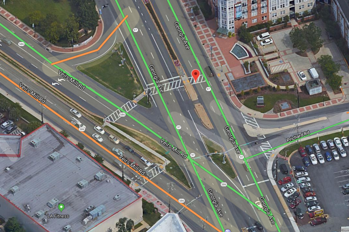
Not far from the Wheaton Metro stop, a man was killed on August 11. The preliminary police report stated that he was not in crosswalk at the time he was struck. It's not difficult to see the problem with this large intersection — there is a whole lot of road to cross here, and lots of traffic feeding into the area.
According people who live in the area (and my own experience), drivers don't always respect the right of way of pedestrians at crosswalks. Plus, speed limits seem more like suggestions on wide roads like these, and they tend to encourage speeding.
From the vantage point of the pedestrian or bicyclist, this intersection looks even more intimidating. 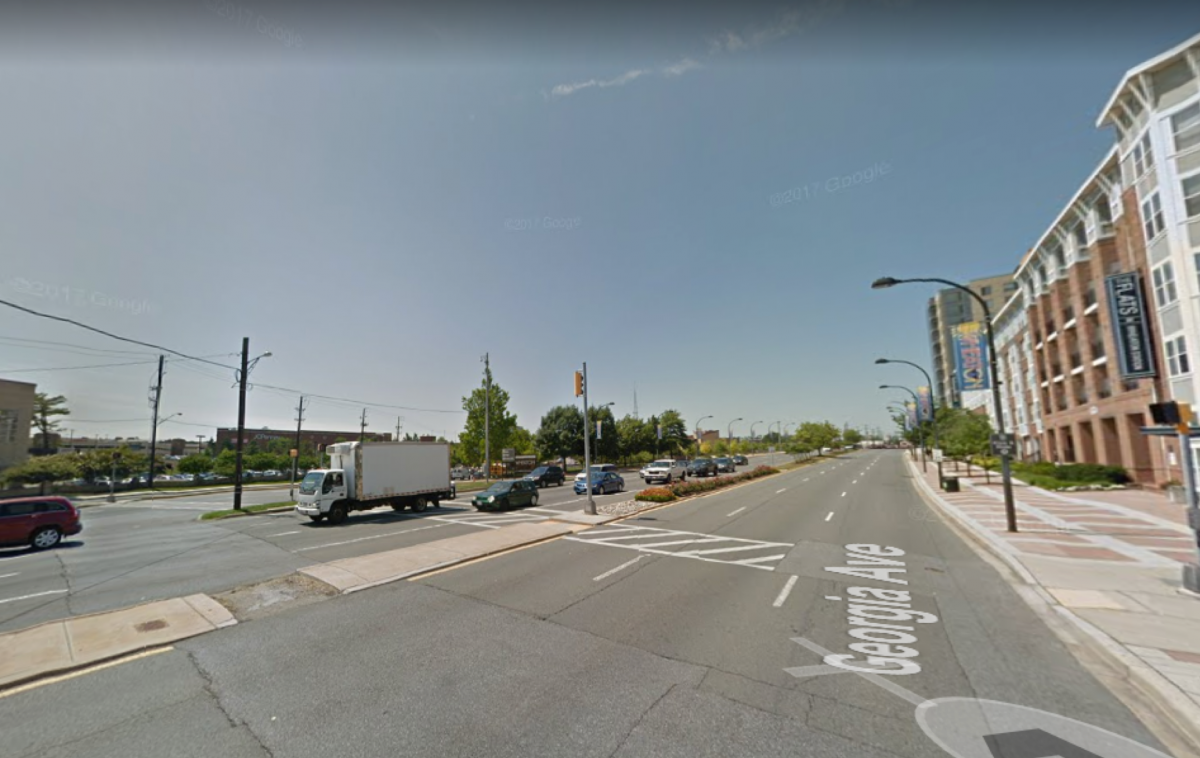
Yes, there are crosswalks and traffic lights, but their design seems more passive or suggestive. The traffic signals aren't very visible, especially for speeding drivers who are more focused on the car in front of them.
Not far from Wheaton is Glenmont, the final stop. As you can see from the picture below, it is also car-oriented.
Red marks the crosswalks at the Glenmont station. 
Access to the Metro is both convenient and safe from the parking lot, or from the crosswalks at intersections to the north and south of the station. For motorists there is plenty of parking space, so this isn't a problem.
For pedestrians who don't mind the extra steps, either crosswalk on that section of Georgia Avenue (at Glenallan Avenue and Urbana Drive) works just fine too. But with the entrance to the Metro part way in between the two intersections, people inevitably cross over illegally. Towards the end of this past August, a man was struck and killed by a motorist as he tried to cross the southbound Georgia Avenue lane.
Perhaps another well-marked crosswalk between the two intersections would mitigate the risks of pedestrians crossing illegally, and would force drivers to slow down. Another radical idea: install protected bike lanes outside of the metro station to calm traffic. Do we really need large volumes of motor vehicles moving rapidly in and around Metro stations? These are areas where it should be absolutely safe to access transit.
This is Waterfront Metro. While improvements are needed, especially at the intersection, the bit of road abutting the Metro slows traffic down. 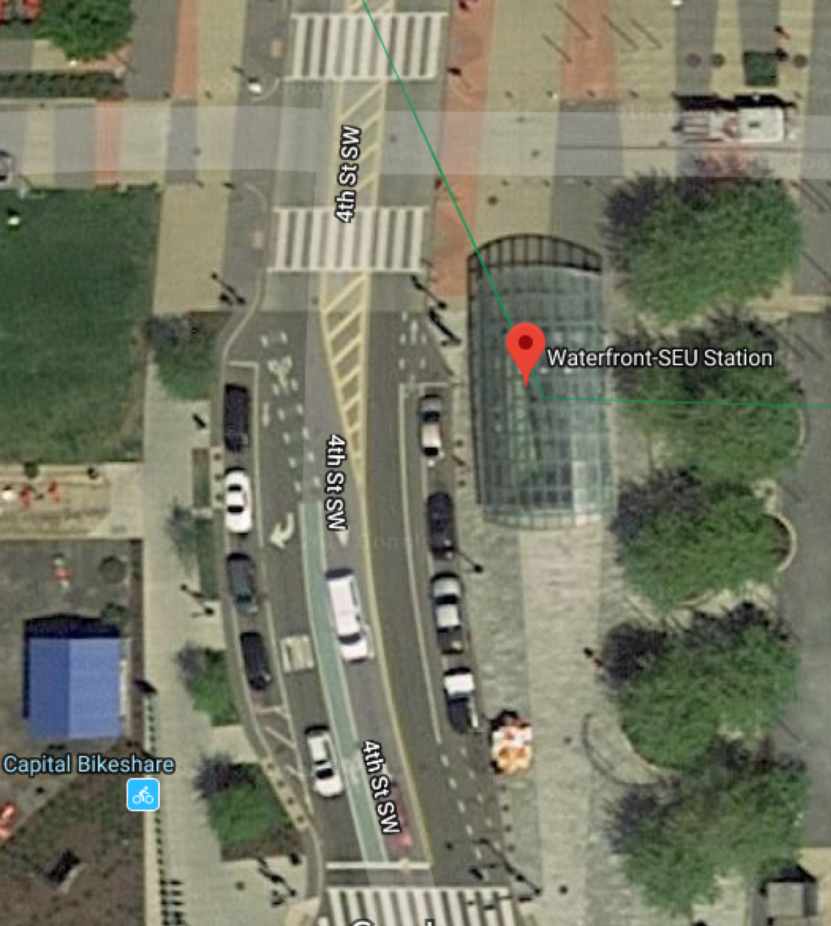
The section of 4th Street running along the west side of the Waterfront Metro entrance, for example, is such a road that slows traffic down. It's mixed use and has clearly marked bicycle lanes (though they're not protected), several crosswalks, speed bumps, and no more parking in the middle between the Office of Planning and 1101 4th Street.
Other improvements are needed, especially at the intersection and at the bus stop on the southeast corner of 4th and M streets, but nonetheless the design serves as a constant reminder to drivers that pedestrians and cyclists have equal rights to the road.
Wide roads, underutilized parking lots, and no pedestrian infrastructure
Our last stop on this short Red Line journey is Forest Glen, which is nestled between Wheaton and Silver Spring. Both Wheaton and Silver Spring are more densely populated than Forest Glen, but the latter is growing.
The Forest Glen Metro sits on Georgia Avenue, a near junction point for the Capital Beltway and 16th street — both major arteries to and from the District. The existing infrastructure wasn't really built for density or walkability, but rather for vehicle traffic. Even that was poorly planned, though.
The Forest Glen Metro stop is not in a pedestrian-friendly location. 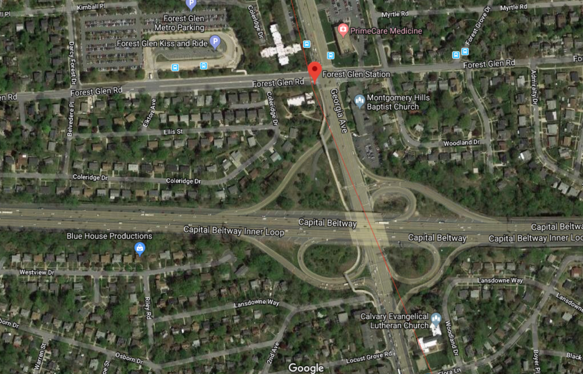
“It's almost like a perfect mix of trouble with people driving to the beltway, driving to get to 16th street…and also trying to get to the Forest Glen parking lot,” Verma says.
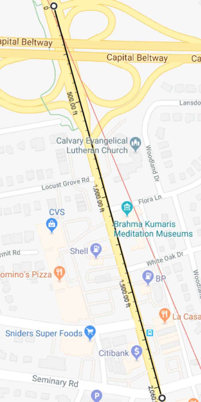
Above, it shows how far one would have to walk or bike in order to legally cross from east side of Georgia Avenue to the west side: about 2,000 feet. I can't imagine pedestrians walking that entire distance from one crosswalk to another, nor should they have to.
There is a pedestrian bridge on the west side of Georgia Avenue that connects Forest Glen and Montgomery Hills, but Verma says the bridge is underutilized — probably because there aren't many people living in Montgomery Hills.
The Forest Glen pedestrian bridge. 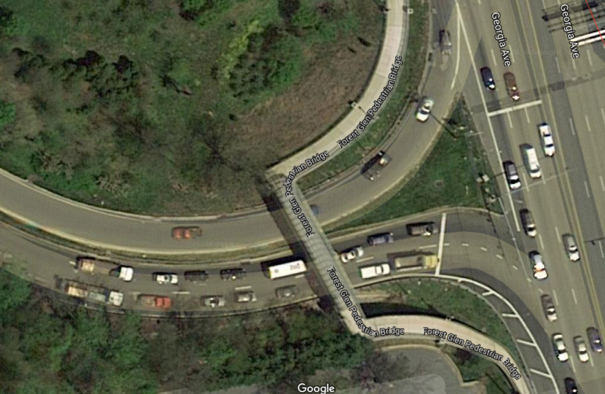
Some positive changes could be on the horizon
The Forest Glen Metro has only one entrance — for now. A proposed second entrance (construction slated to start in 2020-21) will help connect the Medical Center (across the street from the Metro) and Holy Cross Medical Center (on the east side of Forest Glen Road) to transit.
Location of the proposed second entrance. 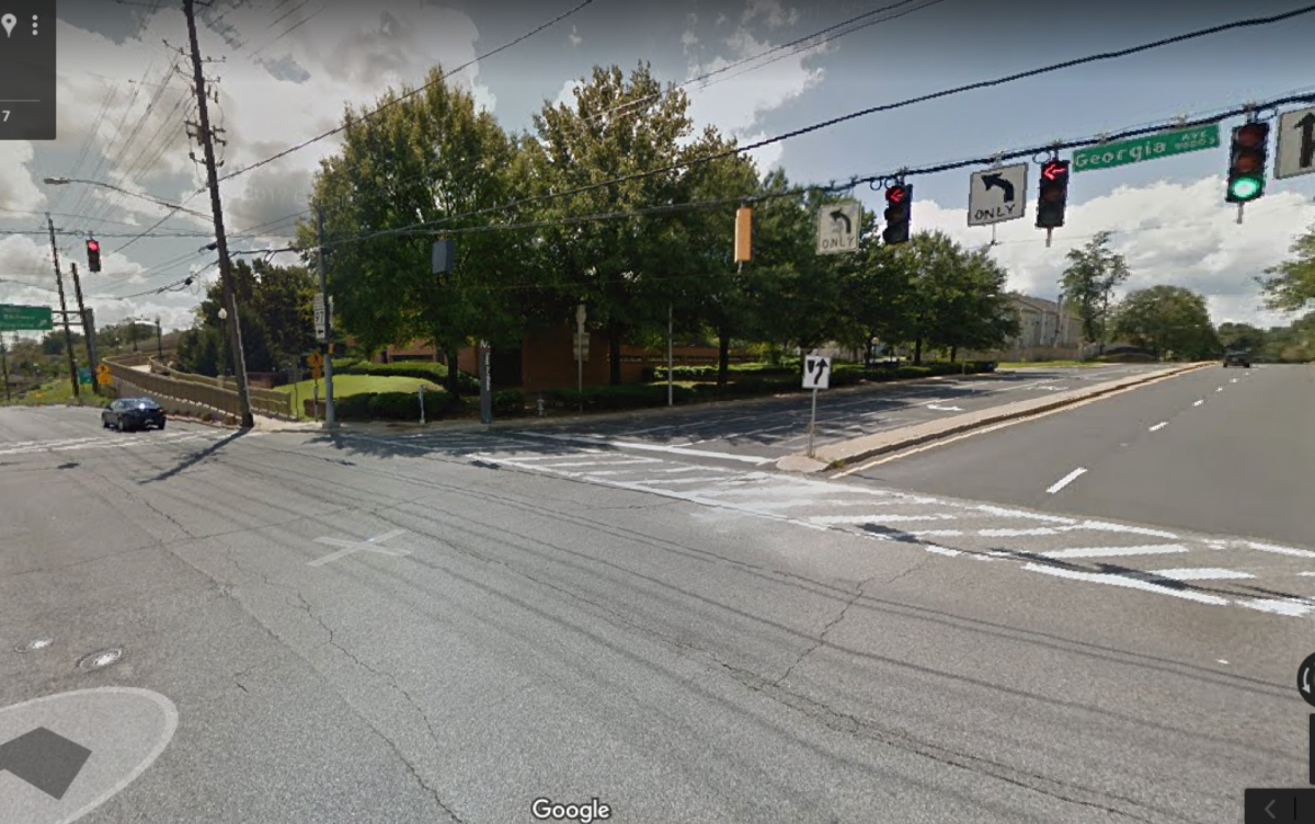
“People won't have to worry about dodging what amounts to almost 66,000 vehicles per day,” Verma says.
The other problem for this area is how the land is currently used. It's wasted on single-family homes and three large parking lots: Forest Glen Metro parking (eight acres), the medical facility's parking (five acres), and another eight-acre parking lot in Montgomery Hills
The good news is that the parking lots are under review, and more density is planned. That, in conjunction with with the Georgia Avenue redesign, will hopefully make the area more friendly to pedestrian traffic.
When I asked Verma if taking away the parking lots would be a problem for people driving into the area, he mentioned the relative size of the area between Wheaton and Silver Spring (with Forest Glen in the middle). It's not that big; it's around three miles.
Why not make this a Metro trip? 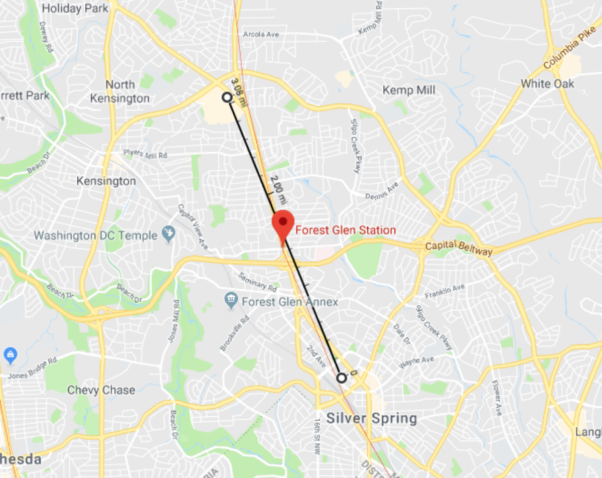
“People are going in their cars for really quick, small trips. Well, what if those small trips could be replaced by a walking trip? And what if that walking trip was done safely?”
For the price of 10 more minutes, motorists could drive a little further out and park in Silver Spring or Wheaton and take the metro in, and vice versa.
You know what else would make these areas more pedestrian friendly? If you guessed more bike lanes, then you guessed right. In fact, bike lanes are planned for these areas and they would better connect the region and perhaps encourage people leave their cars at home.
Solid lines are existing, and dashed are proposed.
Green = trails;
Yellow = separated bikeways;
Blue = striped bikeways;
Red = shared roads 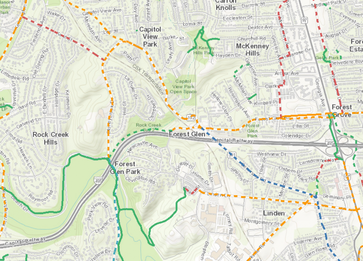
The neighborhoods around these two stations (Forest Glen above, and Wheaton below) are notoriously unfriendly for walking and cycling. Maybe the proposed bike paths/ lanes will make the area more friendly to other modes of transportation.
Solid lines are existing, and dashed are proposed.
Green = trails;
Yellow = separated bikeways;
Blue = striped bikeways;
Red = shared roads 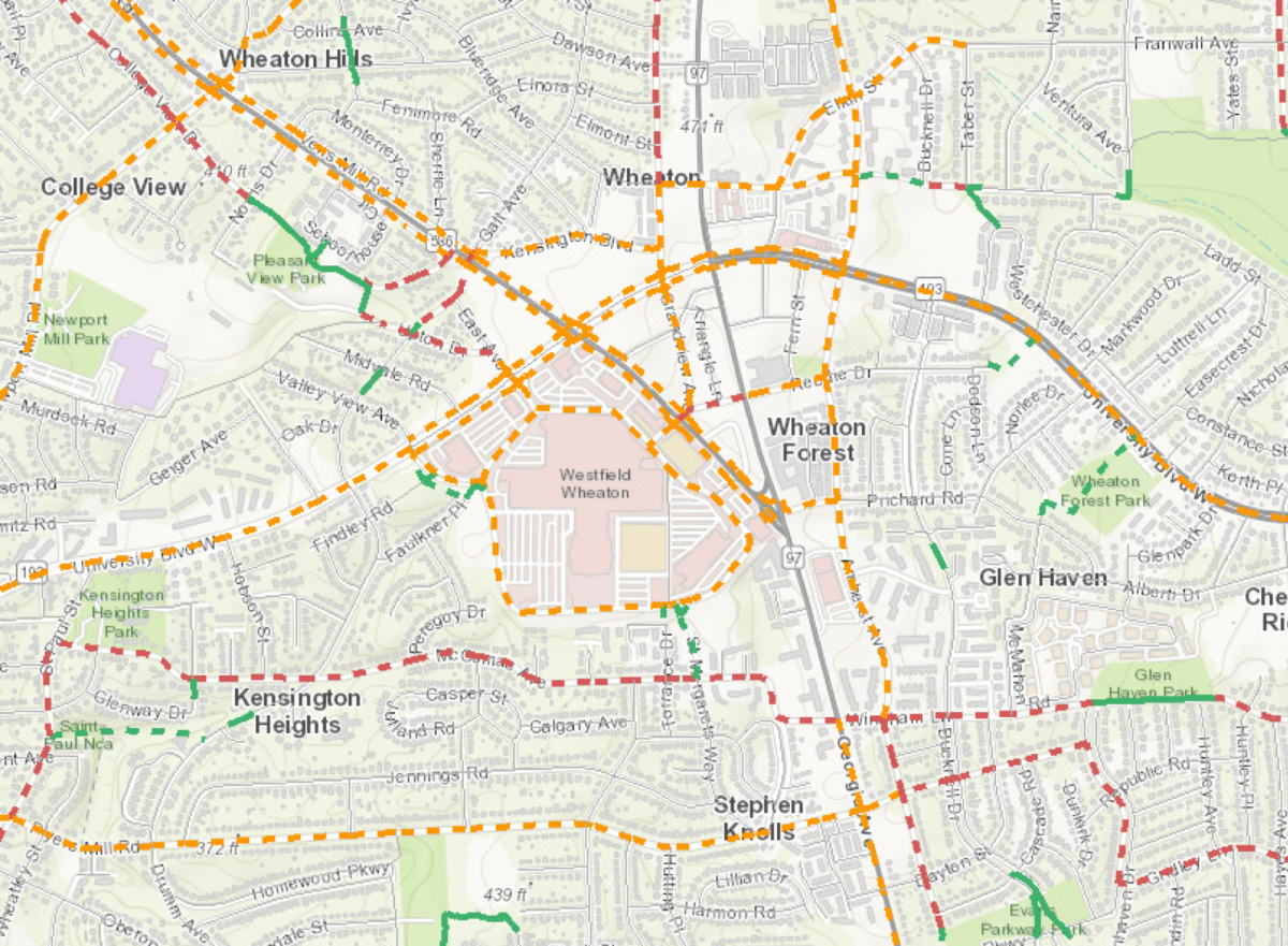
The path forward shouldn't be endlessly delayed
Moving forward, one thing is certain: it doesn't make sense to build more parking, or even to maintain it. Letting the infrastructure remain as is around these stations isn't just a waste of space and money, it's dangerous. Planning and zoning need to change with the less car-dependent times.
Of course, there are plans to upgrade Georgia Avenue, install more bike lanes, and improve existing pedestrian infrastructure. That's all well and good, but in terms of Vision Zero, things are moving far too slowly.
There have been plenty of unnecessary deaths in 2018 alone. A few weeks ago at a round table, many residents testified to the dangers of stalling progress towards a more integrated transit future where Vision Zero is the norm, not some lofty goal.