Here’s the peculiar story of DC’s Irving Street Expressway

Image by Google Maps.
Have you ever traversed the disconnected area between Brookland and Columbia heights — including the confounding traffic cloverleaf at North Capitol and Irving streets — and wondered why the heck this area is the way it is? Turns out, creating a good crosstown transportation network here has vexed District transportation planners for more than 90 years, and led to some seemingly odd infrastructure choices.
In 2016, the District Department of Transportation (DDOT) facilitated a series of community meetings as part of their Crosstown Multimodal Study to examine current and future demands and long-term changes to the larger crosstown transportation network between Brookland and Columbia Heights.
The study resulted in a recommended list of short- and long-term projects aimed and improving all modes of crosstown transportation in the corridor that connects Michigan Avenue east of the Washington Hospital Center to Columbia Road at 16th Street, NW. DDOT’s Multimodal Study is notable for taking all forms of transportation into consideration.
Image by Google Maps.
Unfortunately, efforts in the 1920s and 1950s instead prioritized automotive transportation at the expense of walkability and the environment. This resulted in blocks without street trees, a four-lane expressway that leads nowhere, and a large highway cloverleaf.
Both the Irving Street expressway and the cloverleaf intersection at the Washington Hospital Center date to the 1950s and were intended to solve two problems: the first was to establish a better crosstown route, and the second was to connect that route to the freeway system in Maryland. Neither of these projects achieves those goals.
Planners have been flummoxed by Columbia Road since the 20s
One of the earliest efforts to identify Columbia Road as part of an improved crosstown route dates to 1927. It came out of a recommendation to the National Capital Park and Planning Commission (NCPPC) by a subcommittee designated to study the traffic plan developed by L.D. Tilton, a St. Louis traffic expert.
Tilton’s traffic plan attempted to place all sections of the District of Columbia within a quarter or half mile distance of a major thoroughfare. Recommendations to the NCPPC were divided into two divisions – crosstown and radial.
While 18 major traffic thoroughfares were definitely recommended, the proposal to include Columbia Road was tabled, due to the fact that it was considered unduly narrow between Sixteenth Street and the Soldiers’ Home. While all agreed it was ideally located to serve as a crosstown route, there was doubt that the street could be widened to serve in that capacity.
Google map of expressway and cloverleaf, looking west from Michigan Avenue. Image by Google Maps.
Nevertheless, two important routes were identified in 1927 that would later play a role in creating the North Capitol and Irving cloverleaf.
The relevant radial route consisted of North Capitol Street, Michigan Avenue, Harewood Road, and Blair Road to the District boundary. The relevant crosstown route was Garfield Street, by way of Cleveland Avenue, Calvert Street, and Columbia Road to Sixteenth Street.
From Sixteenth Street to the Soldiers’ Home, the matter of widening Columbia Road or combining the route with another street to be decided later. From the Soldiers’ Home, the route would continue along Michigan Avenue and Franklin Street to Bladensburg Road.
In the 30s, planners decided to realign everything
In 1931, NCPPC used the 1927 thoroughfare plan to prioritize street improvements and paving. While the matter of the crosstown route between Sixteenth Street and the Soldiers’ Home was still undecided, the proposed solution was to develop Colombia Road for westbound traffic and Harvard Street for eastbound traffic — and then to realign the road north of McMillan reservoir to connect this pair with Michigan Avenue to the east.
While the basic corridors were identified in 1927 and expanded in 1931, it wasn’t until the beginning of the 1950s that genuine efforts were made to realize these corridors. The plan consisted of constructing two new highways through the Soldiers’ Home.
Clipping from a February 20, 1952 Evening Star article. _1200_681_90.jpg)
The north-south freeway was proposed as a six-lane highway that would end the detour around the Soldiers’ Home and connect North Capitol Street directly with Maryland.
400 block of Harvard Street looking east from Georgia Avenue. Image by the author.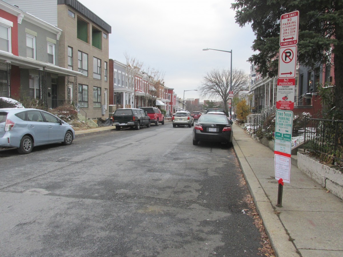
Rather than construct a full-fledged east-west freeway, planners proposed a cheaper alternative. Instead of a freeway, planners proposed a new one-way network – Irving street one-way west and Columbia Road one-way east. Irving would be cut through the Soldiers’ Home to connect with Michigan Avenue at Harwood Road. Other suggestions from this plan included:
- Making Park Place one-way northbound,
- Making Warder Street one-way southbound, and
- Realigning Irving Street at 14th Street and Georgia Avenue.
After two years of negotiations, the southern 42 acres of the Soldiers’ Home was transferred to the District in late 1954 paving the way for the highway project to move forward.
As construction was geared to begin in late 1956, the original plan to use Irving and Columbia Road was altered to include Lamont and Kenyon streets as well. Each street would parallel each other as far as Klingle Road NW. Harvard Street would later be identified to replace Lamont.
400 block of Kenyon Street looking west from Park Place. Image by the author.
Narrow streets were deemed a problem, so planners decided to chop down some trees
The narrowness of the streets between the Soldiers’ Home and Sixteenth Street, identified in the 1927 plan, was not entirely solved with the one-way street scheme. To receive federal aid for the crosstown street project, the streets included in the network had to be a least 30 feet wide.
This meant that several of the streets had to be widened, some as little as six inches on each side. This requirement doomed more than 100 street trees, which were cut down to make way for the widened streets and new curbs.
Evening Star article from September 26, 1954. _1070_948_90.jpg)
For example, Harvard Street between Georgia Avenue and 14th Street was 29 feet wide. To gain the needed extra foot the curbs were moved six inches on either side. To make way for the new curbs on Harvard, 27 trees – 18 pin oaks and nine ginkgos – were cut down. To widen Irving Street west of Georgia Avenue by two feet, 40 street trees were cut down.
While some of these streets have wonderful tree-lined blocks today, other blocks on these routes are still treeless and have no room for new plantings.
Clipping from an April 10, 1958 Evening Star article. 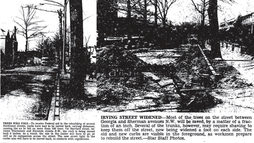
The one-way street network east of 14th Street and the Irving Street expressway across the former Soldiers’ Home grounds was completed and opened to motorists on October 20, 1958 as work continued on the North Capitol cloverleaf and connecting Kenyon Street to Park Road west of 14th Street.
Clipping from an October 19, 1958 Evening Star article. _747_241_90.jpg)
The final stage of the crosstown route project was completed on August 19, 1959, when the final one-way streets were implemented. These were Irving Street between Adams Mill Road and 11th Street (eastbound), Kenyon Street between 11th Street and 14th Street (westbound), and Park Road between 14th Street and 17th Street (westbound).
Detail from a 1958 zoning map. 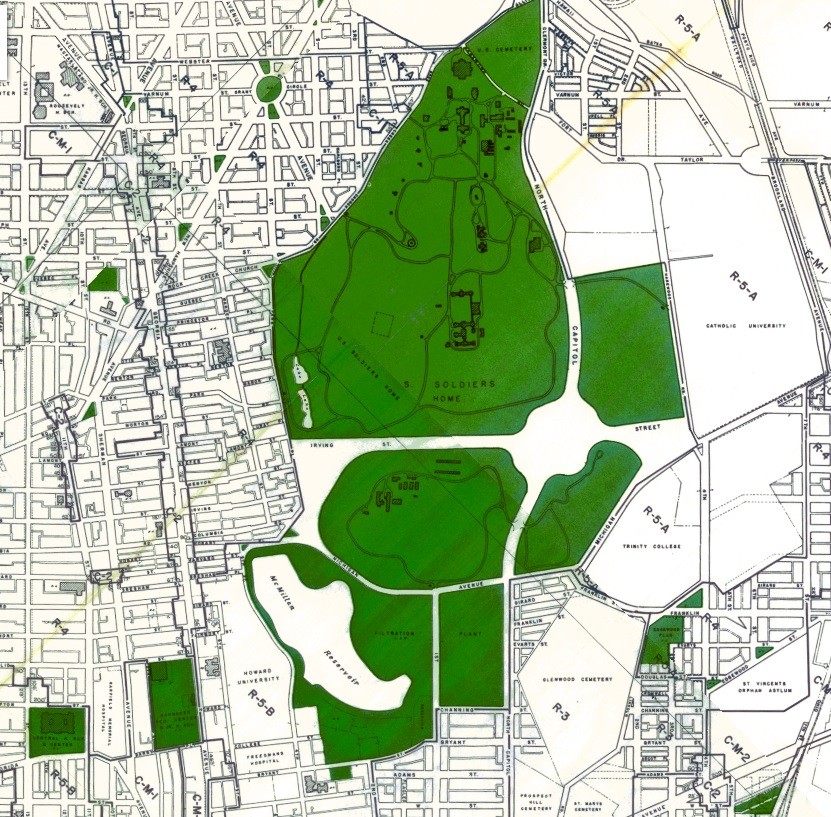
This is where we are today
In a twist of irony, while the effort to complete the crosstown network and cloverleaf intersection were being completed, the District Commissioners put a halt to the north-south freeway effort. Even with construction of the North Capitol street extension underway across the Soldiers’ Home grounds, in 1960 the Commissioners followed the recommendation of city highway officials to cancel the contract.
According to District Highway Director Harold L. Aitken, the engineering study was shelved until firm decisions could be made not only on the Maryland arterial system, but also on proposals for related highway projects in the city.
As the 1960s progressed, public opinion increasingly grew in opposition to many of the planned freeways in and around the District, leaving the cloverleaf on North Capitol as one of several remnants of a planned DC freeway system that was never built.