Identifying your block’s zoning is easy. Here’s how to do it.

Image by the author.
Zoning might seem like a mysterious gobbledygook of confusing acronyms and dazzlingly polychrome maps, but it's easier than you think to figure out what you–or, perhaps more importantly, your neighbors–are allowed to build on their land under area zoning laws.
GGWash's Game of Zones (which we ran this March) introduced you to the DC Office of Zoning and their easy-to-read Zoning Handbook, which tells you all about the different zoning categories in DC. However, the text and content of the zoning ordinance is only half of the question: How are these zones applied across the District? One might also want to investigate a specific development.
For instance, let's say that I wanted to find out more about the recent proposal to redevelop the Forman Mills shopping center in Edgewood, near the Rhode Island Avenue Metro station.
Image by the author.
Step 1. Begin at the Office of Zoning’s map gallery, at http://maps.dcoz.dc.gov, and choose the Official Zoning Map on the left.
Step 2. Navigate to the location you're interested in. You can either pan and zoom on the map, or use the search bar at the top to find a location by its address, Advisory Neighborhood Council, or various other obscure identifiers.
Image by the author.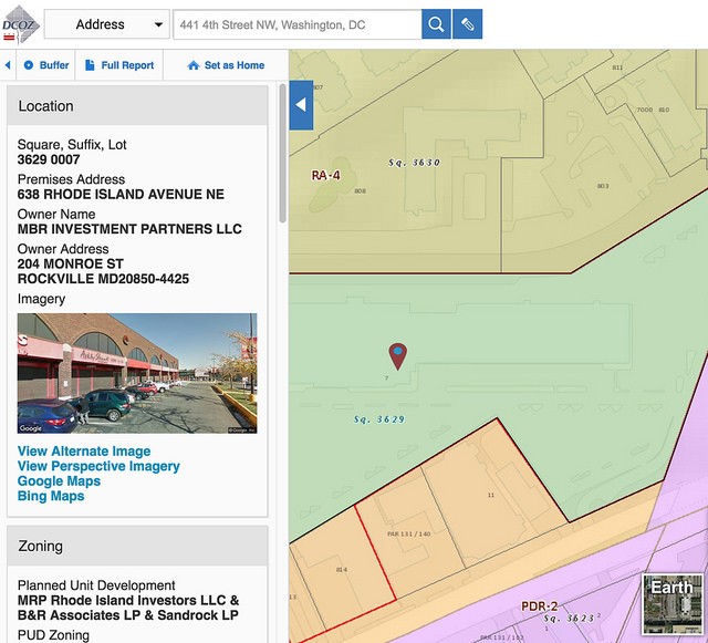
Step 3. Double-click on the site you’re interested in—and voila! The report on the left will tell you all sorts of useful information about the property, like its owner, elected representatives, “square” (every block in DC has an assigned number), other designations like historic protections, and (most importantly for our purposes) its Zone District.
But what does it all mean? Click directly on that zoning classification to read more about it in DCOZ's Zoning Handbook.
Image by the author.
Step 4. This particular site has a bit of a history, as you'll see by scrolling further down in the box. For instance, a Planned Unit Development has been adopted for this site (but, um… it's complicated), and there's a history of zoning changes that affect the site (“Cases for Lot”).
Image by the author.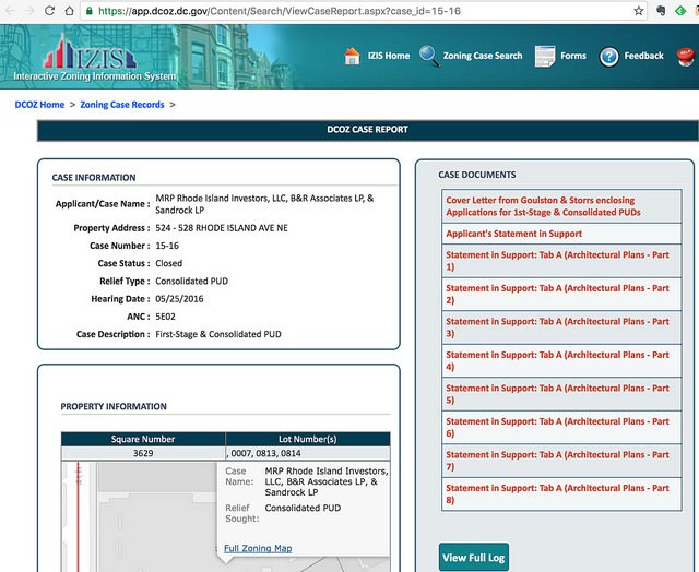
Step 5. For sites with zoning changes, you can bring up a Case Report about each zoning change by clicking on its Case Number. A PUD filing typically includes many detailed pages of exhibits, which are listed on the right under Case Documents. (For a particularly complicated PUD, you may have to click “View Full Log” to see all of the files.)
Image by the author.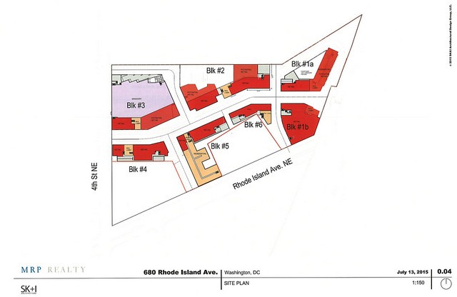
Step 6. These exhibits are all reports, statements, and architectural plans that, if the PUD has been adopted, legally bind any future development on the site, and often contain a wealth of information about what's planned in the future. Here's a map of the building footprints, for instance.
Have you discovered some useful information with this tool?