The Mount Vernon Trail is now a little safer by Roosevelt Island

The Mount Vernon Trail's curve through the parking lot at Roosevelt Island is now much softer. Image by the author.
There's a new crossing where the Mount Vernon Trail passes through the parking lot for Roosevelt Island, which sits between Rosslyn and Foggy Bottom. The trail used to make two 90-degree turns to cross the lot, with no signs to warn drivers of crossing cyclists and pedestrians. Now, the trail crosses the lot at a smoother angle, and there's a large speed bump that both slows drivers and keeps the trail level.
This point on the Mount Vernon Trail (MVT) is notoriously congested, as cyclists, pedestrians, and drivers in the lot all converge there. If you're familiar with the Metropolitan Branch Trail, picture the S-curve at R Street, but shorter, narrower, and essentially crossing a street.
The old trail looked like this. Image by Google Maps.
The National Park Service (NPS), which manages the trail and park, started considering options for fixing this spot in 2014 with the improvements completed last week. In addition to the new crossing and speed bump (a “speed table,” in planning parlance), NPS also widened the trail for the entire length of the lot and added stop signs for cars where it crosses the roadway.
A cyclist on the Mount Vernon Trail passes over the new speed table in the parking lot next to Roosevelt Island. Image by Colin Browne/WABA used with permission.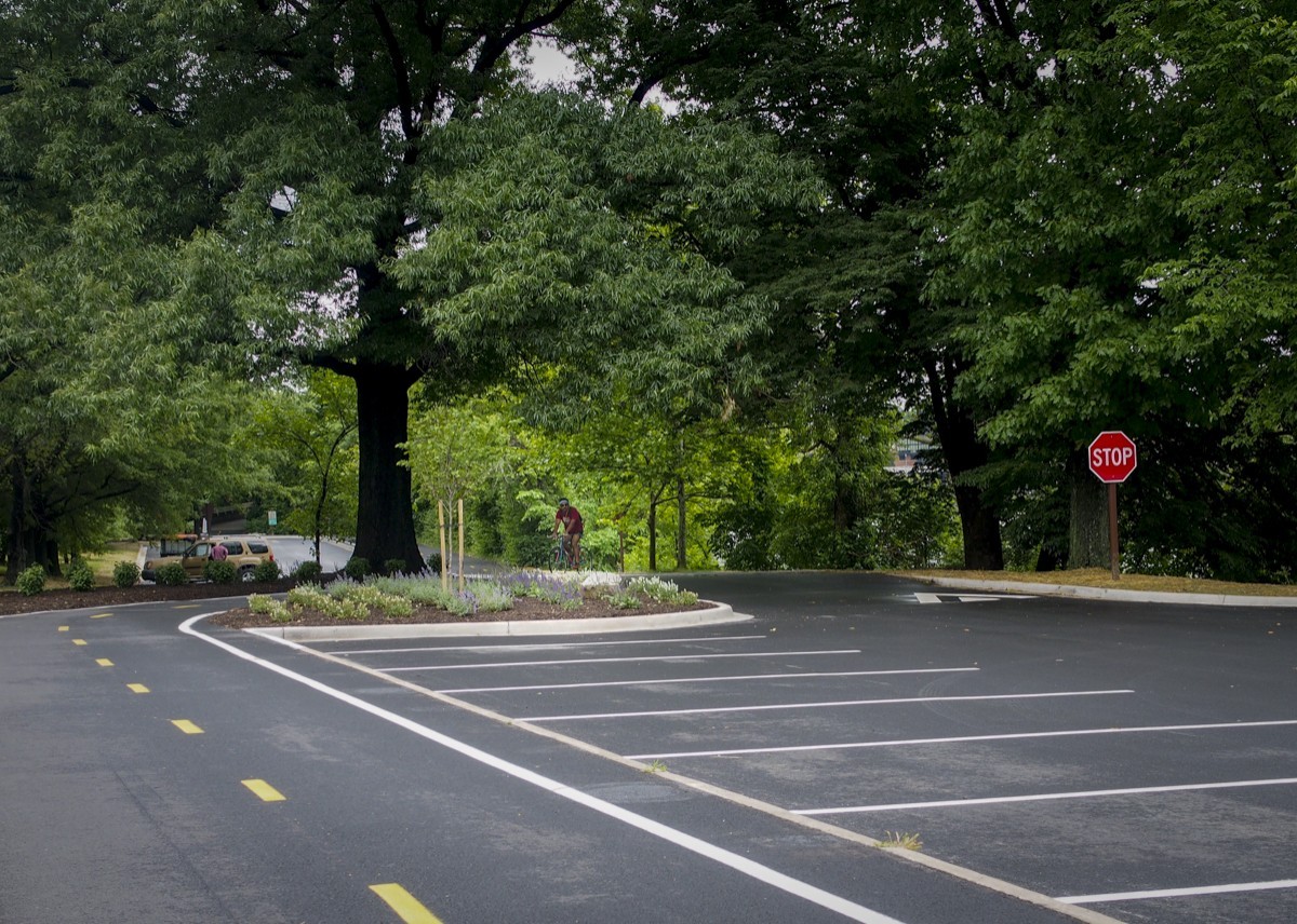
The Park Service also removed a curb cut on the north end of the lot that cyclists often used to exit the trail.
The Mount Vernon Trail on the north end of the parking lot where a curb cut was eliminated. Image by Colin Browne used with permission.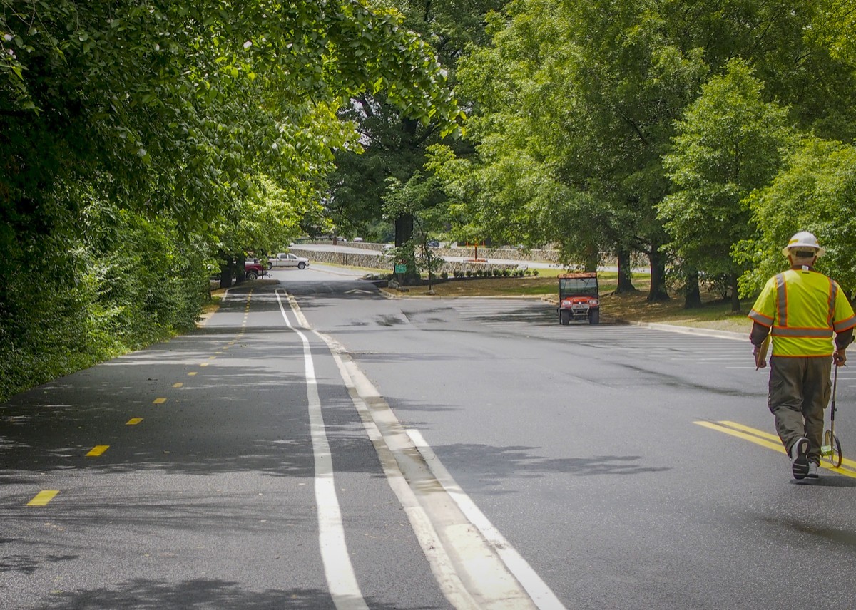
This has been in the works for a while
In 2014, NPS proposed four options for site aimed at addressing the issues above. Other fixes included adding a bike rack and a water fountain, and improving signage.
What's there today are the suggestions from Alternative 1.
A map of the new Mount Vernon Trail alignment next to Roosevelt Island. Image by National Park Service.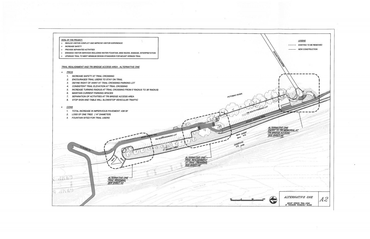
NPS did consider a more aggressive option, Alternative 4, that would have separated the trail completely from the parking lot. The plan here would have been to shift the parking closer to the George Washington Memorial Parkway and run the trail along one side of the lot.
Option three from the NPS' 2014 alternatives analysis. Image by National Park Service.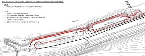
The Park Service eliminated this option because it cut 11 parking spaces from the lot, whereas Alternative 1 one only cut one space.