Here are the answers to whichWMATA week 97

On Tuesday, we featured the ninety-seventh challenge to see how well you knew the Metro system. Here are the answers. How’d you do?
This week we got 30 guesses. 22 got all five. Great work! Also good job to the 8 of you who correctly identified the Maryland theme.
The first image shows the iconic “Largo Beacon” artwork outside Largo Town Center station. We featured it way back in week 4. With 26 guesses, almost everybody got this one right.
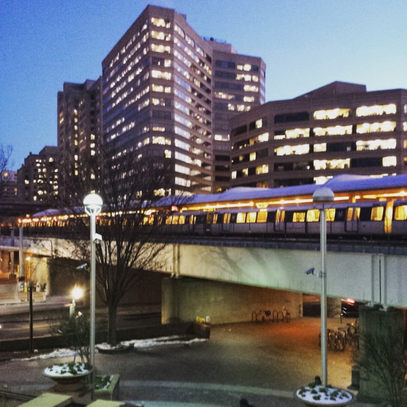
The second picture is Silver Spring, viewed from the plaza northeast of the station. Apologies for the quality; it was a bit grainy to begin with and with the new site, we're using larger images. Despite that, everyone got this one right. The image has quite a lot to see. The NOAA buildings in the background are a key clue. The large girders holding the station up are also indicative of the shared CSX/Metro alignment between Fort Totten and Silver Spring.
This picture shows a bird's-eye view of Twinbrook station from the parking garage. There were several clues. The Gull I canopy was a pretty significant indicator, narrowing the possibilities to 13 stations. The dual railroad tracks on one side eliminates the shared corridor on the eastern end of the Red Line, and the absence of wires cuts out the Orange Line east of the city. Eliminating the elevated platform at National Airport leaves Shady Grove and Van Dorn Street as possibilities.
But Van Dorn Street doesn't have a parking garage or tall building nearby which would offer this vantage point. At Shady Grove, both parking structures are on the same side of the station as the CSX tracks, so this doesn't fit. That leaves Twinbrook.
Other clues included the long ramp on the western side of the station. Use of this ramp means the station has just one escalator, the smallest number at any station, except Forest Glen, which has none. The canopy is also at one end of the platform, instead of centered. And the new development along Twinbrook Parkway was also a hint. So it's no surprise that 29 of you guessed correctly.
The fourth image was a bit harder. The view here looks southwest into the setting sun at Grosvenor. This station's tracks and platform are located in an open cut beside Rockville Pike. The mezzanine is located roughly at street level and is parallel to the road. To access the apartment development west of the Pike, there's an escalator to a tunnel under the road, and it intersects the mezzanine as you see above.
This arrangement is fairly unique. The escalator clearly doesn't lead into the station, which you can see from the canopy above. But generally at surface stations, the escalator would be leading up to a bridge over the roadway. The up-then-down arrangement here is present only at Grosvenor and White Flint. 26 of you guessed Grosvenor.
The final image shows the parking lot at Cheverly. There wasn't much to go on for this image. But Cheverly has a fairly unique mezzanine above the tracks. You can see the eastern end of that boxy mezzanine here, and you can also see the dual escalators descending to the parking lot. We've featured this end of the station twice, both with pictures by Peter K. The underside of the mezzanine was featured in week 52 and the escalator landing was featured in week 38. 23 of you came to the correct conclusion.
Thanks for playing! We’ll be back in two weeks (January 10) with our first quiz of 2017.
Information about contest rules, submission guidelines, and a leaderboard is available at http://ggwash.org/whichwmata.


