Three ideas to make it easier to bike to and from the Mosaic District in Fairfax
Merrifield is a growing part of Fairfax County with a number of bike routes. I’ve got three ideas for making them easier to use.
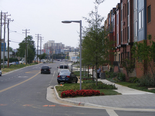
Merrifield is getting better for walking, but it’s still not very easy to bike around. Photo by Dan Reed.
Merrifield is an area of Fairfax County located between the independent cities of Fairfax and Falls Church. Older residential neighborhoods, suburban strip malls, and light industry are still prevalent in the area, but newer mixed-use development has sprung up close to its Dunn Loring Metro station on the Orange Line. This includes the Mosaic District, one of the region’s newest town centers outside of the urban core, similar to Reston Town Center or Kentlands in Gaithersburg.
Gallows Road and Lee Highway, the main “local” roads, are both very wide and can be intimidating to cross or bike along, even on the sidewalk. Both roads were also widened to make room for new exits along I-495’s HOT lanes, which can mean long waits to cross the road on foot.
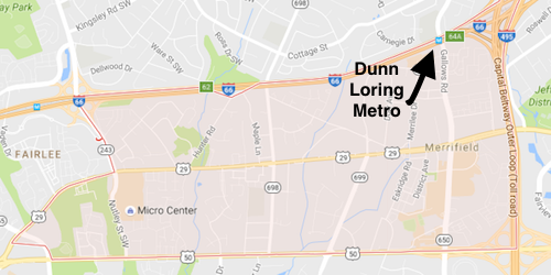
Merrifield. Photo from Google Maps.
But the area also has some great bike infrastructure. Two very popular trails, the W&OD and the Cross County Trail (CCT), run close to or through Merrifield. There are also existing low stress and bike-friendly options, which are routes and streets that cyclists tend to use because they feel safer or calmer riding on those streets compared to others.
The issue is that riding a bike to those trails and other routes is not all that easy. Not many people know the most direct routes, some of the streets are more dangerous than they need to be, and there are places that don’t connect to trails that they could easily could connect to.
Signs, road diets, and some new connections would easily stitch the area’s pedestrian and bike network without the need for huge capital projects.
One easy way to make biking in Merrifield easier: signs
Merrifeld has a number of great bike routes, but unless you study a map, there’s really not a way to know about them. For riding a bike to be a viable option, people need good signs, and signs that make sense for people traveling by car aren’t necessarily sufficient.
The Cross County Trail, which runs north to south across Fairfax County, passes through Merrifield. The Mosaic District is less than two miles from the trail at its closest point, and from there it is only a little farther to the Dunn Loring Metro or the W&OD Trail’s intersection at Gallows Road. It’s far easier to get to those places from the CCT by cutting across an easy-to-miss side trail through a parking lot and then going through a few neighborhoods, but a lot of people simply don’t know that.
A few signs pointing pointing people from the CCT toward the Mosaic District or the Metro (or a number of other destinations, like the hospital on Gallows Road) would instantly make biking a reliable way to travel.
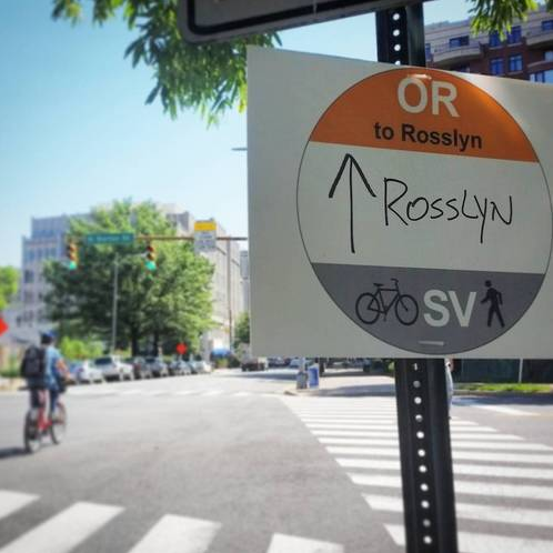
Simple and direct signs can be a big help for cyclists looking for the best routes. Photo by Dan Malouff.
Another thing Fairfax could do with no new infrastructure is look at where existing roads could be resized to encourage more cycling in the area.
Merrilee Drive/Eskridge Road parallels Gallows Road through the area, but fewer people drive on them since the two roads do not actually leave the area. That makes them ripe for more cyclists, especially people who are “interested but concerned” when it comes to riding a bike.
Below is a shot of what Merrilee Drive looks like today. Parking is actually allowed along the street but it is never very busy, and the lack of lane markings can confuse drivers and encourage speeding.
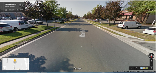
Merrilee Drive today.
There’s more than enough room for bike lanes and parking, or a turn lane. Adding these in would create a bike connection between Mosaic and Dunn Loring that’s nearly arrow-straight. Paint can make a big difference in how people use a road; in this case, it could help people know that there are actually two lanes. Also, painting bike lanes themselves can really help cyclists without totally reconfiguring the road’s layout.
The current road is around 40 feet wide. That’s plenty of room for two driving lanes, two bike lanes, and a parking lane. The sidewalks along the curb would not even need to be touched.
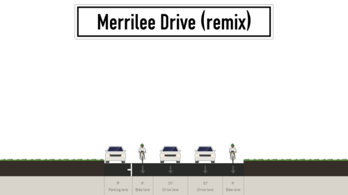
What Merrilee Drive could look like. Image/design from Streetmix
New trail connections
Some new connections between Merrifield’s current bike routes and its nearby trails would make biking easier as well. These would require some capital spending and other steps like acquiring permission to use certain rights of way for these connections, so they’re the hardest of the options I’m putting forward.
But even then, the key word here is “connections”. These are not brand new trails that go on for miles and miles. These would be localized improvements aimed at improving the existing network first.
One big connection would be a proper pedestrian bridge across I-66 at the Dunn Loring Metro. There are sidewalks across the Gallows Road bridge but there are no bike lanes until you are farther down the road. A pedestrian bridge would make it easier for people to get from the Metro to the neighborhoods north of I-66, and existing trails could be extended to link up with a new bridge.
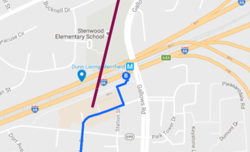
The maroon line is a potential place for a pedestrian bridge across I-66, near one of Merrifield’s low-stress bike route (the blue line). Image from Google Maps.
Another bridge might be explored for crossing Arlington Boulevard near Gallows. There, you have existing park space that is close to the road, but the road itself is hard to cross. Plus if the Arlington Boulevard Trail is completed between Washington and the City of Fairfax then a bridge would be a great addition to a third major trail in the area along with the W&OD and the Cross County Trail.
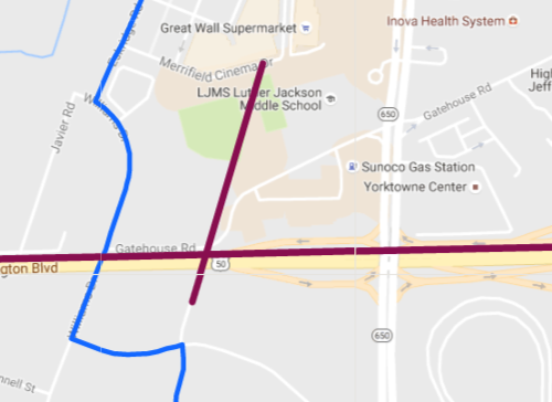
The maroon line is a potential place for a crossing over Arlington Boulevard. Image from Google Maps.
Finally, there could be a connection between the Cross County Trail and Highland Lane which leads to Williams Drive and Eskridge Road, both of which travels through the Mosaic District. That would be a much straighter shortcut than the existing route via Beverly Drive which twists and turns.
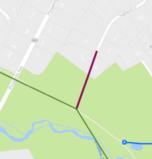
The maroon line is a potential connection from the Cross County Trail (in green) to Highland Lane. Image from Google Maps.
Together, these kinds of changes could have a big impact on helping knit together neighborhoods and destinations throughout Merrifield. That would help people identify with the area and discover that there are options to getting around that do not always require getting in a car.