A streetcar to Georgetown could add a loop ramp under K Street and a pedestrian walkway
DC is planning dedicates lanes for the streetcar almost entirely from Union Station to Georgetown. One tricky spot: from Washington Circle over Rock Creek and I-66 to Georgetown. Here’s how it could work.
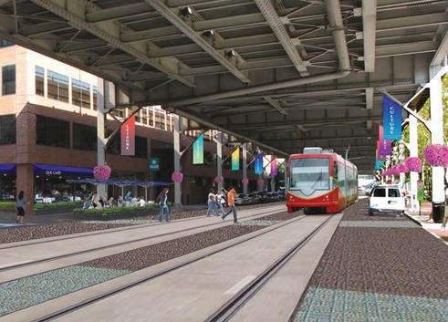
Image from the Georgetown BID.
The District Department of Transportation (DDOT) project team will present its latest options on Tuesday night, and we got a look ahead of the meeting.
The study is considering two options to build a streetcar from Union Station to Georgetown, one in mixed traffic and one (better) one with dedicated lanes, and no overhead wires except at stations and below underpasses.
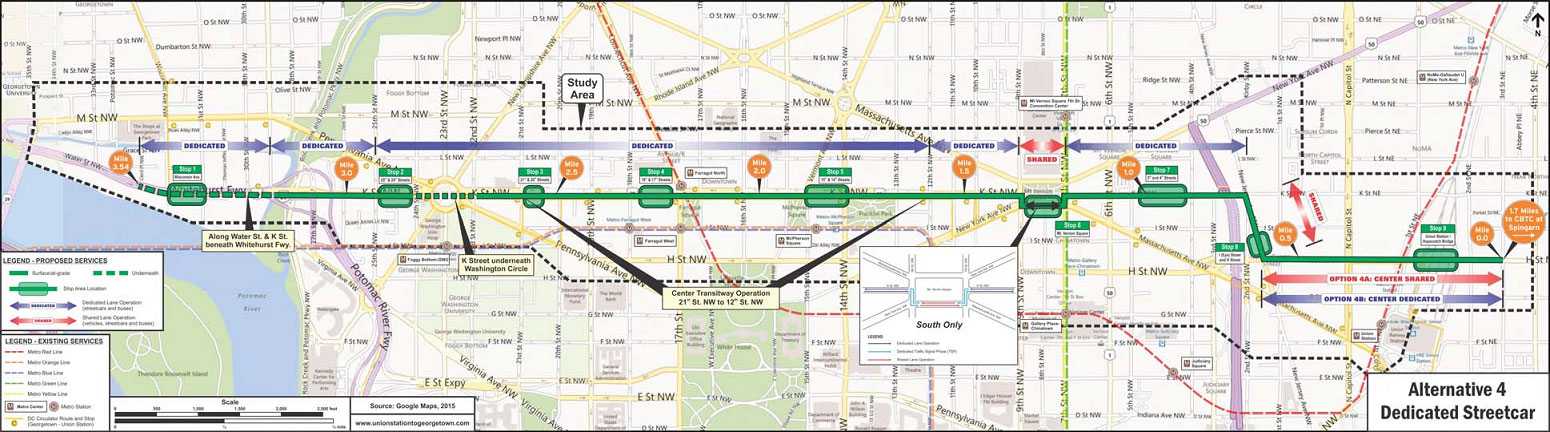
Along K Street downtown, a 2-lane transitway in the center of the road has been planned since 2010. Heading west, the streetcar would then go through the underpass below Washington Circle (leaving just one lane in each direction for cars). That’s where it gets tough.
The turn to 27th Street
If you drive west on K now, you encounter a long left turn lane for cars turning onto 27th Street NW, a little street with almost no buildings but which leads right to a ramp to I-66 and to Virginia Avenue. That left turn lane would mix horribly with a dedicated streetcar lane.
DDOT planners have an idea. The bridge where K crosses two I-66 ramps has an extra span to the west, and there’s a lot of open land which is technically highway right of way in between the various ramps.
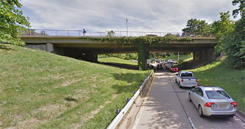
The loop ramp would use the left side of this bridge. Image from Google Maps.
They therefore want to study adding a new loop ramp from K Street, turning right instead of left, looping around, and rejoining 27th Street where it connects to the current off-ramp from 66.

Image from DDOT.
This would allow the streetcar to have the middle of K Street to itself. It would also smooth traffic at that complicated intersection, where there has to be a whole phase for turns onto 27th.
According to the presentation, DDOT is looking at widening the bridge in that area, partly to add lanes and also to create a sidewalk on the north side of K, where there is none today.
Washington Circle
The streetcar will be down in a trench from about 21st Street to 25th. So how can people get from the streetcar line to places in between, like George Washington University?
The study team is looking at putting a station in the median between 24th and 25th Streets, where the center part of the road is still largely below ground. At 25th is a regular at-grade intersection where people could cross from the middle of K to go north or south, but the team wants to better connect it to 24th and Washington Circle as well.
Therefore, they are looking at building a pedestrian ramp from the below-ground streetcar level up to street level at 24th.
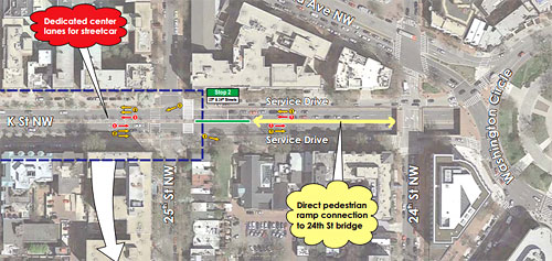
Image from DDOT.
Both of these pieces would cost money — exactly how much, project manager Jamie Henson said, they will study in the next phase of this process.
That will likely make the alternative with dedicated lanes more expensive than the one without, but if the price tag is reasonable, it’s worth it. Encourage DDOT to move ahead with as much dedicated lane as possible below.
Read more from today’s streetcar mega-feature:
- Now that it’s open, 7 takeaways from the H Street streetcar
- DC’s streetcar may go to Georgetown with dedicated lanes
- West of Union Station, no overhead streetcar wires
- A loop ramp under K Street and a pedestrian walkway
- Before going to Georgetown, the streetcar will go east to Benning Road