Use this map to share your ideas for better east-west travel across DC
Is it frustrating to try to travel from Columbia Heights to Brookland on foot, bike, bus, or car? The District Department of Transportation is studying ways to make it easier to travel east-west in this area, and a new interactive map lets you point out problems.
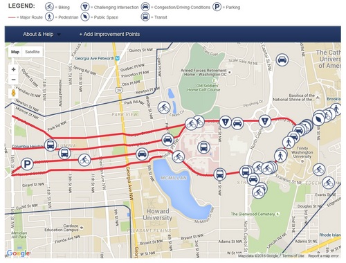
Map by DDOT. map. Click for an interactive version.
This WikiMap is part of DDOT’s Crosstown Multimodal Transportation Study, the goal of which is to improve all modes of travel between 16th Street NW and South Dakota Avenue NE. It lets users identify problems with and suggest solutions for
walking, riding a bike, driving, transit, public space, parking, and intersections, and is a user-friendly way to participate in DDOT’s search for long-term solutions.
People who frequently commute by foot, bike, bus, car, or other means through the corridor have firsthand knowledge on the area’s congestion, safety, and streetscape issues. They’re also likely to have ideas on how these issues can be addressed to improve transportation mobility and mitigate impacts on the surrounding neighborhoods.
Beyond the crowdsourced map, DDOT recently kicked off the first in a series of public meetings for the project aimed at gathering feedback.
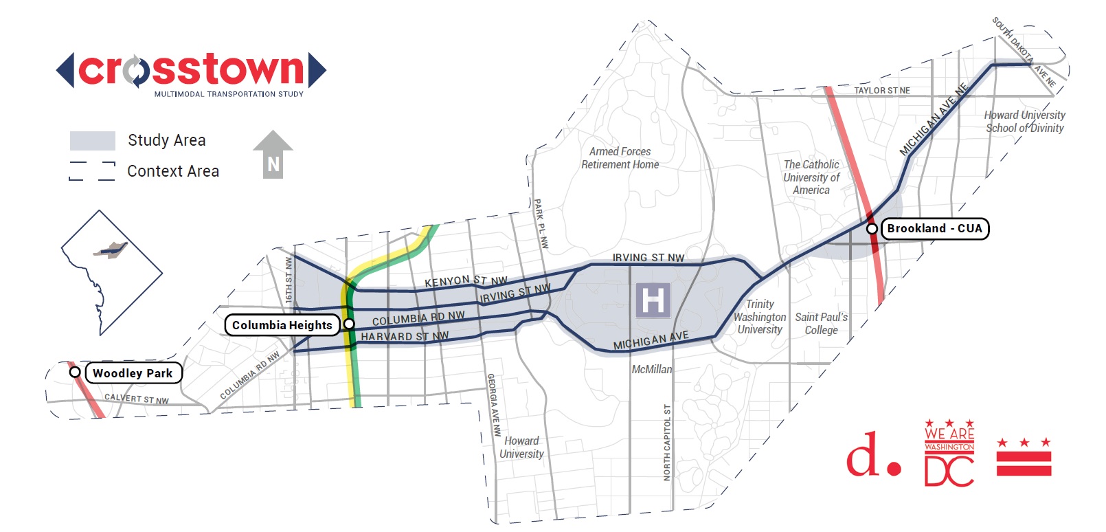
A map of the study area.
The interactive map will be available on DDOT’s website (just click the first image in this post) for several months.