The Custis Trail is going to get a lot longer
Right now, the Custis Trail runs from Rossyln to the west end of Arlington, where it dead ends into the W&OD Trail. There are plans to expand it so that it runs through Fairfax and into Prince William County.
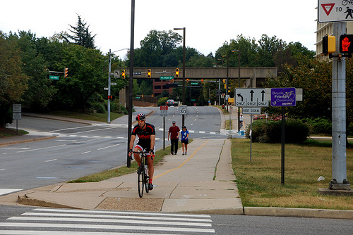
The Custis Trail in Rosslyn. Photo by Dan Malouff.
The changes will be part of Transform 66, VDOT’s overall plan for the I-66 corridor between DC and Haymarket.
VDOT will build some parts of the trail, while Fairfax and Prince William will work to build other parts that don’t fall within Transform 66’s physical boundaries.
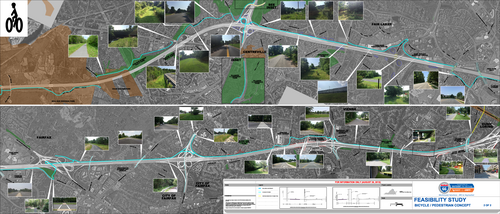
The proposed trail in Fairfax County. Image from VDOT.
This would be a big boost for area trails
Building out the entire thing would make the Custis Trail one of the longest trails in the region. It’d be up there with the W&OD Trail’s 45 mile long path, and it’d dwarf other well know trails in the area like the Mount Vernon Trail (18 miles) or the Capital Crescent Trail (11 miles). You’d be able to take the trail all the way from the Key Bridge to Manassas Battlefield National Park and beyond.
Working new trails in with road plans is a way to make sure that even highway expansions are, in their own way, bike and walking-friendly. For such efforts to be successful, though, trails have to both get built and is adequate for people’s needs. Otherwise the trail just gets seen as a simple amenity rather than a necessary part of the area’s transportation infrastructure.
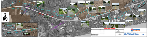
The proposed trail in Prince William County. Image from VDOT.
That was the case with the promised trail along the Intercounty Connector. Only a partial trail went in there, with major sections never being completed because the state DOT deemed the area too environmentally sensitive to host both a trail and a six lane highway.
There are still questions on location and ramp crossings
VDOT still has to nail down a lot of details of the trail’s final path. One question: what side of the I-66 sound wall will the trail be on? On the existing portions of the Custis Trail, the path is sometimes on the highway side of the sound wall because when it was going in, residents didn’t want a trail running on or near their yards.
Another big question is how it will cross the ramps that cars use to enter and exit I-66. Underpasses and overpasses can help keep trail users safe from car traffic, but those add to building costs; in a budget crunch, they may be the first things to go.
In other places, there are plans to supplement the trail by making it easier to bike and walk in surrounding areas. At the Vienna and Dunn-Loring Metro stations, VDOT is looking at redesigning the Nutley Street and Gallows Road interchanges, which might improve their sidewalk crossings over I-66.
VDOT is currently holding public meetings about Transform 66.