A different kind of “fantasy map”: DC, Tolkien-style
Here’s a fun way to look at a map of a familiar place. Following the style of maps in J.R.R. Tolkien’s Middle-Earth novels, Stentor Danielson created this map showing DC and nearby parts of Maryland and Virginia as a land of strongholds, villages, and countryside.
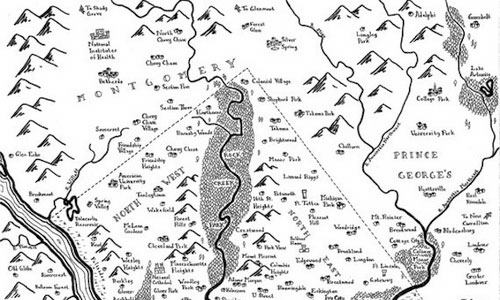

A fantasy-novel inspired map of DC. Drawing by Stentor Danielson. Click for larger version.
The “River Potomac” and the mighty forest of Rock Creek Park are some of the biggest features.
Neighborhoods show up as villages, and points of interest get medieval-looking icons. The Pentagon is drawn as a castle and, curiously, so is Union Station. The Washington Monument looks like something Rapunzel would live in. The National Observatory replaces its atomic clock with a stone circle à la Stonehenge.
Notably missing is any of the region’s major highways, bridges, or roads. Metro probably doesn’t run either in Middle-Earth DC, which would probably make commutes feel like a journey to Mordor.
What do you notice?
Hat tip to io9 for discovering this fun map.