New Douglass Bridge could be best bike bridge in DC
Last night, DDOT presented their latest design for the new Frederick Douglass Bridge, where South Capitol Street crosses the Anacostia. While the racetrack ovals proposed for both ends of the bridge have drawn criticism, the bridge itself has the potential to be DC’s best for bicyclists.

Bicyclists will get a cycletrack across the new Douglass bridge. All images from DDOT.
On the bridge itself, cyclists will have their own, 10-foot wide, two-way cycletrack, separate from the sidewalk and protected from auto traffic by some sort of barrier. And there will be one on each side of the bridge. Cyclists will get 20 feet of space on this bridge all to themselves, and that’s kind of amazing. Pedestrians will get two 8-foot-wide sidewalks and occasional overlooks.
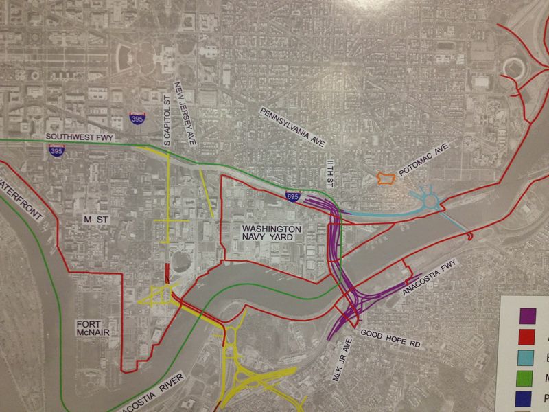
Map of other transportation projects in Near Southeast.
The new bridge will connect to portions of the existing or planned Anacostia Riverwalk Trails (ART). The South Capitol Street bridge and the area west of it constitutes one of the last major parts remaining, along with the Kenilworth Section, for which construction bids are due next week. After that, there’s the Virginia Avenue Trail and a trail along 2nd St SE to connect to it.
Once off the bridge, cyclists will find pretty direct connections to the ART on both sides of the river and in both directions. On the east side, they’ll also get a direct connection to the forthcoming South Capitol Street Trail.
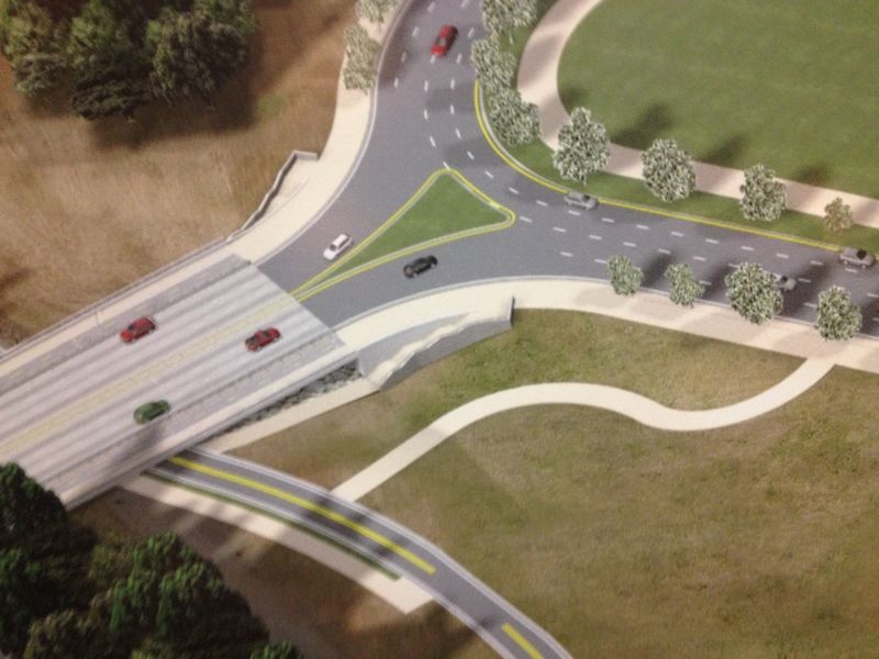
On the southwest side, cyclists will ride off the cycletrack, onto the large mixing area, and then along the sidepath past the line of trees where they could U-turn down the ramp to the ART. Pedestrians would make a quicker turn to go downstairs to the ART. Or cyclists could continue along the sidepath along South Capitol.
On the northwest side, cyclists could also connect to the trail or follow the sidepath, but this rendering is probably unclear since the Florida Rock development will go in next door.

Rendering of the Douglass Bridge’s west side.
On the east side, pedestrians would again connect to the ART via stairs immediately alongside the bridge, but cyclists on the northeast side would ride along the oval and then head north along the Anacostia Drive Connector to connect to the trail near Poplar Point. On the southeast side, cyclists would follow the oval a short distance before turning
left to follow Suitland Parkway.
Rendering of the bridge’s east side.
Below is a map of the bike network on the west side of the river. The blue lines show 18-foot-wide facilities for cyclists and pedestrians, while the orange lines show 12-foot-wide facilities. The purple lines along Potomac Avenue SW and R Street SW are bike lanes.
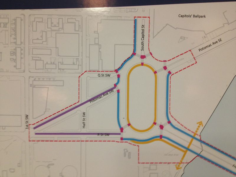
Bike network on the bridge’s west side.
And on the east side, cyclists can continue north around the oval to Howard Road. There are more renderings at the project website.

Bike network on the bridge’s east side.
There was no mention of or drawing showing a bike trail along the old Shepherd Branch rail line, not that I really expected to see that, though I did notice they were planning to buy the ROW under I-295, but that is likely for the streetcar.
There’s not much to criticize here, at least from a biking standpoint at least. Some might wish there were more bike lanes for cyclists who don’t want to ride on sidewalks, even really, really nice ones; but cyclists will be allowed to ride in the road if they choose.
It’s a pretty nice setup though. The whole thing is estimated to cost $622 million using local and federal money. Work could begin in late 2014 and wrap up in 2018.
Cross-posted at the WashCycle.