Then and now: Dulles sprawl
NASA’s Earth Observatory site shows how sprawl in the Dulles Airport area has grown through a comparison of 2 satellite images, one from 1984 and one from 2011.
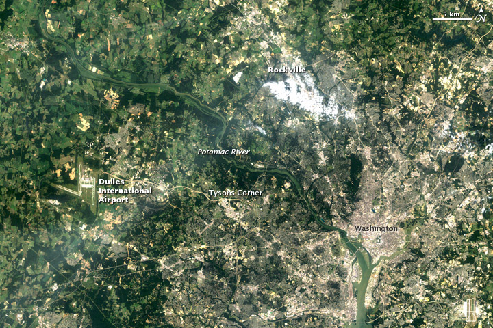
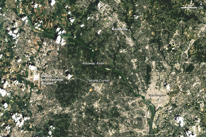
Drag the slider all the way to the left to see the changes around Dulles, the starkest difference between the two.
The NASA page notes:
Tysons Corner was built on farmland in the 1960s. Located 13 miles (21 kilometers) from Washington, Tysons Corner was conceived as an “edge city” on the outskirts of town. Designed for an automobile-rich society intent on shopping, its malls boasted something like 167,000 parking spaces. Now the urban area has grown far past it, and developed areas extend beyond the airport. …
Around the time that developers built Tysons Corner, officials in Montgomery County also designed a community, but instead of cars and shopping malls, it was based on a concept known as “wedges and corridors.” A plan adopted in 1964 aimed to concentrate commercial and residential development along transportation corridors, and leave the wedges between these corridors open with undeveloped land.
A 2002 report from the Joint Center for Housing Studies of Harvard University described Montgomery County’s plan as “one of the most sophisticated systems of growth management in the United States.” The different approach to growth management can be seen around Rockville, where urbanized areas did not expand so substantially between 1984 and 2011.
Thanks to Geoff Hatchard and Heather Goss for the tip.