Posts about History
-

Lost Washington: The Capital Garage on New York Avenue
The Capital Garage was built in 1926 at the corner of New York Avenue and H Street (1320 New York Avenue) and torn down in 1974. The same location is now occupied by the largely nondescript Daon Building. Keep reading…
-
What lies beneath DC? A lot more tunnels than you might think!
Have you ever wondered what’s under your feet in the District? Everyone who rides Metro regularly has some sense of where the subway tunnels in the region are, but may not know that DC also has a number of former streetcar tunnels, currently-used railway tunnels, and a collection of road tunnels as well. Keep reading…
-

Liberty at Lorton: How a notorious prison got a new life as a housing complex
In my previous post about the Lorton Reformatory in Lorton, Virginia, I went over the history of the prison complex from its beginnings in the 1910s to its closure in 1999. In this article, I turn my focus to the long road to redeveloping the prison site and its grounds into a place that the Lorton community could be proud of and see as useful. Keep reading…
-

Here’s a fascinating story about the old Lorton, Virginia prison
The Lorton Reformatory is a prison in Lorton, Virginia that closed in the late 1990s. In May 2018, it reopened as a sprawling complex of apartments called Liberty at Lorton about 19 miles outside of DC. The development is a great example of how a historical site can supply housing in a region that badly needs it, while still preserving a historical landmark with a storied history. Keep reading…
-
_480_320_90_s_c1.jpg)
Why’s everyone talking about upzoning? It’s the foundation of green, equitable cities.
Though we write about zoning plenty on GGWash, it’s a topic that’s been regarded by the wider public as too wonky, too insider, and too jargon-like to figure into everyday life. But zoning literally is everyday life, because it governs what goes where. And it’s circumstantial to affordability, equality, equity, and the distribution of goods, services, and wealth. Keep reading…
-

What we can learn from the history of DC’s circles and squares
From the 1870s up to the present day, competing interests — erecting monuments and memorials, preserving space for civic recreation, and catering to vehicular traffic — have led to drastic changes in our shared public spaces. Keep reading…
-
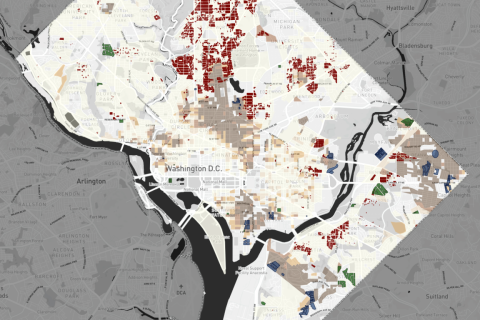
These maps show how public housing was manipulated to segregate DC
Since it was created for white families during WWII, public housing has been used as a tool to segregate cities, and whites in power continued to use it for this purpose as more black residents moved in over the following decades. A map project from the historians at PrologueDC illustrates the ways public housing has been manipulated. Keep reading…
-
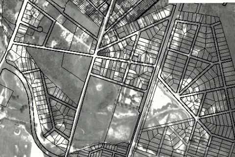
This GIS atlas reveals the history of Prince George’s County
Hey history buffs: Prince George’s Atlas has a slew of fascinating old aerial photos, maps, and other cartographic information about the county, including property boundaries and environmental information. What did your neighborhood look like a century ago? Keep reading…
-

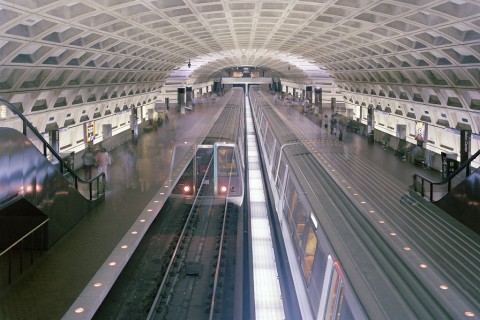
Check out this treasure trove of WMATA construction photographs
The George Washington University Archives released a mother lode of digitized photographs showing the construction of Metro. This amazing cache of hundreds of pictures showcases several segments of the system while actively under construction, as well as renderings of various stations. Keep reading…
-

Washington’s unbuilt highways
This is a map of the Washington that almost was. If mid-century planners, dedicated as they were to driving and the clearance of historic neighborhoods, had their way. It is a map of the highway network proposed for Washington during initial planning of the Eisenhower Interstate System, in 1958. Keep reading…