What would you name your Single Member District? We mapped our ideas for all 345 of them

Screenshot of Google map of proposed districts created by the author.
The District’s hyperlocal Advisory Neighborhood Commissions (ANCs), despite their potential for drama and usefulness as neighborhood glue, are generally quite dry, owing not least to their code nomenclature. Perhaps we could put a little spice into the mix by renaming these commissions, and their single-member districts, to something a little more human. I made a map that does just that.
Some of the ANCs with possible names. Background from OpenStreetMap, ANC shapes from District of Columbia, image by the author. Click to enlarge. Image by the author.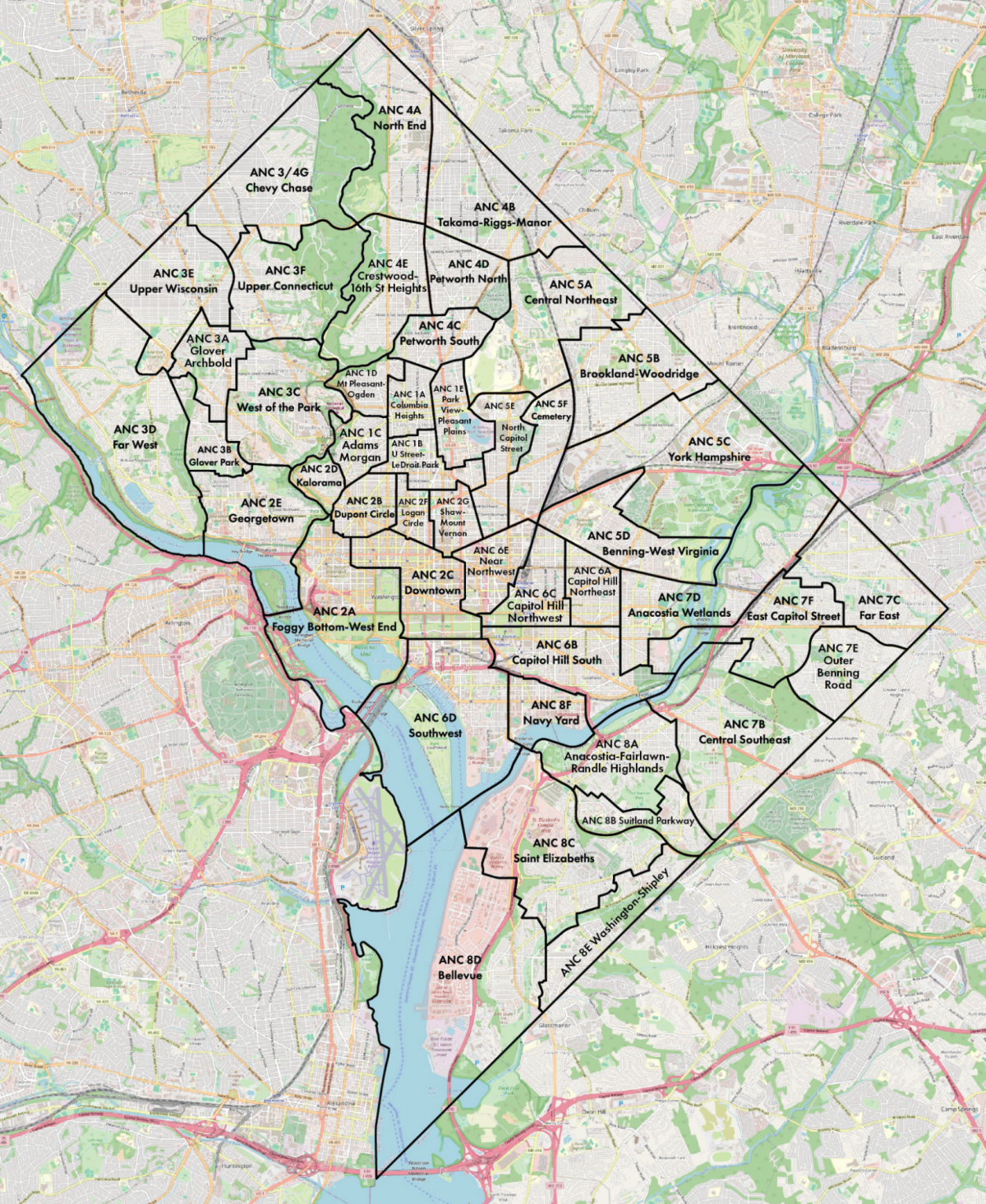
Today, ANC names are strictly a code: the first digit is the ward, and the second digit is a letter (A-G) specifying which ANC it is. ANC members are elected to single-member districts, of SMDs, which add another two digits. Unlike legislative districts, which might be “Maryland’s 3rd District,” this renders instead as SMD 3C08: the eighth SMD within the third ANC within Ward 3.
That’s great for a spreadsheet, but it has no character and doesn’t give anyone except the most in-touch politicos a good sense of where it is on a map. A more human method comes from Canada, which names its districts after the towns, cities, and places covered by the district. So, instead of “Alberta’s 2nd District,” the member of parliament represents “Calgary Rocky Ridge.” My favorite, which would probably be British Columbia’s 42nd, is a delightfully poetic mouthful: West Vancouver—Sunshine Coast—Sea to Sky Country. Who wouldn’t want to live there?
Taking this to DC would mean naming SMDs and ANCs after landmarks, schools, neighborhoods, parks, or prominent roads. So rather than ANC 3C, perhaps it could be named West of the Park, given its location and distinctiveness relative to the prominent neighborhoods east of the park. And, rather than SMD 3C08, perhaps instead, it could be Massachusetts Heights, the neighborhood the SMD covers. SMD 1D04 would be Downtown Mount Pleasant since it covers Mount Pleasant Street; ANC 6B becomes Capitol Hill South; and ANC 2B08 becomes Strivers Section.
I went through all 46 ANCs and 345 SMDs and did my best to name them based on schools, hospitals, apartment complexes, landmarks, and neighborhoods, but the odds are high that I didn’t get things right in your neighborhood. I live in ANC 1D07, for instance, and I probably would have named it “North of Ogden” if I didn’t know our local listserv was called Spring-Perry, after the main streets on the district’s north side.
Check out the full map of ANCs and SMDs here and submit your ideas here. Let’s make a better map so we can inject a human touch into our hyperlocal politics.