Transit Diary: A young professional’s car-free autumn in DC
Transit Diaries is a series in which residents of Greater Washington track how they get around the region for a week, shedding light on what’s working well and not so well with our transportation systems. Read past Transit Diaries.
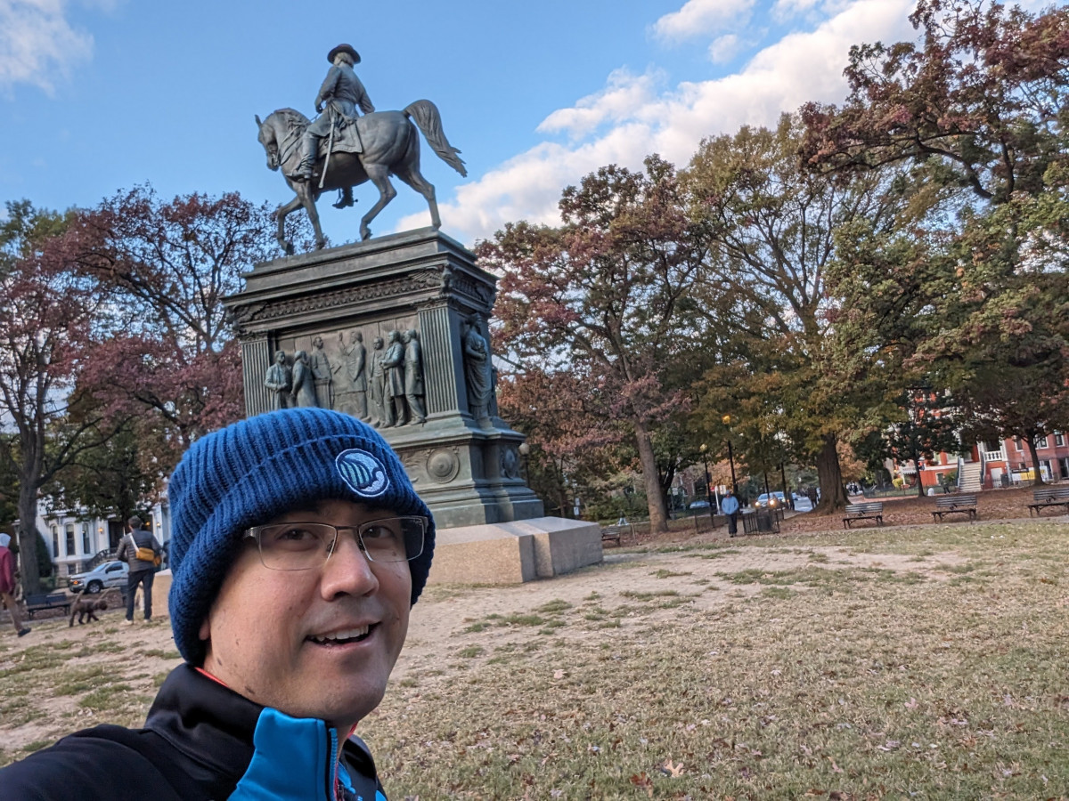
I’m David Breisch, I’m a single young professional living in DC proper on Rhode Island Avenue NE by the Red Line Metro stop. I’m a marketing professional at Destinations International, a trade association supporting destination promotion in the travel and tourism industry. It’s a really fun industry to be in!
I don’t own a car in DC, so I get around primarily by walking, biking, Metro, and – if I have to – Lyft rides. Our association is fully remote, so I’m not required to go into the office on any kind of regular basis but we do have occasional meetups in downtown DC when folks are in town. I’m also a big cyclist so I spend free time biking around the region, as well as meeting up with friends and other general merriment.
Day 1: Monday, October 30
Today was a work from home day, but I was out of town all weekend so it was somewhat necessary to go pick up groceries for the week during lunch time. Unfortunately, my area of Rhode Island Avenue is a little bit of a grocery desert – it’s a nearly mile-long walk to the closest Giant. Luckily, I’m physically fit enough to bring my backpack and tote many pounds of food back to my condo with me, but if I wasn’t able to do it myself I would have to rely on grocery delivery or other people to help me out.
Highlights & hitches:
- The Giant grocery store closest to my house is within a stone’s throw from the Rhode Island Avenue Metro stop – but with a massive parking lot it is the opposite of transit-oriented development. It’s impossible to get there without navigating any number of poorly-designed sidewalks, crosswalks, and too many vehicles. I would love to have a safer way to access the grocery store for those that don’t own a car.
- On my way home from Giant, I usually walk through the new Bryant Street development right across the tracks from the Rhode Island Avenue Metro stop which is coming along nicely – and with apartments, ground-floor retail and food shops, Metrobar, and the Alamo Drafthouse, it is becoming a nice transit-oriented destination. I see people walking there from Metro all the time. However, there’s still a giant “legacy” parking lot there that I have to trudge through, which is not super pleasant. Removing some parking and utilizing the space for more housing, retail, or green space would be great for those city-dwellers without cars.
Total distance traveled: 2 miles
- Walking: 2 miles
Not a great layout for a Metro-adjacent development. 
Day 2: Tuesday, October 31
Happy Halloween! I’m not a big Halloween person, so it wasn’t a very exciting day for me. I worked from home and went out for my daily walk; and then my evening was my weekly online video game night with friends from out of state.
Highlights & hitches:
- One of the highlights of my location is proximity (just a few blocks away) from the Metropolitan Branch Trail connecting Union Station to Fort Totten and (eventually) Silver Spring. It’s a delightful trail to go walking or biking, and NoMa’s new Alethia Tanner Park is an amazing destination to walk to. And the annual mural festival just concluded last month so the new murals from local artists are all in place! Go check them out.
Total distance traveled: 2 miles
- Walking: 2 miles
Alethia Tanner Park is always full of activity and easily accessible by anyone. _1200_903_90.jpg)
Day 3: Wednesday, November 1
While my job is fully remote, we do have a downtown DC office space still. We had a new team member starting and everyone was visiting DC so I had to commute into the downtown office two days this week. My condo is 2.7 miles from our office by Farragut Square so on a nice morning, it’s a very enjoyable one-hour walk straight down Rhode Island Avenue – I can put in my earbuds and decompress before the upcoming day.
After work, we headed over to Beat the Bomb in Ivy City for an incredibly fun team-building activity. Unfortunately, Ivy City is a transit desert with no easy Metro connection. Our group of five people grabbed two Lyfts to head over to Beat the Bomb – at least work was paying for it! After the activity, I again elected to grab a Lyft home. While my condo is relatively close to Ivy City, it’s completely cut off by the maze of Amtrak, CSX, and Metro tracks and the Ivy City train yard. Walking would have required a long loop around; there’s no protected biking/scooting infrastructure most of the way home; and I don’t feel super comfortable trying to navigate that mess late at night.
Total distance traveled: 7 miles
- Walking: 2 miles
- Lyft: 5 miles
Highlights & hitches:
- While the walk to work is pleasant and shady on Rhode Island Avenue through Eckington and Shaw, the downside of the mature trees is that the sidewalks on parts of the road are in terrible condition due to tree roots and uneven surfaces. Some sections of the sidewalks are completely impassable for anyone who has limited mobility (or two people side by side). This is a big problem that needs to be fixed.
- Rush hour traffic was horrendous. It took nearly 20 minutes to even get a Lyft, after one cancellation, and then another 45 minutes to travel the 3 miles from the office to Ivy City. If I wasn’t with a group, I could have walked almost as fast.
- There is no Metrorail service in the Ivy City/Gallaudet/Trinidad neighborhoods, making transit connections more of a challenge for that section of the city. Additionally, protecting biking is not great. Traveling straight north from Ivy City via bike requires a long detour, especially considering it’s impossible to access the Metropolitan Branch Trail from New York Avenue. Better biking connections are needed all around. Given the constraints of the giant train yard, extending the 6th Street bike lanes north along 9th Street and Brentwood Road would be a game-changer for Gallaudet students or others headed north.
Yes, this is your typical sidewalk on parts of Rhode Island Avenue. 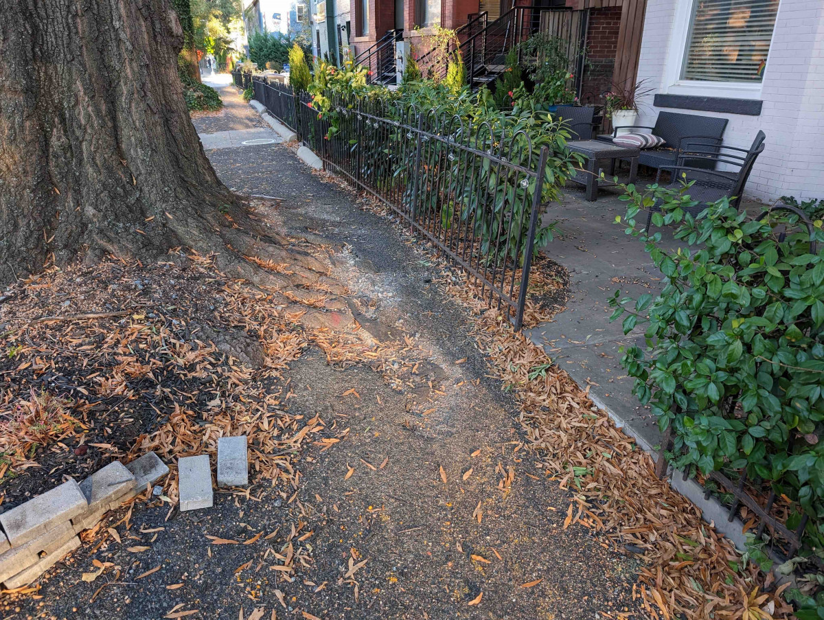
Day 4: Thursday, November 2
Thursday was roughly a repeat of Wednesday, minus the after-work social time. After walking to work and spending the day at the office, I hopped on the Red Line for a one-line ride home. Thankfully, Farragut Square has two Metro stops with easy connections to Red, Blue, Orange and Silver. Once I get back to my home station of Rhode Island Avenue, it’s a quick half-mile walk home.
Total distance traveled: 6 miles
- Walking: 3 miles
- Metro: 3 miles
Highlights & hitches:
- No major problems today, but I love having so much Metro connectivity in downtown DC.
Day 5: Friday, November 3
I worked from home today after being in the office for the previous two days. In the evening, I headed over to my friends’ house for a game night. They live in the Langdon neighborhood, just a mile and a half from my house – unfortunately there’s no Metrorail connection there either. Going to their house is an easy walk, but coming home late at night I elected to take a Lyft because of the lack of transit options.
Total distance traveled: 4 miles
- Walking: 2 miles
- Lyft: 2 miles
Highlights & hitches:
- Langdon is another transit-desert neighborhood and difficult to access for those without a vehicle.
Day 6: Saturday, November 4
As a cyclist, I always enjoy the Washington Area Bicyclist Association’s (WABA) signature rides – and this Saturday was Cider Ride day! The Cider Ride is an annual event where participants enjoy some of the many protected trails in the Washington region, all while enjoying the crisp fall colors and some hot apple cider (and donuts) along the way. I also love the Cider Ride because the start point is usually in the Eckington neighborhood right by my condo.
The Cider Ride is a great way to see the picturesque neighborhoods in Northeast DC during prime fall season. And donuts! 
After the 30-mile organized ride, my friends hosted a Halloween-themed game night at their house. Unfortunately, they live in Woodbridge – outside of the Metrorail service area. Getting there via any kind of transit would have been a three hour one-way trip there via Metrorail and three buses; and physically impossible to get home after 9 pm. So that was out of the question. I had to Metro to King Street Station and then rely on friends to drive me the rest of the way.
Total distance traveled: 95 miles
- Biking: 30 miles
- Metro: 20 miles
- Driving: 45 miles
Highlights & hitches:
- The Washington region has some lovely bike trails for folks of any skill level. Going northeast from my house connects to the Anacostia Branch Trail and the Lake Artemesia area which is delightful – highly recommended for everyone.
- Having said that, there is no protected way for cyclists to get from the northern half of the Metropolitan Branch over to Anacostia Branch Trail, so navigating side streets is necessary.
- Needless to say, traveling outside of Metrorail’s service area without a car is very difficult and requires either rideshare, or help from friends.
The locations are approximate, but you get the idea. Just a casual three hour ride to my friends’ house. One way. 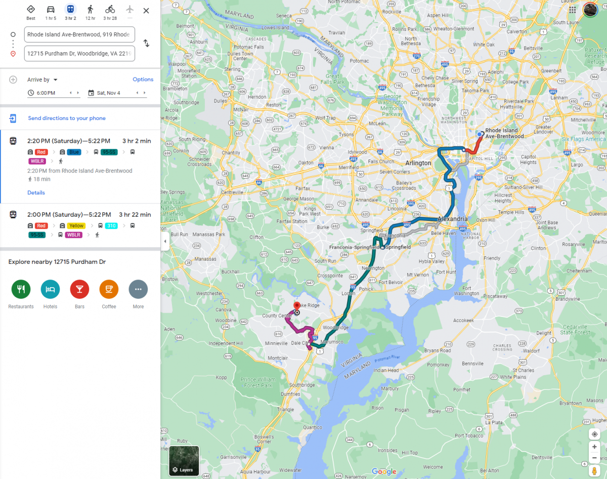
Day 7: Sunday, November 5
After a busy weekend, it was nice to have an “off” day at home. No major travel today except my daily walk down the Metropolitan Branch Trail.
Total distance traveled: 2 miles
- Walking: 2 miles
Final tally: 16 trips
| Mode | Number of trips | % of the total number of trips (rounded to nearest whole number) |
| Walking | 7 | 44 |
| Biking | 1 | 6 |
| Bus | 0 | 0 |
| Metro | 3 | 19 |
| Driving | 2 | 12 |
| Rideshare | 3 | 19 |
| Total | 16 | 100% |
Reflections
As someone who already lives in DC without a vehicle, there were no real surprises during my week keeping my transit diary. While there are definitely improvements to be made, overall DC is a very accessible place when it comes to navigating via transit, biking, and walking. We have made great strides especially in building out protected biking infrastructure (although there is obviously still work to be done).
One observation that I made is that there is still a lot of low-hanging fruit when it comes to improving non-vehicle accessibility in certain areas. While building new Metro stations is decades away, there are things that can be done without massive infrastructure investments. For example, Woodbridge already has a great train station and if VRE or Amtrak provided more service – even hourly – it would be more realistic to commute to my friends’ house without spending an hour in the car. Or adding more bike connectivity on key connector routes, such as the aforementioned Brentwood Road from Ivy City to Eckington, would help a lot of people.
Overall, it was a fun exercise and I hope this series inspires more people to try car-free living!