These three DC neighborhoods almost became freeway-oriented suburbia
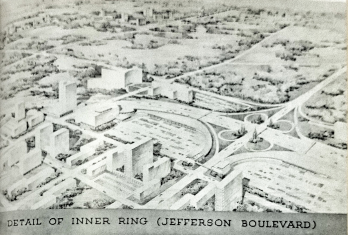
The cloverleaf to the right is what the intersection of 16th, U, and New Hampshire nearly became. Aerial perspective rendering by Louis Justement. Photo by author.
We first published this post on December 2, 2015. We love looking back at the District’s history, wanted to share this piece again.
Planners in the 1950s wanted to replace large swaths of central Washington with freeways. Canceling those plans saved the city not just from the freeways themselves, but also from an equally stunning plan to demolish thousands more blocks alongside said freeways and “renew” them with a suburban landscape of strip malls, office campuses, and apartment towers.
Architect Louis Justement was tremendously influential from the 1920s through the 1960s, both locally and nationally; he chaired the American Institute of Architects’ national Committee on Urban Planning for a spell. Gravely concerned with the tremendous overcrowding and traffic congestion that characterized wartime Washington, Justement published a short book in 1946 called New Cities For Old.
In it, he proposed not just replacing many major streets within DC with limited-access freeways. He also wanted to replace the neighborhoods that had grown up alongside those routes — or, rather, along the streetcars which traversed said streets — with modern new buildings suited to line those modern new roads.
A more detailed look at the proposed Jefferson Boulevard. Plan by Louis Justement, photo by author. 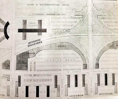
Justement’s startling vision for the U Street corridor would have replaced T Street NW with “Jefferson Boulevard,” and the slightly confusing intersection of 16th, U, and New Hampshire would have been radically simplified with a giant cloverleaf. The backs of two-block-long stripmalls, fronted by broad parking areas, would have lined Jefferson.
Between R and S streets, the rowhouses and small apartments would be replaced by regimented rows of slabby tower-block apartments. Lining the towers up north-south and leaving space in between would, in theory, make sure every unit got an equal chance at sunlight, and would leave room for plentiful surface parking as well.
Development surrounding a freeway that would have run between Decatur and Emerson Streets NW and between 7th and 16th streets NW, north and west of Sherman Circle. Image from the Theodor Horydczak Collection at the Library of Congress. 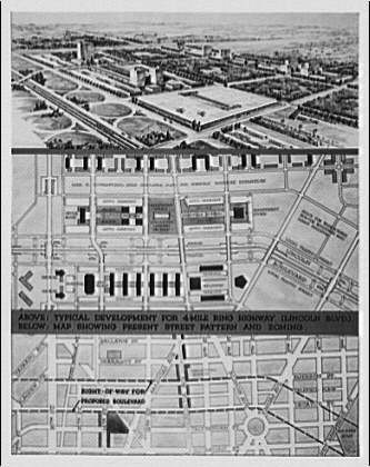
For the blocks between Buchanan and Gallatin Streets NW, around Sherman Circle in the Petworth area, Justement proposed something even more radical: a “Lincoln Boulevard” circumferential freeway bound by surface “access roads,” with a constant series of loops permitting cars to switch back and forth.
A giant parking garage would fill the two blocks currently bound by Georgia, 13th, Emerson, and Gallatin, serving a monstrous shopping mall (crowned with office towers) stretching from 7th Street over to 16th. The blocks beyond would see yet more towers-in-parking-lots.
Connecticut Avenue NW between Cathedral Avenue NW and Albemarle Street NW. Plan by Louis Justement, photo by author. 
Even upper Connecticut Avenue, where developers had been building auto-oriented buildings since 1930, was to be comprehensively renewed. Within 20 years, Justement forecast, Connecticut would become a freeway, with underpasses and “feeder streets” carrying local traffic. The streetcar would be replaced with buses that would pull off the freeway into parking lots.
Cleveland Park’s shops, which Justement said caused “traffic hazzards” by being arrayed on both sides of Connecticut and thus inviting pedestrians to cross the road, would be consolidated into a shopping center where Tilden Gardens stands today. The grand apartment houses lining Connecticut would be summarily demolished, replaced with new towers further from the unceasing traffic.
While most of DC was lucky to escape these ideas, there was one DC neighborhood where Louis Justement’s vision came to pass: the Southwest Waterfront.
The rest of the country was not as lucky, though. Many of the ideas that Justement sought to impose on DC found their way into other plans all across America.
His ideas for Petworth resemble the march of office towers lining the access roads of the Katy Freeway outside Houston; his sketch of Connecticut Avenue looks like the geometric clusters of offices arrayed between Sunrise Valley and Sunset Hills, the “feeder streets” paralleling the Dulles Toll Road in Reston; his plan for U Street resemble any number of Edge Cities, like Tysons Corner or Parole outside Annapolis.