Take a virtual tour of the Potomac and Anacostia rivers
This article was first published on November 30, 2015. During this time of physical distancing, we’ve decided to share it again.
Want to tour the Potomac and Anacostia rivers, but don’t own a boat? Google’s Street View tool now includes the view from a small boat traveling along the DC shore line.
To take the tour, just click the picture below. You can also go to the area in Google Maps and drag the orange stick figure onto the blue line that appears.
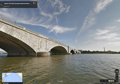
Memorial Bridge from the Captain John Smith Chesapeake National Historic Trail. Photo from Google Street View.
The tour starts north of Kingman Island near Kenilworth Park on the Anacostia River, stretches south and west around Hains Point, then heads north past Chain Bridge.
The project is part of the Conservation Fund’s Google Trekker project, which has created virtual tours of beautiful and historic American places.
In this particular instance, the project has documented the Captain John Smith Chesapeake National Historic Trail. The first entirely water-based trail in the National Trail System, Captain John Smith followed this route over 400 years ago. In addition to helping found Jamestown, Smith became the first English explorer to map the Chesapeake Bay.