The South Capitol Street Trail would transform DC’s bicycle network, but when will it happen?

Anacostia River Trail by Joe Flood licensed under Creative Commons.
In 2016, the Kenilworth extension of the Anacostia River Trail opened with much fanfare. Advocates and city officials hailed it as providing a key missing segment of DC’s bike network. They were right, but they didn't point out what was still missing. When studying a map of the region, it doesn’t take long to notice that Ward 8 has a dearth of lanes and trails.
DC is working to build out its bicycle infrastructure, including building protected bicycle lanes in Northwest and Northeast and adding them in the C St NE Rehabilitation Project. However, portions of the city east of the Anacostia River are increasingly getting left behind.
The planned South Capitol Street Trail would help fill that gap and also provide a connection to allow full circumnavigation of the city’s rivers. Unfortunately, the project has been in the planning stages for almost two decades and there's no timeline for its completion.
This is DC’s trail network. Off-street trails and protected bike lanes are in dark green, and other bike lanes are in light green. 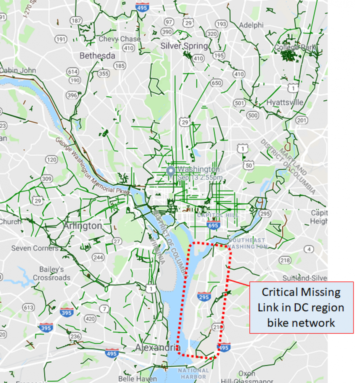
It's difficult to get around many neighborhoods east of the Anacostia
The portion of the District along the Ward 8 portion of South Capitol Street is unique. It holds a number of Department of Defense bases and municipal headquarters sandwiched between the Potomac River and I-295. Moving from south to north you see DC Water’s Blue Plains Wastewater Treatment Facility, The Naval Research Lab, and the Joint Base Anacostia-Bolling, all of which employ roughly 17,000 people.
To the east is DC’s Ward 8 in Southeast DC, a historically underserved portion of the city. The area is attracting significant investment, with the continuing cleanup of the adjacent Anacostia River, the construction of a new Frederick Douglass Memorial Bridge, a soon-to-open DC Mystics Stadium (and Wizards practice facility), the Department of Homeland Security consolidation at St. Elizabeth’s, plans to build a new hospital, potential for a major development at Poplar Point, and more.
However, getting around this area remains challenging except by car, an amenity not everyone wants nor can afford. I-295 represents a massive physical and psychological barrier to movement between most of Ward 8 to the east of I-295 and the Potomac and Anacostia Rivers, the DoD bases, and Blue Plains to the west of I-295. Those who want to bike or walk along South Capitol Street must literally risk their lives — as anyone who’s ever tried to can attest.
DC plans to change this with the South Capitol Trail, which will enable bicycle and pedestrian commuting and give residents an option for healthy recreation. It could also help boost economic growth by allowing for easier movement across the highway and elsewhere around the area.
Typical segment of South Capitol Street. Image created with Google Maps. 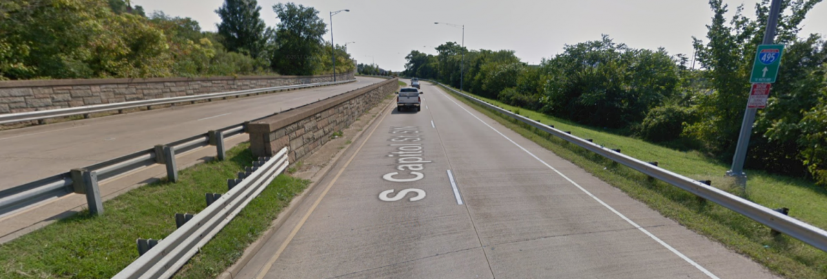
The South Capitol Trail will transform the District
We can estimate how many people will use such a new trail to commute to work. Of the approximately 17,000 employees working immediately to the west of the South Capitol Street, let’s assume about 1% currently commute by bike due to the extremely hostile conditions. If this number increases to the DC average of 5% once the South Capitol Trail is built, this would result in nearly 700 new bike commuters and a lot fewer cars on the road.
The number of individuals walking south from Anacostia Metro Station to these large employment centers would also likely increase significantly. There are also unknown numbers of Ward 8 residents who would be able to get to and from work and other amenities that are now accessible only by car or bus.
If DC is taking its Vision Zero goals of zero transportation fatalities or serious injuries by 2024 seriously, it must include completion of the South Capitol Street Trail in its plans. On top of the benefits above, this critical link would give DC residents dramatically improved access to National Harbor and the beautiful Oxon Cove Park in nearby Maryland.
Oxon Cove Park, immediately South East of the DC border with MD. 
The South Capitol Trail would dramatically improve North-South movement, but providing bicycle and pedestrian connections east-west into downtown DC is also necessary so residents east of the Anacostia can more easily access jobs and amenities in the center of the city. DDOT should begin planning for improved access from the neighborhoods east of I-295 to the proposed South Capitol Trail.
When will this critical project actually happen?
This trail would be beneficial to many residents, but it's a long time coming. Planning for the South Capitol Trail began in earnest in the 2000s, culminating in the 2010 Draft Concept Plan. Eight years have since passed, and except for a single webpage scant of details, there is very little publicly available information.
The project indicates that final design is planned for completion in Fall 2018, with no mention of projected dates to begin or complete construction. For many in the corridor — including those who have been injured from vehicle collisions — this lack of communication on this critical project is unacceptable.
South Capitol Street Trail route from DDOT website. 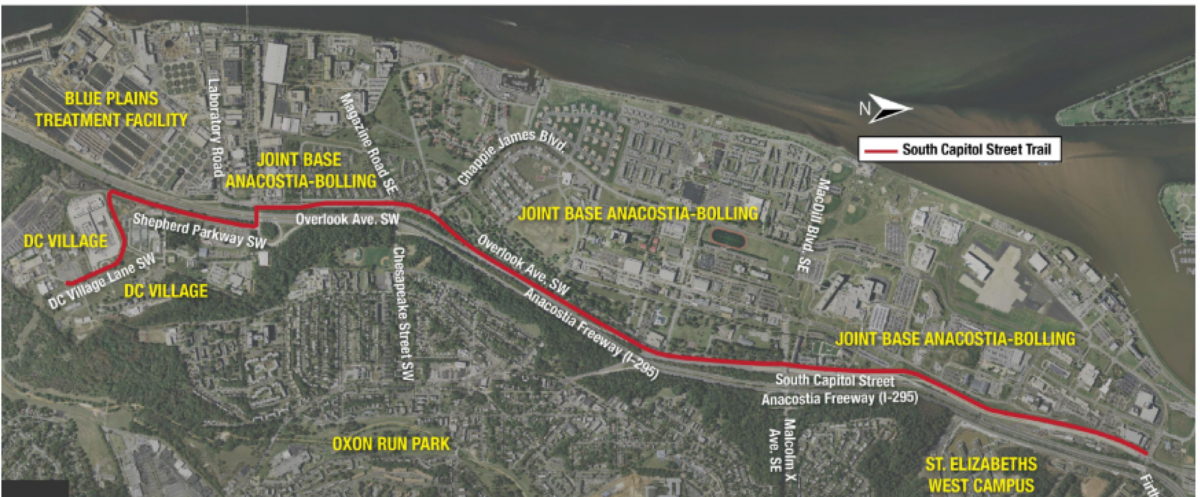
One likely explanation for the project delays is that some roads would need to be reconfigured to accomodate bicycle lanes, an expensive and complicated task. There are a few “choke points” in particular that may require “right of way” negotiations with the Joint Base Anacostia-Bolling.
Location of choke points. Image created with Google Maps. 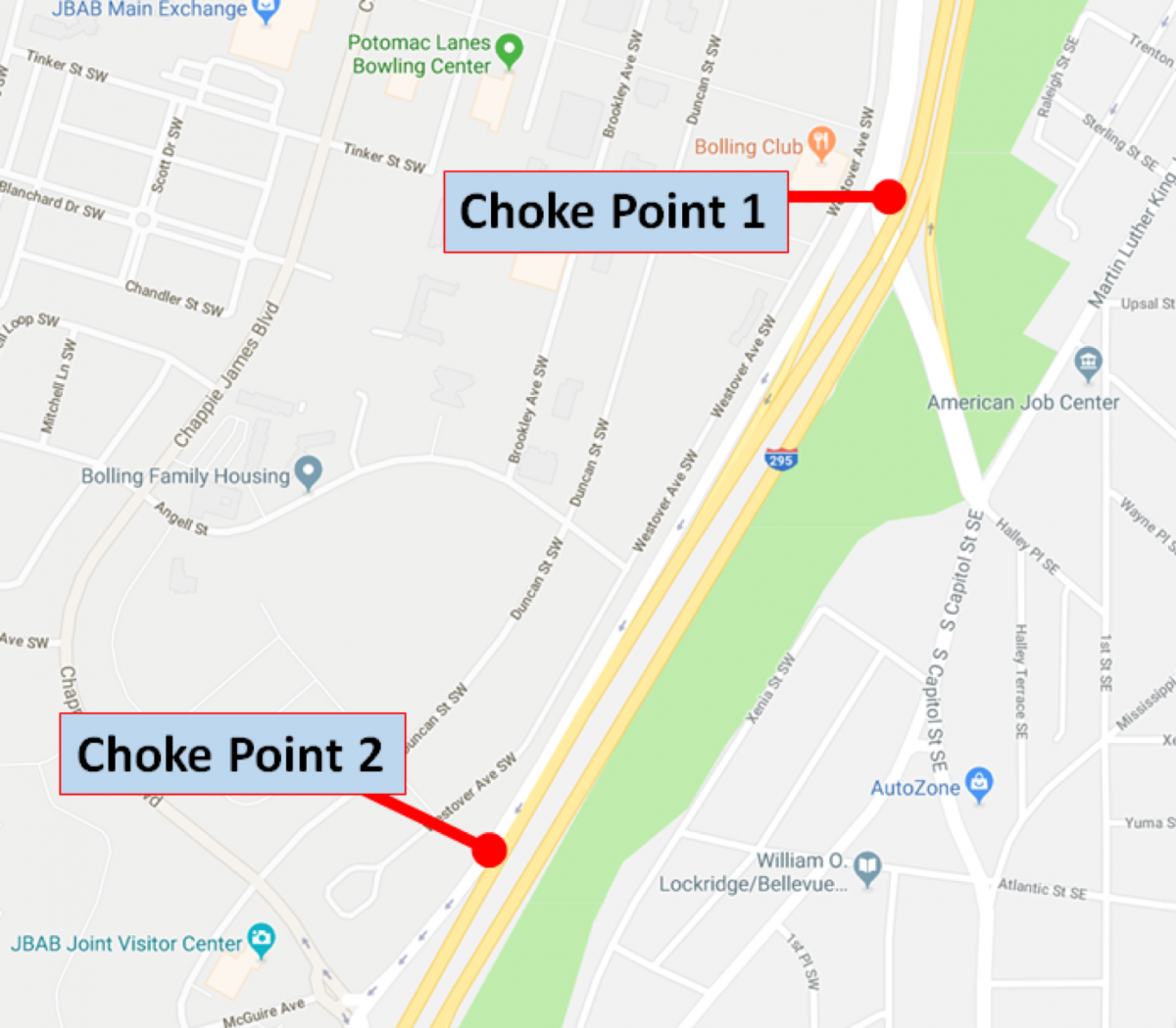
Street view of choke point 1. Image created with Google Maps. 
One choke point in particular is where South Capitol Street forks to the east and Overlook Avenue forks to the west. Installing a bike trail in this location would likely require removing a lane of traffic.
Street view of choke point 2. Image created with Google Maps. 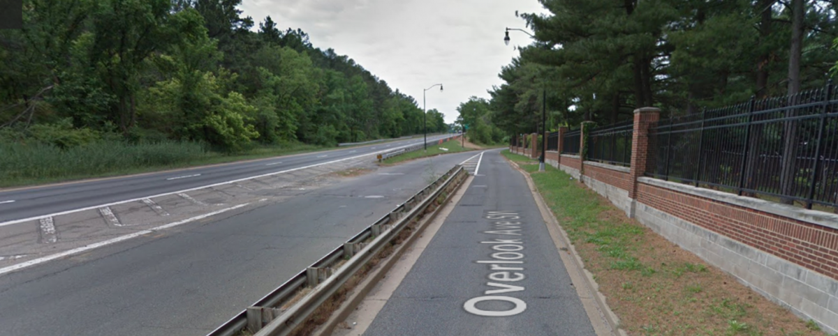
The District Department of Transportation (DDOT) may be on the brink of finally moving forward with this impactful project. DC is in the midst of an economic expansion and has the revenue to accomplish projects it previously may not have been able to prioritize, and the 2019 Transportation Improvement Plan includes $11M for constructing this trail.
The new Frederick Douglass Memorial Bridge will include a rebuild of the northern terminus of the proposed South Capitol Street Trail. It will also significantly improve bicycle and pedestrian access across the bridge.
View looking northwest on the under construction new Frederick Douglass Memorial Bridge. Separated bicycle and pedestrian lanes on the right. 
If done correctly, the South Capitol Street Trail project could transform the corridor. It would improve safety and access for Ward 8 residents and employees, and significantly enhance recreational resources for the entire region.
However, for all these wonderful things to become a reality, the project has to actually be built. It’s time for the DDOT project team to provide a full public update on this project.