See how long it takes to get from each Metro station to the downtown core
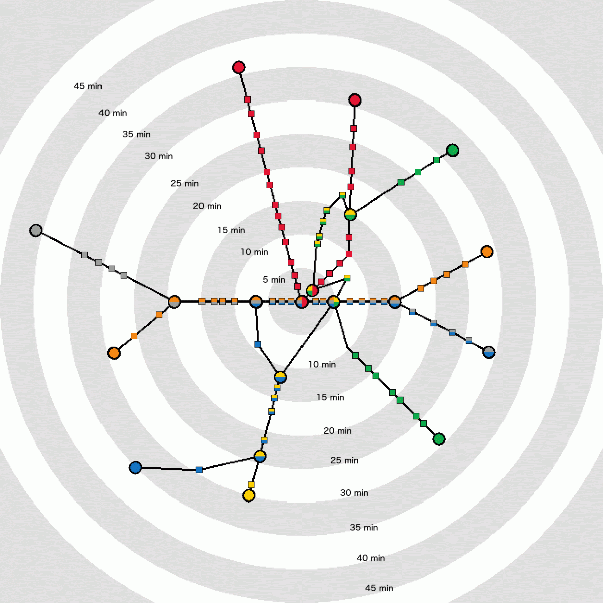
A map of the travel time from Metro Center to each Metrorail station, based on Metro's online trip planner. Image by the author.
Like most American rail transit systems, Metrorail is arranged in a way that sends most trips toward a cluster of downtown stations where the lines converge. I made a map to show how long it takes to travel from each station to the system's downtown core.
In designing my map, I was inspired by this map of the Boston T created by Peter Dunn. However, the geometry of Metro is rather more complicated than the T, which is centered on a ring of four adjacent transfer stations and has no line crossings outside this ring.
Ridership data from PlanItMetro shows that the most common destinations for morning peak Metro rides are Metro Center and the Farragut stations, and the highest-ridership parts of the system seem to be the Red Line and the combined Orange/Blue/Silver line through downtown. Based on this, I decided to treat Metro Center as the system’s hub.
Each station's distance from Metro Center indicates the average travel time to that station, including transfers.
The four lines that pass through Metro Center show fairly simple radial patterns. It takes longer to get from stops on the Green and Yellow line to Metro Center than the physical distance between them because, to make the trip, passengers have to transfer.
That's why the line zigs and zags on the map, or, more specifically, why Archives is significantly farther from the center of the map than either L’Enfant Plaza or Gallery Place, and Georgia Avenue-Petworth is farther from the center than Fort Totten.
Likewise, the nearly five-minute gap between King Street and Eisenhower Avenue is significantly longer than the travel time between these stations. It is due to the fact that one can reach King Street and the stations north of it via the Blue Line from Metro Center without a transfer, but Eisenhower Avenue and Huntington require a transfer to reach from Metro Center.
Do you see anything interesting when you look at this map?