The Metropolitan Branch Trail is ready for a facelift
A safer, accessible, and more popular Metropolitan Branch Trail (MBT) is closer to becoming a reality now that a study on how to make that happen has wrapped up. Specific ideas range from more lights and new callboxes to a connection to Union Market.
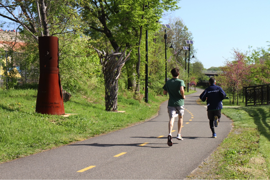
Runners in the annual MBT 5K race. Image from NoMa BID.
The MBT will eventually stretch from Union Station to Silver Spring. Today, the 8-mile trail runs on and off of the street, attracting roughly 800 users on the average weekday. But despite the trail’s popularity, it has been dogged by safety concerns.
That prompted NoMa Business Improvement District (BID) to partner with the District Department of Transportation (DDOT) and the Metropolitan Police Department (MPD) and hire Nelson\Nygaard and ZGF Architects to study the trail last year. From there, a range of stakeholders pitched in to make it happen: WMATA, WABA, Gearin’ UP Bicycles, and Rails to Trails, to name a few.
The ideas also come out of the results of a community survey with nearly 900 respondents and suggestions from a stakeholders group of close to 30 individuals.
Focusing on the stretch from Union Station to Brookland, the study recommends 30 different actions that would result in a safer, more accessible trail, and one that more people knew about, all of which would attract more users.
Here’s a summary some of those recommendations:
Lighting, callboxes, and mile markers make a trail safer
Among the biggest ways to improve safety is to work on existing infrastructure. For example, the trail needs sufficient lighting that works all the time, callboxes, cameras, and regularly-placed mile markers.
DDOT has installed mile markers at quarter-mile intervals along the trail and at least one developer, MRP Realty, has agreed to install a call box near its Rhode Island Avenue development.
In March, DDOT is expected to complete the design portion of a lighting contract to make clear what kinds of materials it needs, and where new lights will go.
More points of entry would invite more users
More “eyes on the trail” would make it a more welcoming place, which would in turn attract more eyes. New entrances and exits would help with this.
Some of the additional connection points suggested, from south to north, include Union Market, Q Street NE, Edgewood Court and the Franklin Street alley.
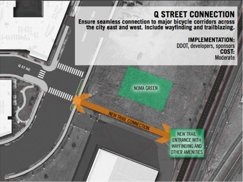
The Q St connection. Image from the MBT Safety and Access Study.
The Q Street and Franklin Street access points are likely to be built in the near term. The Q Street access point will connect to the MBT over the recently purchased parcel of land that will become NoMa’s first park, tentatively named NoMa Green. The Franklin Street alley is underway, with construction happening on the adjacent lot.
Adding some personality could be key
One interesting finding in the study is that a number of nearby residents are simply not familiar with the MBT. Promoting the “identity” of the trail, through increased visibility, branding, and signage, could change that.
That also means signs in neighborhoods the trail runs through, so people who could be using it but perhaps don’t know about it are more likely to get the message.
In addition, murals and signs on overpasses, bridges, and blank walls at key spots along the trail could educate users about the neighborhoods they are passing through. The study also suggests adding flavor to the trail by painting directly on its surfaces.
Another recommendation is activating Penn Center, a District-owned warehouse at R Street NE, with a café or bar space facing the trail.

Rendering of the potential Penn Center refurbishment. Image from the MBT Safety and Access Study.
The MBT safety and access study is a plan that communities along the trail will be able to use to encourage partnership, support and funding for changes for the trail. This will help it to be a key part of the next wave of active outdoor recreation spaces and transportation infrastructure in the District.