The other end of the Purple Line
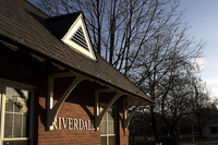
Riverdale MARC station. Photo by [ecpark] on Flickr.
There has been a great deal of fuss over the Purple Line alignment between Silver Spring and Bethesda, notably over the hiker-biker trail and the Columbia Country Club. There have also been debates over the alignments between College Park and Silver Spring, including the East Silver Spring alignment, the transit center at Langley Park, and the alignment through the University of Maryland campus.
After the train gets to College Park, people seem to stop caring. The connection to another Metro line is simply an afterthought. What is at the other end of the Purple Line?
For starters, it connects to the Orange Line at New Carrollton. This links the Purple Line to the third and most traveled branch of the MARC train, the Penn Line, and to Amtrak.
Meanwhile, the high investment light rail option routes the line through a few of western Prince George’s traditionally-laid-out municipalities before terminating at New Carrollton. That option proposes four other stations between College Park and New Carrollton:
- Somewhere along River Road in College Park near the Physics Ellipse, often called Calvert Park or River Road.
- The intersection of East-West Highway and Kenilworth Avenue, usually called Riverdale Park or East Riverdale.
- The intersection of East-West Highway and Veterans Parkway, sometimes called Wildecroft after the adjacent neighborhood, or Veterans Parkway.
- The intersection of Veterans Parkway and Annapolis Road, often called Landover Hills after the nearby municipality, or Annapolis Road.
Map by FallenAngel1109. View Larger Map
These stations rank among the bottom in ridership projections, averaging less than 1,500 boardings per day. But interestingly, no one seems to have raised much fuss over this alignment. Much of the stretch runs through single family homes along roads with disastrous traffic problems, notably MD-410 (East-West Highway/Riverdale Road). The area, though historic and full of gorgeous turn-of-the-century Victorian houses, lacks the affluence of Chevy Chase or even East Silver Spring. Perhaps this has a lot to do with why there is little clamor over plans for a brand new train through these towns.
The Calvert Park area has a great potential for transit-oriented development. Unfortunately, it is currently a couple of office parks with way too much surface parking and no logical street grid. This area is close enough to the Green Line station that it should eventually become one of the more dense areas of the eastern Purple Line. Prince George’s County should revisit their development plans for this area in light of the Purple Line’s potential.
The intersection at East-West Highway and Kenilworth Avenue is currently awash with strip malls, but the town of Riverdale Park has shown a great deal of dedication to improving retail areas along Route 1 and Rhode Island Avenue, so it seems likely that something will be done to improve the giant mess of parking lots there. The area has great potential to house locally owned businesses like the stores on Kenilworth southwest of the intersection. Perhaps the new station will support some new transit-oriented housing. I believe that the Purple Line could help provide this area a much needed makeover.
The areas around the other two new stations are typical of major suburban intersections: strip malls at the center of large tracts of single family housing. With a little work, these areas could become quite walkable. Otherwise, they’re only getting stations because they happen to lie between the two nodes.
Finally, there is New Carrollton Metro Station. I’m convinced that the original design of this station assumed no one would ever walk to it, ever. Situated at the confluence of US-50 and the Beltway, it is surrounded by office parks, spread out apartment complexes, and surface parking. Three (soon to be four) train lines serve the station, and it is an important hub between DC and Baltimore, but it appears to be built to only serve the drivers of US-50 and I-495, as it is isolated between the heavy rail tracks and the two freeways and served primarily by highway exits.
The alignment for this stretch has long been set, and with little controversy. But I wonder about one segment and why a slight alternative was never suggested:
The map above shows the planned route in darker purple, and tunnels in blue. The lighter purple shows an alignment that never received any consideration (at least none that I’ve seen). Instead of following River Road, I have the tracks following the CSX train down to East West Highway. This would allow the Calvert Park station to serve the planned development at the Cafritz property to the west. It continues south to the Riverdale MARC station and then surfaces in the median of East-West Highway at the bridge over the CSX tracks. This alignment adds another station at the MARC station and mitigates the need for the lengthy tunnel under Kenilworth Avenue on the planned alignment.
Perhaps it is unwise to provoke the most agreeable section of the Purple Line into a debate over the alignment. Perhaps there are good reasons this wouldn’t work. But this stretch is oft forgotten in the Purple Line process, and it could be the stretch that generates the most new development surrounding the stations. But as the debates rage on at the University of Maryland, Silver Spring, and Chevy Chase, Riverdale and New Carrollton sit patiently waiting the arrival of an unprecedented transit link connecting their towns with the mini metropolises on the Red Line. Hopefully this new link will help drive similar development around College Park, New Carrolton Metro stations, and points in between.